Crossrail will transform travel by adding capacity and fresh connections, as well as speeding up journeys across the capital. But how much will it speed things up? To help find out, I've been out on the existing network making journeys between consecutive Crossrail stations. For example, the next stop after Paddington will be Bond Street, so I've timed how long it takes to get from Paddington to Bond Street as things stand. Then I've compared that to the new journey time published on the Crossrail website. Just how many minutes might we save?
n.b. Hundreds of new direct journeys will become possible when Crossrail opens, but I've chosen to concentrate solely on consecutive stations to keep things manageable.
n.b. I timed my tube journeys from platform to platform, because that's how Crossrail have timed theirs. I have not factored in the time needed to enter the station at the start, or exit at the end.
n.b. I stood on escalators when changing trains, rather than walking. If you're willing to walk up or down, you could beat my times.
n.b. Crossrail's times are to the nearest minute. Mine are to the nearest half minute.
n.b. If my journey required more than one train, I've assumed a minimal wait for the next service.
PADDINGTON → BOND STREET(by Crossrail: 3 minutes)
Paddington → Baker Street → Bond Street(today: 6½ minutes)
When the Underground works, which it did for me, Paddington into the West End is surprisingly fast. That's four minutes on the Bakerloo to start with, a brief dash through the connecting passageways at Baker Street, then two minutes on the Jubilee.
Paddington → Notting Hill Gate → Bond Street(today: 12 minutes)
Even though it looks the same distance as 'via Baker Street' on the tube map, going 'via Notting Hill Gate' takes roughly twice as long. Just the Central leg of the journey takes the same time as the whole of the aforementioned route. Also, you can expect a longer wait at Paddington, because Circle and District line trains aren't so frequent. Moral of the story, never go via Notting Hill Gate.
Paddington → (walk) Lancaster Gate → Bond Street(today: 10½ minutes)
A well known shortcut to avoid Notting Hill Gate is to walk between Paddington and Lancaster Gate. The walk doesn't take long - it only took me 5½ minutes - but by the time I'd taken the lift down to the platform, it would already have been quicker to go via Baker Street.
Overall saving using Crossrail: 3½ minutes
BOND STREET → TOTTENHAM COURT ROAD(by Crossrail: 1 minute)
Bond Street → Tottenham Court Road(today: 2½ minutes)
There's already a direct connection between Bond Street and Tottenham Court Road, namely the Central line, so the time saving via Crossrail (which skips Oxford Circus) isn't enormous.
Overall saving using Crossrail: 1½ minutes
TOTTENHAM COURT ROAD → FARRINGDON(by Crossrail: 3 minutes)
Here's where things get complicated. Tottenham Court Road to Farringdon is a genuinely fresh connection, indeed travelling by tube today requires at least two changes of train. So which route is currently best? I had multiple attempts...
Tottenham Court Road → Warren Street → King's Cross St Pancras → Farringdon(today: 13 minutes)
It looked promising on the tube map. Up the Northern line to switch to the Victoria at Warren Street (where the interchange proved slightly quicker than at Euston). Then a second train to King's Cross St Pancras, then back up the escalators for a sub-surface train to Farringdon. Each step of this journey took two and a bit minutes, as did each of the connections, making a grand total of 13 minutes.
Tottenham Court Road → Holborn → King's Cross St Pancras → Farringdon(today: 13 minutes)
It looked promising on the tube map. Along the Central line to switch to the Piccadilly at Holborn. Then a second train to King's Cross St Pancras, then back up the escalators for a sub-surface train to Farringdon. But this takes just as long to reach King's Cross as the previous route, again making a grand total of 13 minutes.
Tottenham Court Road → Chancery Lane → (walk) Farringdon(today: 10½ minutes)
A much better route, it turns out, is to take the Central line to Chancery Lane and walk the last bit. The tube journey's quick, and exiting from the depths of the station takes a while, but the walk at the far end is only six minutes. You could do the last leg of the journey quicker by 17 or 45 bus, but not significantly quicker, because they don't quite go as far as Farringdon station.
Tottenham Court Road → (bus) Farringdon(today: 14 minutes)
Or you could take the bus the whole way. I took route 55 from the bus stop called Tottenham Court Road station to the bus stop called Hatton Garden (for Farringdon station). The bus journey took me just nine minutes, which could have been a winner. Alas this second bus stop is a five minute walk from the station entrance, which knocked the total time up to 14 minutes, making this the slowest option of all. Also I had good traffic, and the timetable suggests it's not usually this fast, so maybe don't take the bus.
Overall saving using Crossrail: 7½ minutes
FARRINGDON → LIVERPOOL STREET(by Crossrail: 2 minutes)
Barbican → Moorgate(today: 1½ minutes)
Here's an oddity, a slower journey by Crossrail, thanks to the 'chaining' of Crossrail stations through the City. Farringdon's Crossrail station will also have an exit to Barbican, while Liverpool Street's Crossrail station will also have an exit at Moorgate. Hence it's currently quicker to take the Metropolitan line from Barbican to Moorgate than it will be to ride Crossrail, and that's without taking the long hike down into the depths and back up into account. For comparison, I can confirm that Farringdon to Liverpool Street via the Metropolitan line currently takes 5½ minutes, and Crossrail will be quicker.
Overall saving using Crossrail: potentially slower
LIVERPOOL STREET → WHITECHAPEL(by Crossrail: 2 minutes)
Liverpool Street → Whitechapel(today: 4½ minutes)
This link already exists, via the Hammersmith & City line. I got lucky, and my train whizzed across the points at Aldgate East without one of those interminable waits passengers often suffer. Also I got on a train straight away, and the H&C generally only runs every ten minutes, so in reality the current journey usually takes a lot longer than 4½ minutes. Crossrail will be a genuine improvement here.
Whitechapel → Canada Water → Canary Wharf(today: 10 minutes)
First let's try the more obvious route. The first part of the journey (on the Overground) takes six and a half minutes, which isn't fast, but the connection at Canada Water is dead quick and the Jubilee line whisks you into Canary Wharf post haste.
Whitechapel → Shadwell → Canary Wharf(today: 10½ minutes)
Now let's try the less obvious route. This time it's the DLR section which takes six and a half minutes, and the change at Shadwell is quite a schlep, but the total time taken is almost the same as via the Jubilee.
Canary Wharf → Canning Town → Custom House(today: 8½ minutes)
This journey can be completed solely on the DLR, but it's much quicker to do the first leg via the Jubilee line, which takes four and a half minutes to Canning Town, and then another three and a half to Custom House.
Overall saving using Crossrail: 5½ minutes
CUSTOM HOUSE → WOOLWICH(by Crossrail: 4 minutes)
Custom House → Canning Town → Woolwich Arsenal(today: 15½ minutes)
Because Custom House and Woolwich are on different outer arms of the DLR, and bus connections are currently poor, the quickest route is to head west to Canning Town, then head back east. It's still not especially quick, even with 'perfect' connections (which may not actually be timetabled in real life). Also, as Woolwich is the only Crossrail station being built entirely from scratch, I had to terminate my journey at Woolwich Arsenal instead. If you want to be purist and cross Plumstead Road to where Woolwich's Crossrail station is going to be, the total journey time would be nearer 20 minutes.
Overall saving using Crossrail: 11½ minutes
WOOLWICH → ABBEY WOOD(by Crossrail: 4 minutes)
Woolwich Arsenal → Abbey Wood(today: 5 minutes)
This is one of the feebler time savings, as Southeastern already run trains between Woolwich and Abbey Wood, stopping at Plumstead. But then Crossrail isn't about short hops, it's about cross capital connections, including all the places that residents of Abbey Wood are suddenly going to be able to reach so much quicker.
Its easy to cut the frequency of a London bus route because almost nobody notices.
Cut the frequency of a tube or rail service and passengers yell. Cut an entire bus route, or trim one back, and a long public consultation is required. But for TfL to run less frequent buses than they used to, that's easy. All they have to do is publish their intention in a fortnightly online document hardly anyone looks at, and suddenly one day fewer buses run.
Here's a list of all the buses whose weekday daytime frequencies have been cut since June last year. In most cases the cut is about one bus an hour. If the cut is two buses an hour, the route number is in bold. If the cut is three or more, the route number is in bold and underlined.
To save you counting, that's 83 different London bus routes whose frequencies have been cut since this time last year. Of the 543 daytime TfL bus routes, that's 15%. One in every six London bus routes now runs less often during the day than it used to. It's just as well nobody's noticed.
The most common cuts are from "every 8 minutes" to "every 10 minutes", and from "every 10 minutes" to "every 12 minutes". They're the kinds of cut it's hard to spot. People don't look at timetables any more, they focus on when the next bus will arrive, so it's easy not to twig that average waiting time has increased.
The biggest cut was on the RV1, the tourist-friendly bus which shuttles from Covent Garden to the Tower. Its frequency was halved in February, dropping from every 10 minutes to every 20, essentially no longer a turn-up-and-go service. That chop may have made the media, even if TfL held firm, but cuts on other routes have remained far below the radar.
In total, that's approximately 100 buses every hour which used to run this time last year, but no longer do. Over the course of a day that's well over 1000 buses removed, which adds up to a useful saving for a budget-strapped transport authority. TfL are trying to cut their annual bus mileage from 486 million km last year to 471 million km in 2018/19, so this'll help.
Most of these service cuts are "to match demand". If fewer people are using buses, it makes sense not to run them as often. Cut the service from, say, 6 buses an hour to 5, and everyone still travels, just squeezed onto slightly fewer vehicles. But there's also a potential vicious circle here. If buses arrive less frequently, or are packed out when they arrive, passengers may choose to divert to other means of transport, or not travel at all... and the service may be cut again.
Indeed this seems to be what's happened on two routes cut last year, and scheduled to be cut again this month. Route 31, which runs between White City and Camden Town, was cut last July from "every 6 minutes" to "every 7½ minutes". In two weeks time it's going down to "every 10 minutes", which'll be a total loss of 4 buses an hour. Likewise route 24, which runs between Hampstead and Pimlico, was cut last November from "every 7½ minutes" to "every 8 minutes", and will reduce to "every 10 minutes" by the end of the month. Either passenger numbers have fallen further, or TfL have cunningly concealed a large cut by introducing it in two smaller stages.
For balance, I should list all the buses whose weekday daytime frequency has increased in the last year. Here they are.
390, H14
The 390 is a special case, because it was rerouted last June to make up for a curtailment of route 73 at Oxford Circus. The only genuine increase is for route H14, an outer London connection between Hatch End and Northwick Park Hospital. That's 83 reductions in daytime services over the last year and one, maybe two, increases. The direction of travel is very much clear.
Bus frequencies are also being cut back at weekends.
Here's a list of all the buses whose Sunday frequencies have been cut since June last year.
Sundays are an easy time to cut buses, because it's not a working day, and people are accustomed to waiting a bit longer. Trim a service from 6 buses an hour to 5, or from 5 to 4, and leisure-focused passengers probably won't complain.
And then there's overnight.
Here's a list of all the buses whose Friday and Saturday night frequencies have been cut since June last year. Again, bold signifies a cut of two buses an hour, and underlining means three or more.
Weekend nightbus cuts have been particularly savage, as you can see from the amount of bold and underlining in that list. 45 routes have been affected altogether, that's a third of the overnight total. In particular, of the 50 N-something routes, which only run overnight, almost 60% have suffered weekend cuts.
24 nightbus routes have had two buses an hour removed, and eight routes have lost more than that. Route 25 has lost five buses an hour overnight. But the most savage chop was on the N29, where buses used to run every 3½ minutes between Trafalgar Square and Wood Green, and now run every 10. That's 10 buses an hour deleted.
Route 14 is another victim of two consecutive cuts, in July from "every 10 minutes" to "every 12 minutes", then in January down to "every 20 minutes". Meanwhile, compared to this time last year, an extra twenty nightbus routes now only run twice an hour. If you're a solo traveller at 3am, on a route with a newly-infrequent service, an Uber may appeal far more than a 30 minute wait.
There is a good reason why TfL are now running 500 fewer buses overnight on Fridays and Saturdays, and that's the Night Tube. This connects central London to all sorts of far flung outposts previously reliant on nightbuses, so there's little need for duplication. But the Night Tube can't always manage the last mile home, plus it's a more expensive way to travel, so shift workers are more likely to be getting a raw deal than occasional clubbers.
In summary, I've counted 83 bus routes whose weekday daytime frequencies have been cut over the last year, 26 bus routes trimmed on Sundays, and 45 nightbus routes culled on Friday and Saturday nights. Altogether, over 130 different London bus routes are affected.
The bus network is always kept under review to match demand, indeed there are bold plans to reshape the network after Crossrail arrives. There's no point TfL running buses if hardly anybody's aboard, and far better to be trimming buses than withdrawing routes altogether. But in a budget-strapped fare-frozen city, cutting bus frequencies remains the easiest way to cut provision and save money without anybody noticing.
Where was the world's first mechanical paper mill? Not in China, nor the industrial north of England, but in Hertfordshire, just southof Hemel Hempstead. The River Gade was ideal for manufacturing, not just as a source of water but because as a chalk stream it was clear and clean. A chain of small paper mills grew up around the end of the 18th century, initially with every sheet made by hand, and one was selected to try out a new French patent (because the French were otherwise preoccupied with revolution at the time). The pioneering choice was Frogmore Mill, which today lives on as a small business and visitor attraction - the Frogmore Paper Trail.
I'll confess a local interest. I grew up in Croxley, home to the John Dickinson paper mill, indeed my Dad grew up a stone's throw away across the canal. John Dickinson was by far the biggest employer in the village, and I'd always thought Croxley was the jewel in their crown, ever since seeing countless boxes of Croxley Script paper stacked up in the school secretary's office. In fact Apsley Mill was bigger, having become the site where John Dickinson turned their paper into stationery products like feint-ruled ledgers and embossed notepaper, and Frogmore Mill also became part of the JD portfolio. The easy availability of paper also explains why Watford became a nationally-renowned centre for printing... indeed much of the economic history of southwest Hertfordshire can be attributed to the chain of events kicked off at Frogmore.
To go on a tour of Frogmore Mill you need to turn up on a Thursday, or on the first Sunday of the month. I did the latter, and had time to pootle round the shop (which is open daily except Saturday) before the tour began. Golly, the paper they make on site is lovely, from the coloured notepaper stacked in racks on the far wall to the large sheets of handmade art paper, roughly edged and embedded with seeds and leaves and petals. It probably wouldn't do for painting on, but if you were ever planning on mounting stuff, or doing something a bit showy for a celebration, it'd go down a treat.
The tour kicks off with a demonstration of how paper used to be made by hand, the slow technique illustrating why mechanisation was a game-changer. You might even get to have a go yourself. Remember to stir the mix of water and pulped rags vigorously before you dip the mesh, otherwise the resulting sheet of paper might be rather weak. Be sure to sponge as much moisture as you can out of the frame, otherwise it may stick when you lift it off the paper towel. And keep your fingers crossed the member of staff doesn't leave your sheet on the hotplate or the glazing machine for too long, otherwise all your best efforts will have been in vain and your final souvenir will be a torn, shrivelled mess.
The demo takes place in one corner of a small museum, which includes a satisfying number of models, and a history of paper manufacture down the Gadevalley. I was fractionally over-excited every time I found something related to Croxley, but you don't need to be local to be intrigued. There's even a corner devoted to Postman Pat stationery, which it seems helped prevent the collapse of the John Dickinson brand for a crucial last few years. Another corner is set up as a letterpress facility, and was in use by a separate group during my visit, indeed if you've ever fancied trying printing, bookbinding, or any one of a number of paper-based workshops, Frogmore might have something to offer.
It's on the large paper-making machine in the mill building proper where most of the real business takes place. This Edwardian contraption was built to test consistency before much larger jobs were launched, but the process is still much the same, indeed recognisably similar to the 1803 original. Mulchy water bubbles in, is squeezed to create a continuous roll of paper, then passes through several heated rollers before winding round a spool at the far end. Frogmore still employs someone to make the stuff, be that parchment for City livery company certificates, banana pulp for Lush gift boxes or recycled paper primed with elephant poo for sale in the shop at Whipsnade Zoo.
Passing further into the mill, things get a bit older and somewhat less well maintained. That's been good news for various movies and drama series who've used the upstairs space at Frogmore to film action sequences requiring a generic "decaying industrial" backdrop. The Flash's lair in Justice League? That was just outside Hemel Hempstead, although I suspect they cleaned the pigeon mess up first.
It was great to see a full-size paper making machine in the penultimate shed, a massive thing with variable-width feed and dozens of heated rollers... although there's no chance of it ever being brought back into working order, for economic reasons, so it may just continue to decay. And right down at the far end is the Apsley Mill fire engine, which still gets out to appear at rallies and the like, surrounded by a display to satisfy the most ardent Dickinsonophile. A fire brigade was always essential in a paper mill, we were told, which helps to explain why the building on the site today is by no means the original. The website suggested that the full tour should last 45-60 minutes, whereas mine lasted double that, and along the way explained much about the valley in which I grew up. [virtual tour]
Apparently narrowboat trips operate from outside the main entrance in the summer, but although I saw the boat laid out with chairs, there was no sign it was heading anywhere. Instead I walked along the Grand Union towpath, this being the most pleasant way to make the 15 minute connection to Apsley station. The adjacent site of the former Apsley Mills is now a trading estate and apartment complex, with waterside pub and Holiday Inn, linked by a spiral footbridge sponsored by an estate agents. But there are a couple of repurposed mill buildings left, one with a splendid Basildon Bond clock on the front and a John Dickinson plaque on the rear.
Hertfordshire is still a hotspot of paper production - the world's largest newspaper printingplant is on the other side of the county outside Waltham Cross. But it's Frogmore where the mass-produced revolution began, helping to bring books and newspapers and printed information to a fast developing society, and spreading ideas that changed the world. It's great to know that some of that history lingers on, and the rollers still turn, and paper's not yet had its day.
Having been to the Isle of Wight last week to see where Queen Victoria died, yesterday I went to see where she's buried. [10 photos]
She's buried in Windsor, but not at the castle... she and Albert lie half a mile south in the Royal Mausoleum at Frogmore. And Frogmore's not often open to the public, indeed only for three days each year at the start of June, although if you had an invite to Harry and Meghan's wedding reception you might have been tippling champagne on the lawn a few weeks back.
To get inside the gardens you need to pay attention and buy a ticket in advance from one of the three designated charities, which this year include the National Open Garden Scheme (Tuesday 5th), SSAFA (Wednesday 6th) and the Prisoners’ Education Trust (Thursday 7th). E-ticketing has yet to reach this corner of the royal household, so wait a few weeks and your ticket will eventually arrive in the post. I did wonder whether this was to enable police checks, but it turned out tickets are also available on the day in a tent at the end of the drive, so evidently not.
Frogmore lies at the heart of Windsor Great Park, hidden amongst a huge secret backlot where the royal family ride horses and play at farmers. Access is through a gate on the Long Walk, watched over by Royal Palace guides in smart uniforms and suitably equipped police. First there's an enormous field to file past, currently replete with unripe corn almost as far as the horizon, then a gravel drive towards the delightfully titled Mausoleum Lodge. Cue bag check ("Oh, what a lovely picnic"), and then step through the gate onto hallowed turf.
There are 30 acres of immaculate gardens at Frogmore, beautifully landscaped and cared for by unseen hands. A sinuous water feature crossing the site creates a pastoral vibe, with a central artificial mound as the centrepiece. Many different species of tree have been lovingly nurtured over the years, the finest specimens carefully labelled, from Indian horse chestnuts to a bush of Glastonbury thorn. The flower beds are informal and rich in rhododendron and iris, or at least they are in the week the public get a look in - only royalty sees what blooms at other times of year.
The first mausoleum at Frogmore was for Queen Victoria's mother, the Duchess of Kent, who spent 20 years living in the big house in the grounds. She planned a summerhouse on top of vaults inside the central mound, but died just before the summerhouse was complete, so it was filled with a statue of her instead. The front steps are chained off for mere mortals on Open Days, but you can climb the mound to almost see the exterior up close, as well as admiring it from various vantage points around the lake.
Queen Victoria selected the location for the much larger Royal Mausoleum a few days after her beloved Albert died. Designed in a Romanesque style, from above it takes the form of a Greek Cross, and is topped by a copper dome. It used to be possible to go inside, with limited public opening on the Queen's birthday in May, but the interior is now structurally unsound due to damp, and has been closed off since 2007. Initially it was thought repairs would take five years, but the current estimated date for reopening is 2023, assuming government or royalty are willing to dip into the Privy Purse.
If you're a lesser royal, like a Duke of Gloucester or an Ogilvy, your likely final resting place is the burial ground outside. It's been in use since the 1920s, and although it isn't meant for monarchs or their consorts, it is where you'll find Edward VIIIand Wallis Simpson, as well as three of Queen Victoria's children. Someone was obviously planning ahead because the lawn is still mostly empty, apart from a few pristine slabs in family clusters, and the overall effect seemed oddly artificial.
And then there's Frogmore House - owned, enlarged, and increasingly tarted up by the royal family since the 18th century. George III bought it as a country refuge for his wife Queen Charlotte, and it was lived in by an assortment of mostly queens and princesses after that. It must have been convenient to have a house available in Windsor that wasn't a castle, and had a bit of rustic privacy. These days it's used exclusively for entertaining, ideal for exclusive soirées or garden parties, and of course for wedding receptions when your grandchildren tie the knot.
Frogmore House is also only open to the public three days a year, for an additional fee on top of the gardens, and the queues to get inside generally die down mid-afternoon. Expect to shuffle through the ground floor rooms, and to wonder quite how anybody ever agreed to fussy decor in such extreme colours. Two rooms have been laid out as they would have been when Queen Mary used Frogmore to display her 'bygones' in the 1930s, including rather too many black/gold lacquer boxes and artificial flowers in glass belljars. The guide in the room seemed most unimpressed by Mary's taste, but still opened up one of the boxes to give me an illicit flash of handwritten label.
The next room is set out as the Duchess of Kent would have known it, almost a century earlier, and the box beneath the crystal chandelier may just include a box of Queen Victoria's knitting. The last room on the tour used to be the library, but was repurposed as the Britannia Room after the royal yacht was decommissioned in 1997. Prince Philip ensured that Britannia's enormous dining table ended up here, along with chairs and other trophies which he wanted to keep close to home rather than aboard a berthed tourist attraction in Edinburgh.
I confess to feeling somewhat on the young side while walking around Frogmore yesterday, the midweek timing ensuring that the main clientele was retired ladies and couples who like historical gardens. We were also repeatedly interrupted by planes whining directlyoverhead, Queen Victoria having completely failed to recognise that Heathrow's northern runway would be built a few miles due east of her favourite peaceful hideaway. In case you want to slip inside for yourself, hurry, because the Frogmore estate will be shutting its gates for another year at 5.30pm on Thursday.
Yesterday the Rail Delivery Group, in conjunction with passenger watchdog Transport Focus, launched a consultation into revising rail fares. Ticketing regulations aren't always fair to all travellers, and many passengers find them over-complex, so could a long-overdue revision make things better?
The current regulations were set in 1995, when it was assumed all journeys would begin with a paper ticket bought at a station, so fail to take into account modern digital options. The working week was also much more regular back then, so part-time travellers were overlooked when it came to season tickets, and peak and off-peak were more sharply defined. Britain could do better.
KPMG carried out a preliminary study as background research, which you can download here, although there's really no need. All the important issues are in the public consultation, which ends in October, and the RDG propose to publish a summary report before the end of the year. The intention is that whatever changes might ultimately be adopted, average rail fares would remain the same. That means there'd be winners as well as losers, so this isn't going to be universally popular, if indeed anything happens at all.
The consultation can be completed online, or there's a pdf version you can print out and send to a Freepost address. It's in three parts - Fare Structures, Buying A Ticket and Any Other Thoughts. Various high-level strategies are suggested for consideration, some of which may be taken forward, with the caveat that these are "broad concepts which would require further consideration and refinement."
So I thought I'd cut and paste the high-level strategies from Part 1 below, along with a brief mention of what I think, and add a separate comments box for each. I know some of you love to discuss railways a lot, so here's your chance. But remember it's not all about what would be good for you, it's about a fairer system across the full range of rail travellers. And if you have lots and lots you feel you need to say, remember that responding to the actual consultation would be far more productive than speculating here.
We know that rail fares can sometimes be confusing to customers and we are interested in your views about how rail fares should be structured in the future. To what extent do you think each of the following options should be considered in re-structuring rail fares?
Fares based on distance travelled (e.g. there is a cost per mile travelled). This may mean that some fares become higher than now and some become lower than now.
Charging by distance might sound eminently sensible, but would disproportionately affect passengers in certain parts of the country. For example an open single from Penzance to Plymouth currently costs £17.60 to travel 64 miles, whereas it's £50.60 to cover exactly the same distance from Ipswich to London. Equalising this out would greatly help those on short commutes, but do serious damage to peripheral rail travel. Do we really want to make long distance rail journeys, say from Edinburgh to Bristol, prohibitively more expensive compared to a short local hop?
Fares based on the level of service received (e.g. fares for routes with a lower quality service - such as slower, less regular and more basic trains - are lower than fares for routes with a higher quality service). This may mean that some fares become higher than now and some fares become lower than now.
In some places setting fares by quality of journey already happens, for example High Speed services from Kent cost more than other routes, but how might this apply in areas where there's no existing competition? And while it'd be nice to offer some financial compensation in return for a sub-optimal service, can you imagine the fuss if fares went up every time better or more frequent trains were introduced?
Fares where the cost is the same at all times of day and for all days of the week (e.g. fares are the same at busy (peak) and less busy (off-peak) times). This may mean that fares at off-peak times become higher than now and fares at peak times become lower than now. As a result trains during peak times may be busier than now.
If your aim is to simplify the price of train tickets, a flat fare regardless of date or time would do it. But it'd also encourage even more people to crowd onto rush hour trains, because there'd no longer be any financial disincentive, and it'd make off-peak travel increasingly unaffordable. Of all the options in the consultation, I reckon this is the least workable.
Fares based on time of booking (e.g. fares booked in advance of the day of travel are lower than fares available on the day of travel). This may mean that fares for customers booking on the day of travel become slightly higher than now.
Buying a ticket in advance is always a risk, in case someone's health intervenes or the weather's foul, and it's not always possible to get compensation, nor cheap to swap the date of travel. I'd hate for 'always more expensive on the day' to become the default.
Fares based on the amount of flexibility required (e.g. fares for booking travel on a specific train service are lower). This may mean that customers wanting complete flexibility over when they travel pay slightly more than now.
Flexible pricing already happens on many routes, but I take issue with extending it more widely where congestion isn't actually an issue. Tying yourself to one particular service isn't always possible, especially when booking in advance, and the differential in fares charged can be enormous. If passengers were always encouraged to book a designated train, and for whatever reason missed it, the only winners would be the train company's shareholders.
Fares designed so that it is unnecessary to buy a ‘split-ticket’ in order to get the cheapest deal. At present, there are occasions when it is cheaper, when making a journey from A to C, to buy two or more separate tickets e.g. two tickets (A-B and B-C) may be cheaper than one ticket (A-C).
Unless you're the kind of traveller who saves a fortune by exploiting wrinkles in the system, ending the need for split-ticketing can only be a good idea. But good luck trying to come up with a ticketing structure that can solve the split-ticketing issue, without the end result being so blunt that it introduces all sorts of other injustices instead.
Fares based on encouraging travel to fill up empty seats (e.g. more last minute deals to fill available seats). Even if this means different passengers paying different fares for the same journey.
This seems quite specific, as the majority of UK railway journeys don't have reservable seats. It's an intriguing idea though, as fares normally rise as the day of departure approaches, so it might be excellent if train companies held a last minute fire sale to get bums on seats.
Fares based on loyalty to regular travellers (e.g. regular travellers can earn discounts for future purchases). Even if that means higher fares for individual journeys using single and return tickets.
Everyone loves a loyalty bonus scheme... except hang on, when the balancing action is to raise fares for occasional travellers, that's hardly going to attract people to choose the railway over a car or a flight.
Fares which provide savings for certain groups in society (e.g. lower fares for certain groups in society such as young people, older people, people with disabilities). Even if this means slightly higher fares for other passengers.
Railcards already exist to offer these kinds of savings. Again, I'm uncomfortable with the idea that everyone else's fares should rise to somehow balance out concessions for deserving groups.
Fares where both the outward and return journey fares are based on time of day travelled (e.g. return tickets replaced with easily combined one-way tickets, purchased together, enabling both outward and return journey fares to reflect time of travel, e.g. peak ticket for outward journey, off-peak ticket for return part of the journey).
This suggestion's genuinely dangerous - scrapping return tickets so that passengers can be charged 'the appropriate fare' for their time of travel. There'd be winners, but in a world where return fares currently often cost just a few pence more than a single, I suspect I'd be a loser every time.
Reforming rail fares will involve balancing the needs of different customers and it is unlikely that a single approach will suit everyone. Which of the three options described below best reflects your preference for the range of rail fares available?
Option A: No discounted tickets, standard ticket price lower than now Option B: Discounted fares same as now, standard ticket price same as now Option C: Greater discounts than now, standard ticket price higher than now
As previously discussed, Option A is a non-starter ("Trains are likely to be busier than now in the peak period."). Option C is about pricing tickets according to demand, so would make rush hour travel even more expensive. We'll obviously end up with Option B, the status quo, but perhaps with a slight nudge towards A or C.
If you started again and rewrote the UK rail fares system from scratch, many of the existing anomalies and annoyances could be removed. Passengers might also have faith they'd bought the best value fare for their journey, rather than picking their way through a minefield of options and unintentionally paying over the odds. But in a consultation which can only keep average fares the same, what's the betting that the potential losers ultimately drown out the potential winners?
The finest tourist attraction in south Essex?! I was sold. Who hasn't dreamed of journeying to a postwarnew town to enjoy a seven mile heritage trek? I grabbed a digital copy of the figure-of-eight route, which reassured me I could begin the Basildon Heritage Trail at any point, and kicked off at the bus station. [9 photos]
The colourful 'Ceramic Tile Panel' across the top of the bus station was designed by William Gordon, and consists of 16,000 hand printed tiles depicting the history of Basildon. The panel goes out of its way to stress that Basildon is an ancient settlement, kicking off in 412 AD, lingering long in Viking and medieval times, and only leaping past 1500 in the last few metres. Down below, folk fresh off the bus from Laindon or Vange can pop into Shoeworld for Final Massive Reductions, grab a £20 meat pack from Leggs Butchers or ponder a wedding centrepiece from The Icing On The Cake.
When it opened in 1985, Eastgate was the largest covered shopping centre in Europe. It still feels vast when wandering around inside, tracking between Debenhams and Asda, or ascending the ethereal escalators to the upper car park. But the place to be, on the hour every hour, is on the Upper Level outside Next to see the unique Cats Cradle ‘Pussiwillow III’. This whimsical kinetic sculpture tells the story of the Owl and the Pussycat, with guitar-playing felines, a bright pink balloon and three bicycle wheels to help it rotate. If the style looks familiar it's because it was built by Rowland Emett, who also designed the breakfast-making machine in the film Chitty Chitty Bang Bang. But bits of no longer quite function as intended, alas, and these days when it jiggles into action the shopping populace barely give it a second look.
The main pedestrian precinct, around which the town centre is based, is broad and long. A lot of it is quite lowrise, but there is a whopping great residential block on stilts in the centre to add a residential focus. Public sculpture isn't quite at Harlow levels, but the Mother & Child fountain provides a useful spot to slouch and vape, while the Sputnikesque Town Clock now acts as a useful beacon to guide folk into Costa's central pavilion. Alas architecture which once would have been deemed bold has since been found lacking, densitywise, and the council have big plans to redevelop Freedom House and the tumbleweed East Square into a defiantly un-concrete leisure complex.
At the precinct's western end, behind the just-closed M&S, St Martin's Square is already undergoing serous repaving in readiness for the market moving in. Careful negotiation of the temporary barriers will lead you to the Basildon Centre, which the Queen was unfortunate enough to visit in 1999, and the world's only steel and glass bell tower positioned just outside. This shiny needle houses eight bells - six medieval and two millennially commissioned - while on the ground floor is a kind of religious drop-in centre, with comfy chairs and community-based reading material, which it didn't appear possible to drop into.
Eventually the Basildon Heritage Trail makes a break for the ring road and invites you to admire Wendy Taylor's Armillary Sundial, which is hidden from traffic below the centre of a major roundabout. Apparently it's "a symbol of optimism and progress", which are two buzzwords any aspiring artist can attach to a sculpture in a new town and the council will commission it post haste. Venturing beyond the ring road is a matter of diminishing returns, with the southeastern loop seemingly contrived solely to see three municipal buildings and a bumpy lawn where the moat of Basildon Hall used to be, before it was demolished so that only its name would linger on.
But the northwest loop is the sloggiest, a four mile detour simply to see a nice park, and the town's one genuine historical treasure - St Nicholas's Church. This 13th century timber-steepled place of worship, of the kind scattered intermittently across medieval Essex, was built atop a (very) compact hill with panoramic views. I trudged miles out to see it, partly because I'm a completist, but mainly because a couple of Depeche Mode used to live along the way, and sweated up the grassy slope and subsequent path to the church door. Here an usher glared at me to ensure I didn't enter and spoil the wedding taking place inside, so I made do with spotting butterflies in the churchyard and eyeing up the skyscrapers of central London 30 miles away above the gravestones.
You already know whether or not you're the kind of person who would enjoy walking the Basildon Heritage Trail. If you're wavering, perhaps best stick to the town centre, where most of the intriguing stuff is, and which the BHT might have been wise to stick to in the first place.
The tube map isn't the only map posted up on station platforms, there's also a Rail & Tube map.
It appears online, here, and you can pick up a paper copy from certain stations.
Today's post is about a new symbol which has appeared on the latest Rail & Tube map, dated May 2018. Here are two examples.
There it is at West Hampstead. And there it is between Archway and Upper Holloway.
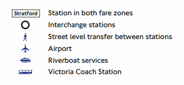
The new symbol is a walking man to show "Street level transfer between stations".
West Hampstead has a symbol because there are three stations closely spaced along West End Lane, and to get from one to another requires walking out onto the pavement. Archway has a symbol because it's a five minute walk down the Holloway Road to Upper Holloway. But Finchley Road and Kentish Town don't have symbols, because swapping trains doesn't require leaving the station.
Here are four more examples.
Walthamstow Central to Walthamstow Queen's Road is a bespoke outdoor link added in 2014. Wanstead Park to Forest Gate is a simple 3-minuter down Woodford Road. Clapham High Street to Clapham North is even quicker than that, if the traffic lights are in your favour. And Catford to Catford Bridge confirms it's not just the Overground which merits the new symbol.
But not every eligible interchange gets a walking man.
Transferring from White City to Wood Lane definitely involves walking down the pavement, but doesn't have a symbol. Getting from one Hammersmith station to the other requires negotiating two pedestrian crossings, but that doesn't have a symbol either.
I did have a theory that, because this is the Rail & Tube map, Underground-only connections don't count. But that theory instantly collapses at Shepherd's Bush, which has Underground and Overground stations on opposite sides of a road, and there's no symbol there either. If there is a rule, it's not being applied consistently.
Importantly, this isn't about showing all the possible walking routes, it's about labelling the existing interchanges. Bayswater to Queensway is famously walkable, but isn't an interchange, so doesn't get a symbol. Battersea Park and Queenstown Road are almost as close, but have never shared a connection on the map, so they don't get one either.
There are only two more interchanges marked on the map, one at Fenchurch Street/Tower Gateway/Tower Hill and the other at Hackney Downs/Hackney Central.
Except hang on, the walking man symbol between the two Hackneys is incorrect. A connecting walkway was opened in 2015, and this no longer requires going anywhere near a pavement, so whoever labelled the map shouldn't have put this in. Meanwhile Bow Road to Bow Church should absolutely definitely have one, but doesn't. And both ends of the cablecar should have one, but neither does. The whole thing is a mess of contradictions, which is pretty much what we've come to expect.
Indeed I hope nobody ever tries to shoehorn this particular symbol onto the actual tube map, which is overloaded enough with superfluous information, and doesn't need more.
While you're staring at the Bow area, allow me to draw your attention to the newly-appeared 'c2c limited service'. Consider the line from Fenchurch Street to Southend and Shoeburyness. At weekends two trains an hour depart from Liverpool Street via Stratford, rather than taking the usual route, and this limited service has now been shown as red tramlines on the map. That's fine. But someone's also added red tramlines linking Fenchurch Street to Stratford, which is odd, because there are no timetabled services along this route whatsoever.
The rogue extra line crosses the centre of Bow Road, and is occasionally used for moving empty stock. Very (very) occasionally it might get used during engineering works, but it has no absolutely place on a map of the rail network in London and the South East. The spaghetti-like mess of lines through Bow is bad enough already, and with Crossrail due to add an extra purple fork next year it can only get worse. No other 'unused' lines have been added to the map elsewhere, only this one, which suggests either overzealous inclusivity or a careless error.
Still, at least they remembered to include New Addington.
The London Festival of Architecture, which kicked off in 2004, is Europe’s biggest annual architecture festival. It lasts a month, and that month is June, so now is the ideal time to explore some of this year's 400 events and installations. I struggled through the atomised listings on the website to discover what was taking place on the first day, picked ten that sounded interesting, and set out to track them down. Spoiler: the majority were either missing, closed or disappointing, but at least the last one was good.
The Bird Hide – An art installation by Sara Heywood Royal Albert Docks [June 1 - 30]
Here's a cracking idea. On an emerging housing estate at the far end of the Royal Docks, Sara has erected a wooden ornithological shelter complete with binoculars and large west-facing window. But it's not for watching birds, oh no, it's for watching planes. The end of City Airport's runway is less than 500m away, so you can either watch the beasts taking off, or await the wheels-down roar as one suddenly appears almost directly overhead. An illustrated poster inside the hut lists all the aircraft you might see, to aid identification, but doesn't warn of the noise. Sara's underlying message appears to be "Only an idiot would buy a flat here." Unfortunately the Bird Hide was locked. The website did warn that it might be on a weekday, in which case I should "visit RAW Labs (across the bridge) for more information", but that was closed too. The arse end of Gallions Reach is a long way to yomp for a padlocked box.
Dynamic City: Reflections in Canary Wharf – Paintings by Debbie Ayles Crossrail Place [June 1 - 30]
Debbie makes colourful deconstructed artworks of cityscapes, all office block panes and towering facades. In amidst are hints of office workers, clouds and buses, but mostly this is about hundreds of spangly geometric windows. Her giant hoardings are looking good across the flowerbeds in the garden atop Crossrail Place. The lunchtime gym class taking place alongside made appreciation a bit tricky, but eventually they picked up their towels, switched off the Prodigy and sweated back to their desks.
LONDON 1840 Greenwich Visitor Centre [June 1 - 30]
An amazing model of early Victorian London, at 1:1500 scale, is being gradually assembled, block by block. If you ever get a chance to see it, do. I looked round the Greenwich Visitor Centre for the Greenwich section of the London 1840 scale model but I couldn't spot it. I asked at the desk about the London 1840 scale model, but nobody there knew where it was either. I showed them the listing for the London 1840 scale model on my phone, but they said they'd never heard of it. One of them suggested it might be at the National Maritime Museum, and apologised if it wasn't, which it wasn't. Total fail.
"Custard cream, digestive, shortbread or bourbon - How do your biscuit preferences represent your identity and what type of biscuit would you reinvent yourself as? Join us as we explore the theme of identity around a place by looking further into the name of our studio home 'The Biscuit Factory'." Well that sounded interesting. Totally wasn't. First of all I went to the Biscuit Factory, a clump of offices and workshops where Peak Frean used to make Bourbons, and fought my way through the lunchtime gymgoers streaming across the car park. But it wasn't in their cafe, it was in another cafe round the corner. I looked round the walls at the art, but failed to find anything biscuit related. There was an information board, and a man packing away a children's workshop, and a very long queue for pizza, but absolutely nothing worth trekking all this way for.
The LFA blurb describes the Treehouse thus: "It is a place of contrasts, a space in which to explore, to play, or simply take a moment to reflect. The Treehouse is a pavilion for everyone to experience architecture, and offers a new perspective on the individual, city and identity." Nah. This a shiny black wall with two entrances, plus a few cubic blocks scattered around outside. It's made from trees rather than stuck up in one. Walking inside I did feel like I was entering a urinal, but no, the interior is completely empty. Still, the shiny exterior is ideal for selfies, if that's what you like. It felt very much at home in the shallow glossy exterior of Battersea Power Station.
This is a leftover from 2016, several clumps of blue and yellow pipes hanging down to create a sort of shelter, and plonked outside the art gallery in Battersea Park. It was put together by some architects, some structural engineers and a local secondary school, which is why it looks like it does. Normally there's nothing under it, but I turned up during an FLA mapwork workshop, so there were some maps laid out on the spools underneath, and some organisers waiting patiently in case any children turned up, which they didn't. So I went inside the art gallery instead, where the latest four-storey exhibition is about flirting and sex, which filled a few minutes, but not enough to have made the trip worthwhile.
Every year the LFA has a pop-up pavilion, and this year's is in Old Laundry Yard, which if you're not familiar is a new street food market just off Shepherds Bush Market. Think loaded skin-on fries, Venezuelan fusion cuisine and a curated cocktail fix. The pavilion is an elevated illuminated box, draped with vibrant abstract colours, and will provide a focus for various cultural events. When I walked into an empty Old Laundry Yard, all the stallholders looked up from their phones and stared at me, hoping desperately that I might justify their existence by buying some food. When it became obvious I was simply wandering round looking for an elevated illuminated box, they went back to their phones with a glum expression of resigned desperation. If you're an Apprentice contestant this year, and Lord Sugar suggests Old Laundry Yard as a possible pitch for a streetfood task, I strongly recommend picking absolutely anywhere else. Also, there isn't currently an elevated illuminated box, nor any pop-up pavilion of any kind. Stay away.
Golly, it's all pavilions, innit? But this was my favourite, a collaboration between a collective of professional engineers and a group of GCSE students from across London. They spent two days designing a structure to fit under the trees outside the church, then another two days fitting all the labelled timber pieces together, and weaving a web of coloured threads above, and planting flowers round the rim. Some lucky playground in Canada Water is going to end up with this after the festival has finished. The pavilion appears to have been designed for lying down, rather than sitting, which may be why the rest of the churchyard was quite busy with adults relaxing in the sun, but the pavilion stood ignored and empty.
G-tainer Installation Royal Exchange [June 1 - 30]
This one's across the road from the Bank of England, behind the Royal Exchange. It's a "smart glass" screen designed to display digital content, across a product the manufacturers like to call a "media facade". According to the LFA listing, "This temporary installation will provide a focus point and will enable stakeholders to use both the internal space and display promotional, artistic and engaging content to draw interest and communicate with those viewing externally." Codswallop. Nobody has erected a glass screen behind the Royal Exchange. It seems the LFA listings are full of unchecked promises, not necessarily delivered, hence not to be trusted.
Skip Gallery x Richard Woods: UPGRADE Hoxton Square [June 1 - 30]
The Skip Gallery is an 8-yard rubbish skip, painted blue, into which curators Catherine Borowski and Lee Baker place temporary artistic interventions. That is genius. This month it contains one of Richard Woods' model bungalows, last seen at the Folkestone Triennial floating in the harbour. They looked striking there, and they look striking here, in a parking space opposite a pizzeria in the hipsterest heart of Hoxton. They've had to ruin it by claiming that "the house acquires further meaning by being framed by the walls of the skip in which it sits – perhaps representing the elements of a home that are discarded or abandoned in the process of renovation". But if you can ignore that, and just come to admire, I can guarantee Instagram likes.
What I should have done was carry on into the evening to enjoy the Friday night Open Studios event, which this week was taking place across Clerkenwell, but it sounded a bit social, and I probably wasn't hip enough, but mainly I was too tired after traipsing round looking for things that weren't there. Maybe some of them will appear before the month ends.
New York's High Line has been an overwhelming success, causing other world capitals to consider whether they too might have a disused elevated railway they could turn into a urban greenspace. London has numerous railway viaducts, but very few that are unused, and a decent length, and somewhere vaguely interesting.
A couple of years ago Ollie O'Brien reviewed a dozen of the likeliest candidates, and concluded that a viaduct alongside the Overground in Camden had the likeliest chance of success. Digital publication Kentishtowner noted the outcome in a front page splash, which came to the attention of the local business district, who launched a speculative crowdfunder, which paid for preliminary investigations, which confirmed the feasibility of success, hence the project is officially nudging forward. You can tell the Camden Highline is getting serious because someone's now made a wooden model.
The route runs from Camden Town to King's Cross, near enough, and if completed would be about half a mile long. It follows disused railway land alongside the Overground, mostly to the east of Camden Road station, on a thin shoulder of elevated viaduct eight metres above street level. The area in question was once part of the railway, but is currently either overgrown or used for trackside infrastructure. It's never going to be an uptown nirvana, because all along one side is a live railway which would need careful screening throughout. But the space does have genuine potential, and could be a cracking resource, if only several millions were available to effect the transformation. [Google map]
Last week the Camden Highline team organised four walking tours, alas not at high level but instead a close meander along the ground. It's a walk I can imagine project manager Adam has done several times with interested partners and potential contributors, stopping off at each major bridging point to tell another chapter of the story. And it always starts at the western end, in Camden Gardens, at the northern tip of the Camden one-way system. This pocket park is split in two by a line of brick arches where the Overground crosses Kentish Town Road. Some of these arches might ultimately be filled in to create marketable spaces to provide a source of income, but Adam emphasised the aim is not to turn the viaduct into a garish commercial space.
I've stood here before without ever noticing that the tracks are much wider right up to the edge of the road, then half of them suddenly terminate because there was no need for the sidings to go any further. It's here that the Highline would begin, requiring steps and undoubtedly a lift of some kind, and maybe an extra footbridge across the road to improve the connection. Camden Market is tantalisingly close, but not yet directly accessible, so it'd increase potential footfall massively if a link could be made through the new Hawley Wharf development.
It doesn't take long for the Highline to reach Camden Road station, indeed if you stand on the eastbound platform it's possible to see the disused section immediately behind. A lot of it is seriously overgrown, and currently the only potentially accessible section lies behind a chained gate. The ultimate plan is that this will become a new high level gateline, ushering passengers straight out onto the Highline, perhaps to walk to Camden Market or simply to enjoy the new resource. Network Rail are certainly on board, and even though they might need the land back for other projects in the future, a 25-year lease is being discussed.
That bit is Phase I, the easiest to turn into reality. The next bit's harder because the bridges have decayed somewhat, and at present can only be crossed via a narrow maintenance walkway slung above a slatted void. It looks damned pretty from underneath, especially if the sun is shining through the gaps, but a whole new floor is going to be required, first over Royal College Street, then Randolph Street and finally St Pancras Way.
The further east the Highline goes, the less gentrified its surroundings become. The first set of backstreets had cobbles and some desirable villas, but by this stage it's a little gloomier with lock-up yards and infill flats, and further ahead we'll be entering full-on abandoned car territory. If New York is anything to go by, the Highline has the potential to drag this peripheral area somewhat upmarket, which is of course a double-edged sword... and it would (for example) be ghastly to see Castle's pie and mash shop swapped for some bland chain selling chai and churros rather than spotted dick and custard.
By the time the Highline reaches the top end of Camley Street, its environs are distinctly less salubrious. A dozen abandoned vehicles lurk in a dip under the railway bridge, graffiti scrawled into the grime on their windscreens, while a generator pumps away on behalf of one of the minor industrial units alongside. This area reminded me very much of parts of Stratford before the Olympics came, and we all know how that turned out. But adjacent redevelopment plans could also increase possibilities for better connections, because someone else might end up paying for the necessary ramps and lift.
Camley Street is also where Adam ended the walk, even though the final section of the proposed Highline is already partly walkable. A narrow metal staircase leads up to an existing path over the Midland mainline - a veritable mugger's paradise - with a vague connection through to the back of the Maiden Lane estate. I didn't linger, because the two gentlemen drinking the day away in this secluded spot were every bit as unsettling as Adam's description had suggested. But it proved simple to peer through the rusty railings on the far side, and to see the messy strip alongside the Overground littered with gantries and other railway clobber, and to conclude that a trackside walkway might not be such an appealing possibility after all.
Unless a very substantial amount of funding can be sourced, the Highline will probably grind to a halt here, a few hundred metres early, at the top of Camley Street. The project blurb may therefore be technically correct when it says the Highline "would link Camden Town to King's Cross by a 10-minute walk", but that's not the King's Cross you're probably thinking of. Instead it's almost a mile down Camley Street to the entrance to the station, and not even especially close to the burgeoning redevelopment zone to the north. If you want a shorter walk from Camden Market to King's Cross St Pancras there's already a safe and direct route, at low level, following the towpath of the Regent's Canal. Perhaps that'll placate the cycling lobby when they discover the Highline won't be allowing them in.
For the time being the best way to get an idea of what the Highline might look like is to ride an Overground train from Camden Road to Caledonian Road & Barnsbury and look out of the window. There it is, a strip barely three metres wide in places, far broader elsewhere, with considerable leisure potential if only money is forthcoming. The Camden Highline team would be only too pleased for your contribution, anything from 50p upwards, to help inch the transformation forward. Alternatively you might want to go on one of the next set of explanatory walks, in late July... or keep your fingers crossed you'll eventually be able to enjoy the genuine experience, when it's finally high time.