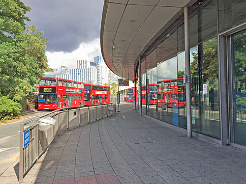
Darryl's 853 blog had a cracking scoop on Wednesday, featuring leaked details of a massive set of changes to central London bus routes, due to be consulted on next month.
It's part of a high level TfL strategy to reshape London's bus network in readiness for future growth, which likely means a lot more fiddling with bus routes than we've seen for many a year.
One key issue is removing excess capacity where it's deemed not to be needed. Another is reducing over-bussing on crowded roads, where there are currently too many routes in place. And a third is "simplifying the network", a phrase TfL seem keen to use as a bit of uplifting spin, rather than as a negative reaction to budgetary strain.
Matching customer demand – bus demand has fallen by 8-12 per cent in central London and will fall more as a result of the opening of Crossrail and other new or improved rail services. Reducing buses on crowded roads – this will make our network run more efficiently, help improve journey times and reduce congestion, emissions and road danger. Modernising the network – we will improve bus services in several town centres to simplify services and reducing the number of buses, while still providing connections and access
Passengers in outer London, where demand for buses remains high, may see more services. Expect major announcements at the start of 2019. But demand in central London is falling for a variety of reasons, slower traffic being just one, hence TfL's urge to kick off here and trim things back.
This first mega-consultation is due to launch in the third week of September, once details have been shared and finalised with borough representatives and other stakeholders. But the list of proposals is already drawn up, and likely won't change much, so I thought I'd share a summary below. Darryl has additional detail here, including some illuminating slides from TfL's high level Powerpoint presentation.
Embarrassingly, because TfL no longer produce their own bus maps, the official presentation had to resort to using an external map produced by charity worker Mike Harris. Even the last official TfL bus map will be three years out of date by the time this tranche of changes is pushed through, and entirely obsolete, so don't expect to ever see an overview of what the evolving reshaped network actually looks like. Muppets.
My table includes other central London routes currently up for consultation, or where outcomes have not yet been announced, but 28 of the routes in the list below are appearing for the first time. Skimming down the list should give you an extra month to mull over what you'd like to say in response, before the six week consultation period actually begins.
Route
Current situation
Proposed change
Result
3
Crystal Palace to Trafalgar Square
Crystal Palace to Whitehall
small cut
4
Archway to Waterloo
Archway to Blackfriars
medium cut
9
Hammersmith to Aldwych
reroute via Piccadilly, not Pall Mall
re-route
10
Hammersmith to King's Cross
merged with route 23
WITHDRAWN
11
Fulham Broadway to Liverpool Street
Victoria to Liverpool Street (see 311)
big cut
14
Putney to Warren Street
Putney to Russell Square
small cut
15H
Trafalgar Square to Tower Hill
summer weekends and bank holidays only
ALMOST
WITHDRAWN
19
Finsbury Park to Battersea
Finsbury Park to Holborn (see 311)
big cut
22
Putney to Oxford Circus (via Mayfair)
Putney to Piccadilly Circus (see 311)
re-route
23
Westbourne Park to Aldwych
Westbourne Park to Hammersmith (see 10)
merged
25
Ilford to Oxford Circus
Ilford to Holborn Circus
medium cut
40
Dulwich to Aldgate
Dulwich to Clerkenwell Green (see 45/388)
re-route
45
Clapham Park to King's Cross
Clapham Park to Elephant and Castle
big cut
48
Walthamstow to London Bridge
route withdrawn (see 55)
WITHDRAWN
53
Plumstead to Whitehall
Plumstead to County Hall
small cut
55
Leyton to Oxford Circus
Walthamstow to Oxford Circus (see 48)
extended
59
Streatham Hill to King's Cross
Streatham Hill to Euston
small cut
67
Wood Green to Aldgate
Wood Green to Dalston Junction
big cut
76
Tottenham Hale to Waterloo
reroute via London Wall (see 4)
re-route
88
Clapham Common to Camden Town
Clapham Common to Parliament Hill (see C2)
extended
94
Acton Green to Piccadilly Circus
Acton Green to Marble Arch
medium cut
100
Shadwell to London Wall
Shadwell to St Paul's (see 388)
extended
113
Edgware to Oxford Circus
Edgware to Marble Arch
small cut
134
North Finchley to Tottenham Court Road
North Finchley to Warren Street
small cut
159
Streatham to Marble Arch
Streatham to Oxford Circus
small cut
171
Bellingham to Holborn
Bellingham to Elephant & Castle
big cut
172
Brockley Rise to Farringdon
Brockley Rise to Aldwych
medium cut
205
Bow Church to Paddington
re-route to skip Marylebone station
re-route
242
Homerton to St Paul's
Homerton to Aldgate
medium cut
311
New route (see 11/19/22)
Fulham Broadway to Oxford Circus
NEW ROUTE
341
Northumberland Park to County Hall
Northumberland Park to Waterloo Road
re-route
343
New Cross Gate to City Hall
[subject to separate review]
unknown
388
Stratford City to Elephant & Castle
Stratford City to Finsbury Circus
big cut
476
Northumberland Park to Euston
Northumberland Park to King's Cross
small cut
C2
Oxford Circus to Parliament Hill
route withdrawn (see 88)
WITHDRAWN
RV1
Covent Garden to Tower Hill
[subject to separate review]
unknown
Many of the proposed changes are to ease traffic flow on specific road corridors:
• Euston Road: 59, 476
• Oxford Street: 10, 23, 94, 113, 159
• Tottenham Court Road: 14, 134
• King's Road/Piccadilly/Shaftesbury Avenue: 9, 11, 19, 22 (and new route 311)
• Whitehall/Westminster Bridge: 3, 53
• Kingsway: 171
• Waterloo Bridge/Fleet Street: 4, 76, 172, 341, 15H
• London Bridge/Blackfriars Bridge/Farringdon Road: 35, 40, 45, 100, 343, 388, RV1
• London Bridge/Hackney Road: 26, 48, 55
The only newly-doomed route is the 48 (joining the 10 and C2 which went to consultation earlier this month). Someone's looked at its route and decided it shadows the 26 and 55 too much, so a kick of the 55 into Walthamstow means the 48 can safely be scrapped. Then there's the almost-demise of the heritage Routemasters on route 15, which currently run daily, but in future will only roll out on bank holidays and summer weekends... which should help potential passengers to entirely forget the route exists, so it can be wholly scrapped later.
A few routes are being chopped to shadows of their former selves, including the 242 which has been sequentially cut back from Tottenham Court Road to St Paul's and now to Aldgate. Savage reductions in length are also proposed for routes 11 and 19, their decapitations mostly covered by new route 311. The 311 will also take over from route 22 through Mayfair, becoming the fourth different bus on the Mayfair route in less than ten years... as if nobody who plans bus routes quite knows where any of this is going.
The 45 and 171 face big cuts which'll see them both terminate at Elephant & Castle, far short of central London. while the 67 gets a similarly big curtailment to Dalston Junction from the north. Then there's the sorry tale of the 388 from Stratford, which fairly recently was extended across the Thames to Elephant & Castle to replace the 100, but is now to be lopped back to Finsbury Circus, close to where the 100 currently terminates, but the new plan is for the 100 to be partially extended... and again it feels like the planners are simply messing about.
Other things to note. The rerouting of routes 9, 40 and 341 appears to mean that Pall Mall, Fenchurch Street and Fetter Lane will no longer have a bus service. Check the consultation when it officially emerges to see if this is genuinely the case. The beleaguered RV1 is to be "subject to separate review", which following the recent halving of its frequency can only suggest that a much more serious fate awaits. And it seems the long-promised beheading of route 25 to Holborn Circus is still on the cards, severing the East End's link to the West End, and without a decent connection to take its place. [Update: Yes, that's been confirmed today, as part of another enormous consultation reveal]
It does make sense not to run buses filled with empty seats, especially now Mayoral fare policies have made this an untenable luxury. It does make sense to reduce traffic congestion by taking out some buses so that others can run more smoothly. But the breaking of long-held connections is a harder pill to swallow, resulting in increased journey times partially mitigated by use of the Hopper fare, which may just be what a "simpler network" is all about.
Watch out for the full consultation in mid-September. And know this... there's more coming.
If today's stretch of the 51½th line of latitude were 500 metres further north, it'd run from Tower Bridge to the Royal Festival Hall. Instead it slips through the minor backstreets of Southwark, missing almost everything of interest, for which I apologise in advance. [map][photos]
Bermondsey Street [51.5°N 0.081°W]
How hip is Bermondsey Street? Not at its northern end, where it slinks beneath London Bridge station, but down here winding through the becalmed historic heart of Bermondsey proper. Time Out are hyper for the place, evangelising especially about the food and drink options, but also the retained artsy craftsy vibe. 51½°N sweeps in across Tanner Street Park, around half of which is tennis courts, and well-used tennis courts at that. The remainder is mostly grass and path, where creative types come to recharge, students skim through their college notes and well-dressed women follow behind tiny pugs with plastic bags poised. What looks like a cafe in the corner is more of a restaurant, with pre-booked tables and a wine list, so Al's Cafe on the main street is a better bet. A shop called Lovely and British promises Eclectic British Sourced Lifestyle Shopping, and is shelved with stuff nobody genuinely needs, which doesn't stop it being busy. The average age of those hereabouts looks to be below average, while the average income looks to be above average, in sharp contrast to the slice of Southwark we're passing through next.
I'm peeved because the White Cube gallery isn't quite on my invisible line, so I have an existential debate with myself about whether 51.4998°N really counts. It's only ten metres out, and if my smartphone were less accurate it'd be reading 51.500°N anyway. I decide no, it doesn't count, but go in anyway. I enjoy the latest exhibition, Memory Palace, more than I expected. The themes it's hanging off are tenuous, but some of the artwork is challenging and splendid, and I spend far too long looking at Jac Leirners collage of 1980s regional advertising. Best of all there's a new-ish Christian Marclay film to enjoy, a 24 minute decontextualised splicing of movie scenes depicting the destruction of art, and it totally hyped me up for next month at the Tate.
The Borough [51.5°N]
The next kilometre is the dull stretch I hinted at earlier. I'm expecting a lot of this kind of thing out west, but wasn't expecting to experience it quite so close to the South Bank. It turns out northern Southwark has an entrenched residential/commercial underbelly of housing estates, backstreets and minor office blocks, as if the primeness of the location has been overlooked simply because it's south of the river.
The Leather Market [51.5°N 0.085°W] once housed true craftspeople, but now hosts recruitment consultants, marketing executives and novelty wellness engineers. The stark terraced flats of the Lockyer Estate [51.5°N 0.086°W] have an unavoidably undernourished feel. On the Kipling Estate, Richer Sounds Head Office [51.5°N 0.089°W] is a peculiar bastion of modern infill, opposite an LCC block where a council operative is strimming round the pear trees. The Royal Oak [51.5°N 0.091°W] is a traditional Victorian boozer serving Sussex ales, and a highly recommended watering hole, but I'm too early to get behind the net curtains. Lighthouse-keepers Trinity House own a lot of land alongside Borough High Street, which is why Avon Place [51.5°N 0.094°W] has a bicentennial mural along its length featuring Henry VIII, osteopathy and a fox chewing a brake cable.
Scovell Estate [51.5°N 0.098°W]
Here's an oddity off Great Suffolk Street, an entirely atypical council estate built by Southwark's architects in the 1970s. Long blocks of totally lowrise housing run along pedestrianised walkways decorated with pot plants and hanging baskets, with a few garages hidden out of sight out of mind. Many residents have little back gardens, with gate access to one of the mini streetlets, and some actually own bungalows. You see this kind of development further out from the city centre, but here we're less than a mile from Westminster Bridge or the Bank of England, so it all feels delightfully parochial. I don't think residents are used to many cut-through visitors, though. A lady out chatting to her neighbour has to break off ("Olly!") to stop her Jack Russell ("Olly! Olly!!") from chasing after me ("Olly! Olly!! Olly!!!"), and my presence leaves both quite perturbed.
Blackfriars Road [51.5°N 0.105°W]
Nearly, not quite at St George's Circus, the foot of Blackfriars Road is in flux. The old BT offices at Erlang House have been demolished, and in their place has arisen Blackfriars Circus, a large Barratt development whose last penthouse apartments are currently up for sale for between £1m-£2½m. The ground floor retail/restaurant units have yet to be filled, apart from a Tesco Express, whose delivery lorry has decided not to park in the bay provided and is blocking the single southbound carriageway. There used to be two lanes, but one has been sacrificed to a smart whizzy Cycle Superhighway on the other side of the road, the two-way nature of which throws me when I walk out into it without looking. Thankfully no Super Cycles were incoming.
Facing Blackfriars Circus is a completely different approach to housing, in plain London brick rather than some fancy variegated palette. Peabody Square is a Victorian collection of four-storeytenement blocks, each with a central porch, and each of these topped off with a keystone flourish depicting a letter of the alphabet. Blocks A to R run clockwise around the first great courtyard, now filled with a micro-playground, while a second quadrangle juts off from the rear. It's quiet and human in scale, admittedly concierge-free, but I'm sure most residents are happier to pay less rent rather than have a suave clerk to sign off their Amazon packages. A plaque confirms that the Queen Mother visited in 1962 to mark the centenary of the George Peabody Donation Fund. Expect Blackfriars Circus to be demolished long before any royal curtain-tugger drops by.
SOUTHWARK LAMBETH
Lower Marsh [51.5°N 0.114°W]
Just briefly, let's do Lambeth. Lower Marsh is a beloved market street, technically a conservation area but very much a treasure in transition. Several quirky old businesses survive - the Olympic Cafe has a slew of photos of its Chinese menu across its window, and Top Wind is a flute shop whose retro frontage seemingly hasn't changed since it opened in 1991. But elsewhere are blatant incomers, like Waffle Doodle-Doo and Vaulty Towers, and heaven knows how anyone gained planning permission for the geometric white condo at the western end of the street. All the street vendors serve from identikit stalls in Olympic ring colours, with tables alongside to enable rapid guzzling. Don't expect hot dogs, it's more Taste of Morocco/Falafel Wrap/Newdlez.com kind of line-up. I greatly approve of Barbarellas cafe because one of the things advertised on its shopfront is panini, plural. The beggar sitting crosslegged outside the Co-Op is busy reading a book, obliviously hoping that passers-by drop coins into his empty popcorn tub.
At the far end of Lower Marsh the multiple tracks heading out of Waterloo station cover a large portion of Westminster Bridge Road. It's gloomy under there. Only four of Waterloo's platforms extend far enough to just cross the line of 51.5°N, and they're the former Eurostar platforms so are currently out of commission.
St Thomas' Hospital [51.5°N 0.118°W]
I've ended up at London's most central hospital, thankfully of my own volition. Entrance to the site is on two levels, a concrete walkway for independent visitors and a canyon below for all kinds of ambulance. One neonatal carrier from the Kent coast has seemingly come a heck of a long way. Inpatients has recently been relocated to Gassiot House, alongside the Pain Management Unit. I watch as a member of staff, downgraded from her receptionist role by automation, politely tells a checker-in that they may have to press harder because the touchscreens "can be a bit temperamental sometimes". Beneath my feet is the Florence Nightingale Museum, which I had been planning to pop inside because it's the first museum I've encountered on the 51½th parallel. Instead I transfer that baton to Ian Visits, because he's just published a review of the place, saving me the need to go round again.
The Hospital Gardens provide a chance to escape the wards for staff and patients alike, for example the nurse who walks past shepherding an old man in pyjamas. Other orderlies are grabbing a bite to eat around the new statue of Mary Seacole, or wandering off site completely for a cigarette. Someone medical-looking is breastfeeding her baby while she takes lunch. Caution, the water in the fountain is impregnated with chemicals. A new plaque reveals that Searle's Boathouse, first home of the Leander Club, was established here in 1818. A siren wails as another arrival pulls in down below. Once again I'm hugely impressed by the NHS's compassionate ambition (and equally despairing of an official poster I spot on a wall by the ambulance park praising the valued contribution of "Siemens Healthineers").
The point on the Albert Embankment where 51.5°N launches off across the Thames is marked, coincidentally, by the memorial plaque to the victims of Human BSE (vCJD). The spot is very popular with tourists, who like to place one or more of the group against or on the river wall and take photos with Westminster's gothic turrets immediately behind. Westminster Bridge is very close by, along the line of 51.501°N, but I've come on the one day passage is sealed off by a strip of blue and white tape, two police cars, several clustered officers and at least one wielded weapon.I will get across the river to continue my latitude quest, but alas a screwball in a Ford Fiesta got there first.
A fifth crossing of the Thames brings the 51½° line of latitude south of the river for the last time. That means Southwark, and a lot of Rotherhithe and Bermondsey, as we close in on central London. [map][photos]
Surrey Docks City Farm [51.5°N 0.034°W]
I'm too old to have a favourite city farm, but this delightful farmyard slams in high on my non-existent list. It's been here by the riverside since 1986, before which the site has been a shipyard, timber yard and a receiving station for smallpox patients. It's easy to slip in from the Thames Path, by the herb garden, but most parents and very small children enter via the main gates on Rotherhithe Street. There is an unmistakeable whiff of livestock just before you head inside. It's amazing how much has been crammed in, including a central yard where you pet the goats, a duckpond, a blacksmith's forge and a small orchard (please do not pick the loganberries).
Animals kept along the 51½°N line include Alice and Hermione the donkeys, who give rides to those of small enough stature, and Rupert, Winnie and Marmalade the Oxford Sandy and Black pigs. A path laid with mosaics leads round the back of their pens to the Muck Heap, which might explain that whiff earlier, passing the Youth Allotments where a crew of young locals grow flowers and veg in raised beds. One of these children was proudly telling her Mum about all the good work she'd been doing with the farm animals that morning, and pointing out her sweetcorn of which she was evidently very proud. The sunflowers are coming on particularly nicely. And don't forget to wash your hands before you leave.
We don't quite get to pass Stave Hill, one of London's largest artificial hills, which is a shame because it's the only elevated bit of land for miles with an actual view. But we do cross Russia Dock Woodland, which is one of the original Surrey Docks filled in to create an ecological buffer, with tiny meandering paths amongst the trees, a wider recreational space, some very keen volunteers and a few old wharfside rails thrown in for good measure.
Albion Channel [51.5°N 0.046°W]
I wanted to stop off somewhere in the old Surrey Docks to take the temperature of the 80s redevelopment, so picked this artificial waterway running across its heart. Originally this was Albion Dock, one of a labyrinth of ten, and the edge of the docks can still be seen as the higher of the two paths along the eastern side. Most of the rest was filled in to create a place the LDDC hoped people would want to live, and they've been proved right. What's striking is the variety of styles, from pointy-topped stacks to sweeping curved crescents, with red brick flourishes and primary-coloured window frames for added interest, and what's also striking is how not-very highrise the development is. These days they'd have crammed far more people in, indeed down at Canada Water they're doing just that, and nobody gets to live alongside a duck-topped iridescent green channel, more's the pity.
Rotherhithe Tunnel [51.5°N 0.053°W]
I was worried when I saw that the 51½th parallel crossed the Rotherhithe Tunnel, because I've walked through this polluted tube once and once was enough. But it all turned out fine because the relevant slice is out in the open, on the gentle descent from the roundabout, not far from the huge gates that slam shut to read 'Tunnel' 'Closed'. A slew of signs along the glazed tiled wall warn incoming drivers what they should, must and absolutely cannot do for the next zigzag mile. Breaking down is strongly unrecommended. I love that the Edwardians laid a pavement along both sides of the carriageway, but 21st century pedestrians shouldn't expect to be able to cross from one side to the other as the flow of two-way 20mph traffic never stops.
Two church towers rise above the approach ramp, both belonging to Scandinavian places of worship, and originally built for the benefit of seamen. The one with a copper spire atop what looks like a town hall is the Sjømannskirken, a Norwegian Church Abroad, and gives its name to neighbouring St Olav's Square. The one that looks like a firefighters' practice tower is the one we're interested in, because it's on the right line of latitude, and that's the Finlands Sjömanskyrka, or Finnish Church. It looks very much like a small blockof flats, but if you ever get inside (say for the annual Christmas Fair) it resembles a modern and rather compact school hall. These days the seamen are long gone, and both the oldpubs bookending the shopping parade opposite have closed down, and [insert usual comment about how fast London changes].
King Edward III's Manor House [51.5°N 0.059°W]
Another direct hit, and our first ancient monument. Edward III built a moatedproperty here around 1350, when this was merely a watermeadow, with a gatehouse facing the Thames to allow him to come and go by boat. Nobody's entirely sure why he picked the hamlet of Rotherhithe, but falconry's the likeliest reason. By the 16th century river access had been lost and the manor house went private, becoming a pottery, then partially warehouses, then was entirely demolished in the 1970s other than a few foundations. These now sit at the centre of a sparse lawn, the indentation of the former moat clearly visible, watched over by an astonishingly mundane terrace of Southwarky housing. Better known is The Angel pub, a much more likely destination for those walking by, which dates back to the 17th century, not the 14th (when this particular bit of land was in the river). Best place on today's walk for a Thamesview, this, on the outside of the final bend before the Pool of London.
Dockhead [51.5°N 0.072°W]
I'm pausing here, on Jamaica Road, because something's changed. For the first 12 miles of my journey I don't think the line of 51.5°N crossed a single house or dwelling place that was more than 50 years old. Partly that's because of the quirkiness of the line travelled, but mainly because estuarine London wasn't particularly development-friendly until relatively recently. But here on the Dickens Estate the five-storey LCC blocks are of 1930s vintage, at the extremity of the SE1 postcode, and are built on the site of the infamous Jacob's Island rookery. Dockhead also has the first shopping parade I've come across since starting out, which boasts an art gallery, an organic cafe and a quality dry cleaners amongst its semi-gentrified line-up. Two of the shopkeepers are out front chatting, because for much of the week nobody's really interested. The doors of Most Holy Trinity RC Church are firmly bolted. Shad Thames isn't far away. It feels like we've finally hit the city.
Maltby Street Market [51.5°N 0.077°W]
Oh. My. Word. I have somehow never managed to be here at the weekend before, and I am unprepared for the seething crush on the far side of what looks like a quiet railway viaduct. A few of the arches on the Druid Street side provide clues, like the hairnetted lady from the St John's Bakery selling doughnuts and three quid Eccles Cakes fresh from ovens under the railway. But it's on the other side, along the narrow Rope Walk, that the foodie herd squish to enjoy the very best in everything Time Out adores. Some sellers serve out of the arches themselves, perhaps dispensing gin, raclette or beefsteak. The majority serve from little stalls, griddling while you watch or unpacking from coolboxes stashed underneath. It is rammed.
The clientele is mixed, but mainly young, the occasionally gymbod leading his parents into the melee to source something with noodles. At the Cheese Truck a grilled stilton, bacon and pear chutney sandwich costs an amount with the trailing zero missing. Craft beer is big. An acrid smell sparks the alleyway. Only the central section has tables, and they're all taken, so latecomers juggle their way to the council estate car park at the far end holding a plastic trayful in one hand and a cup of tinkered juice in the other. Not everyone's pleased. "I can't believe they charged £6 for this and skimped on the chicken," joshes one lad to his mates, But most have the look of regulars about them, Maltby Street being where they kick off their weekend to ensure it isn't wasted.
How absolutely appalling. How mindbogglingly awful. I have no words.
I simply cannot believe how wrong this is. It made me so cross when I saw it. This is not the way things should be.
Sadly we're seeing a lot more of this kind of thing these days. That's why I always share it when I see it, so I can add my voice to how unacceptable it is. Who are the idiots behind the circulation of this outrage?
When I saw this latest abomination I became so angry that I needed to tell everyone how angry I was. Not to express my indignation would make me complicit in the sharing of untruths, indeed to adopt a passive neutral position would be morally unforgivable. Every one of us is honour bound to call out misinformation whenever we see it, and to tell the perpetrators what we think of them, rather than allowing this malicious deception to be circulated unchecked.
I do not understand how anyone else could look at this situation and not come to the same conclusion the rest of us have undoubtedly reached. That's what I think, and I know you think that too.
Does it not strike you as odd that these people are saying one thing, when what they should be saying is another. I literally screamed when I heard it, as their weasel words cut deep into my very soul. My gut reaction was to yell back and tell them how very wrong they were, to put them right, to set the record straight. But I recognised I could only achieve this by replying and sharing that reply with everyone else. A rebuke shared is a judgement settled.
I disagree with these opinions in the strongest possible terms. There is no evidence whatsoever for any counterargument. We must not allow ourselves to be lured into an irrevocably unjust society by the siren voice of popular thought.
I mean, let's look at the facts, which are clear and plain and unequivocal. All these are self-evident truths, based on my interpretation of reality, and no other reading of the evidence is possible. We all know what the facts are, and yet some people still go out of their way to deny them, and it makes me mad.
The manner in which the person in question has reacted is disgraceful. No right-thinking person could ever condone what they said, that much is self-evident. There's only one way to interpret what they said, which is to find it morally repellent. I'm ashamed now that I may once have given this person the benefit of the doubt, when it turns out they held such offensive views all along. Their moral compass is seriously flawed, and I will never take anything they say or do seriously again. With this one single outrageous statement, they are dead to me.
I condemn their position unreservedly. Where is the sense of tolerance our national conversation demands?
Why do so many people continue to believe such indefensible things? We all know that a complete spectrum of opinions exists, but some viewpoints are so incorrect that it makes no sense to hold faith in them. For centuries humanity has been split along ideological lines, but I know the day is coming when the partisan will see the error of their ways and come down on the side of truth, and I'm convinced my pithy comments will help seal the deal.
And you never see any of this reported in the media. People carry on spouting these lies but nobody ever holds them to account, nobody presents the opposing point of view. I know the BBC's rigged agenda refuses to inform the public about what's really going on. Their silence only goes to reconfirm the institutional bias at the rotten heart of our so-called national broadcaster, and I can no longer countenance any of their output I disagree with.
We all know racism when we see it. We all recognise irresponsible opinions on the Israeli-Judeo-Palestinian situation. We all understand the only defensible attitude to Islamophobia. So how has it become so difficult to define the obvious dividing line between right and wrong?
The state of media regulation has become a matter of constant shame. Hateful comments which plainly break disciplinary rules are left upstanding, while colleagues of mine who only want to share the truth are brutally silenced. The ease with which unbridled misinformation and intolerance can now be circulated shames our very existence. As our civilisation slips blindly into vindictive animosity, never let it be said I kept my powder dry.
My inner monologue rages against the injustices of collective communication. How dare people make their contrary opinions known, and twist the truth in full public view. I am distressed by the thoughtless hatred being expressed in our world today, and I thoughtlessly hate those who express it. Why must they always seek to distort reality, rather than reinforce my core beliefs?
I despair at our civilisation's direction of travel. The voices of those who should be silenced are instead being amplified by the mindless over-reactions of others. We must not offer a platform to malevolent rabble-rousers who seek only to corrupt the mainstream.
Nobody wants to see this sort of thing in their timeline.
If you've been counting down my longitude as I travel across London, you'll have realised we must be getting darned close to the Greenwich Meridian. Now here we are on the North Greenwich peninsula, approaching the precise point where the eastern hemisphere meets the west. But first, well, 51½°N couldn't have delivered us anywhere better... [map][photos]
Dangleway South [51.5°N 0.008°E]
Of all the places to coincidentally end up, the southern terminal of London's best-loved cablecar is surely as good as it gets. Nowhere else in London can you take off and soar over the breakers yards of Silvertown, taking in all the glories of the estuarine Thames as you go. On the day of my visit the service is being well used by out-of-town parents keeping their kids busy with a brief school holiday treat, and ageing rockers who've arrived at the O2 too early for tonight's Iron Maiden gig and need something to fill the time. Despite the fact that Oyster and contactless is the cheapest way to fly, everyone's queueing up to pay extra for the Airline Discovery Experience emblazoned on a sign stuck above the ticket office, which'll bring them straight back here after they've discovered how dull the area around the Royal Docks terminal is. My cynicism for this Mayoral white elephant remains undimmed.
The latest commercial development inside the terminal is a souvenir kiosk, carefully positioned to attract passengers coming down the stairs after southbound flights. One of the Dangleway's many surplus members of staff hangs around in front of shelves of branded goodies, including a fridge magnet for £3, a fudge bag for £4, a thermal cup for £7 and a selfie stick for a tenner. They know their target audience well. If you've ever wanted an Emirates-red baseball cap with the cablecar's logo on the front, and have £9 to spare, you know where to come. None of this is freshly sourced, it's the same tat they've been selling in the gift shop in the cafe opposite for years, and another member of stuff lugs extra boxes of snowglobes over should they run out. Every year, without fail, the cablecar provides additional confirmation that it remains a tourist-milker rather than a useful means of public transport.
North Greenwich Bus Station [51.5°N 0.003°E]
...and not just the bus station but the centre of the bus station, the midpointof the arc, immediately opposite the escalators where the Jubilee line disgorges. Here are blue bins stacked with copies of this morning's Metro, and plastic bags into which tonight's Standard will later be flung. Three yellow cones warn that the floor might be wet, two purple footprints point off towards the local animatronic dinosaurs, and arrivals from Charlton dash to grab a Caffe Nero before descending into the depths. This is a space which sometimes seethes with people, but today is quiet as a lamb.
Of course this millennial transport interchange is due to be swept away in a few years's time as the Lords of Greenwich Peninsula replace it with a three-pronged crown of shops and flats, which'll be great if you've ever dreamed of something better than a W H Smith, but likely less convenient if all you want to do is catch a bus. In the meantime, if what you truly desire is a copy of the May 2017 tube map, the Travel Information desk has a handful in its racks and a box of 3000 on the counter (but you'll be lucky to catch it open).
Delta Wharf [51.5°N 0°W]
Dammit, it's impossible to stand on the precise spot where fifty one and a half degrees north crosses the zero meridian because it lies in an undeveloped zone behind hoardings. The intersection's about halfway between the entrance to the Blackwall Tunnel and the River Thames, on a former aggregate-processing site called Delta Wharf. The godforsaken backwater of Tunnel Avenue is as close as you can currently get, unless you're the lackey who picks up the golf balls at the far end of the Greenwich Peninsula Driving Range. The last vestiges of industrialisation were razed from Delta Wharf in 2009, but the rest of the site remains vacant until developers Knight Dragon finally get round to building Meridian Quays ("boutiques, bars and towering waterfront living at its most glorious").
For the riverside view, take the Thames Path south from Drawdock Road, almost to the jetty [51.5°N 0.002W°], where a semi-overgrown bench has been provided for your comfort. The skyscrapers of Docklands look particularly imposing from over here, I always think. Frosted half-globe lights line the promenade, wild flowers sprout in the gap between footpath and cycle path, and all could be quite pleasant were it not for the fenced-off nomansland behind you. In a city with a housing crisis, it seems insane that a peninsula cleared for residential redevelopment almost twenty years ago still hasn't got its act together (and, affordably at least, probably never will).
GREENWICH TOWER HAMLETS
Pierhead Lock [51.5°N 0.008W°]
My line of latitude's arrival on the Isle of Dogs coincides with actual riverfront access at the tip of Stewart Street. The dominant building here is quite something, an apartment block of pure white graduated towers stacked high with circular balconies, dipping backwards in a kind of swirling horseshoe formation around a landscaped terraced garden. It almost looks like some giant 1930s ocean liner has docked beside the Thames. This is Pierhead Lock, completed in the year 2000 before the area became hugely desirable, hence of far lower density than anything Barrett Homes would build today. There's no gym on site, the poor darlings, but residents do have access to a tiny private concrete jetty with two benches and a flagpole. I don't know what you do when you see a sign that says "Strictly No Loitering", but I hung around for an extra few minutes to revel in their glorious meandering panorama.
South Quay DLR [51.5°N 0.016W°]
If you're familiar with Docklands, 51.5°N sadly misses the main highrise cluster and crosses the peninsula to the south, approximately along the line of Marsh Wall. But it does score a direct hit on the bridge at the entrance to Millwall Inner Dock, where red flashing lights would halt the traffic if only any of the sailing boats moored up alongside wanted to nip through. This is also where South Quay DLR station was relocated in 2009, spanning the waterway and creating a gloomy undercroft beneath its platforms where yesterday's lunch wrappings inexorably accumulate. I particularly liked the street sign at 191-195 Marsh Wall, across the road, which still bears the original 80s logo of the LDDC quango.
The only skyscraper on the 51.5°N line of latitude is the 48-storey Pan Peninsula, which overtook the Barbican's Shakespeare Tower as London's tallest residential building in 2009. Some of the office blocks close by are the same bullet-grey cuboids erected when Docklands was new, others are covered in the telltale multicoloured panels of the late Noughties, and several more are in the process of being demolished to make way for something bankers can live in. I don't know how much longer the geometrical sheds of Skylines Village can hold out against the 48-storey tower described in the planning notice pinned to a lamppost outside, but for the time being they house a useful collection of (very) small businesses which help keep the neighbouring financial empire ticking over.
Millennium Harbour [51.5°N 0.028W°]
And on the western edge of the Isle of Dogs, another screen of flats. You can probably guess roughly when Millennium Harbour was built, its residents cursed by tiny slanting balconies smaller than the minimum area permissible today. I turn my attention instead to the Thames, a classic section downstream of a serious bend, and watch the river traffic riding the tide. i) a Thames Clipper, zigzagging over to Greenland Dock. ii) three Rigid Inflatable Boats, giving their paying customers the weaving speed-blast they paid £30 for. iii) a bright orange open-topped launch, ferrying a trio of hi-vis guys upstream. iv) three dozen empty waste containers on a chain of barges, heading to the City for refilling. v) a cruiser called Pride of London, its rear deck packed with identikit beery blokes in Crystal Palace jerseys singing "Who are ya?" at the tops of their voices, a huge St George's flag draped from the stern. It's a fabulous spot to pause and watch London drift by.
The next stage of my journey along the 51½th line of latitude returns to the north bank of the Thames, and will lead me through what were once the Royal Docks. For orientation purposes, we're in Newham, and at no point during the next two miles does the line stray more than 200m from the river. [map][photos]
Gallions Point [51.5°N 0.073°E]
On the inside of yet another Thames bend, facing Thamesmead West, the housing developers arrived early. They threw up gates around their enclave, and coveted their riverside promenade, and are I suspect seriously miffed that the Thames Path runs along it so they had to include a pushbutton system to allow the public through. Despite this being Gallions Point on Gallions Reach, all policy directives are countersigned by a body called Galleons Point Management Limited, and they have prohibition signs slapped all over. On my incursion I discover every bench on the promenade is empty, perhaps because when seated the entire river disappears behind a concrete wall. An over-optimistic number of litter bins has been provided.
At the point I'm looking for, steps lead up and over the concrete wall to a wooden gate, where a sign informs me I'm about to enter the Galleons Point Riverside Wildlife Area. This is a rarity in inner-ish London, free access to the tidal foreshore down a steep scrubby slope. The only wildlife is a pair of swans wading where the muddy beach turns to water, and occasionally flapping their wings because they can. I could jump down and walk on the bed of the Thames, or more sensibly follow a sliver of grassy path below the river defence not terribly far round the next bend. Instead I clamber back onto the promenade, surprising a kagouled couple walking through, one with her thumb in a copy of the Capital Ring guidebook. They're so nearly finished.
Royal Victoria Gardens glows with civic benevolence, imbued in the days when dock workers needed somewhere to recreate. Today its playgrounds are its best feature, but football tricky because there's only one goal. A faded sign outside the bowls club suggests a cup of coffee costs only 80p, a beef burger £1.50 and a single slice of toast 10p (chocolate spread 20p extra). Originally this park was in Essex, but peculiarly the two pockets of land immediately to either side were administered by Kent, because Woolwich'sboundaries have long been archaically obtuse.
Pier Road, North Woolwich [51.5°N 0.063°E]
My westward odyssey scores a direct hit on the crossroads at the very heart of North Woolwich, where Pier Road breaks off from Albert Road, at what was once the end of the North Circular. Traffic continues to feed down to the ferry terminal, and gushes back out in regular waves. On one corner is North Woolwich Police Station (brick, 1904), while opposite is the Royal Standard Hotel, purveyor of (cough) gentlemen's entertainment. It's too early in the day for live on-stage action, so the clientele can be seen heaving their t-shirted paunches over the pool table, feeding the fruit machines and occasionally stepping outside for a smoke. A young lad hurries over the zebra crossing towards TJ's Kebabs, cursing the parental errand that will see him entirely drenched by approaching stormclouds before he gets his box of chicken home.
Tate and Lyle Refinery [51.5°N 0.049°E]
The next mile of 51½°N is inaccessible because it passes through grubby industrial estates and Europe's largest sugar refinery. Once all this was chemical works, jam factories, mills and wharves, as river frontage and proximity to the Royal Docks made Silvertown bustle. Today Factory Road is easily one of London's most desolate streets, trapped behind Crossrail's uncrossable tracks, and will thankfully be shielded from passengers by an unbroken concrete wall. What they will see if they look up are the silos and chimneys of the Tate & Lyle refinery, which have been "keeping the nation sweet for 140 years" according to the banner strung on high. The original owner was Henry Tate, not Abram Lyle... we'll be narrowly missing his golden syrup works further along at Plaistow Wharf.
Thames Barrier Park [51.5°N 0.035°E]
51½°N doesn't quite skim the Thames Barrier, but it does hit the attractive modern park on its upstream flank. Opened well ahead of the curve in 2000, its reclaimed acreage has done much to boost house prices in these parts - so much so that its former car park is currently being converted into 236 flats. The sunken rippling Green Dock is its finest feature, but I'm heading to the flat-topped Pavilion of Remembrance closer to the river. Finally repaired, and devoid of scaffolding, its undulating stones pay tribute to unnamed local victims of war.
I'm up on the marble-edged lawns, trying to get a decent photo, when I slip and start to fall. It recently utterly tipped it down, and although I did read the sign which says "decking slippery when wet", I stupidly forgot to transfer that warning to the stones laid around the edge. Initially there's a moment when I think I might be able to regain my balance, but after a split second additional momentum kicks in and I resign myself to a flying splat. I wonder how much it's going to hurt. I should never have worn these old trainers, the tread's too worn. But somehow I tug myself out of it, a cramping muscle in my left arm the only injury, and steady myself on the ground in blessed relief. One day, I remind myself, a similarly careless slip could have more far-reaching consequences.
Royal Wharf [51.5°N 0.030°E]
Nobody wants industry any more, they want homes, so an enormous area of Thames frontage has been cleansed and Ballymore are creating Royal Wharf in its place. They're keen to give it gravitas, claiming they're creating a district with "unmistakeable character" like Belgravia or Bloomsbury, whereas the reality is brick vernacular apartments and townhouses squished along a warren of streets, the vast majority with no river view at all. Estate agents scuttle along the streets in golf buggies, private security guards in something dinkier, and colourful hoardings represent vibrant businesses which might be moving in on the ground floor but haven't yet. Starbucks is doing well, and Sainsbury's has a captive audience, but the only other sign of retail life I could find was a planning notice for an unopened nail bar requesting an 7-days-a-week alcohol licence. Nothing else along my 31 mile journey will nod at London's future more clearly than Royal Wharf.
Lyle Park [51.5°N 0.024°E]
I like Lyle Park, mainly because whenever I visit I always assume nobody else knows it's here. That's doubly the case on this occasion, because the sole entrance to the park has been swamped by a puddle, and I have to teeter round a dog mess bin and brush along a soaking privet hedge to gain access. I am correct, there is absolutely nobody else present, the football pitch awaiting matches that never come, and the riverfront benches devoid of even a scattering of litter. And yet the park is evidently well looked after, the shrubbery vibrant, the changing rooms primed, and developers held firmly at bay.
The park was gifted to the people of West Ham by Abram Lyle's syrup dynasty, essentially to give their workers a thin sliver of recreational land and a smidgeon of river access. The focus of the raised gardens at the rear used to be a bandstand, but the formerfactorygates of the Harland & Wolff shipyard now provide the centrepiece, relocated from North Woolwich when the business folded. I could sit happily up here staring at the ugliest bit of Greenwich, and the river traffic floating through, were it not for the nagging feeling that I'd be a sitting duck for petty crime. The park's single entrance is so far distant, and the adjacent businesses so bleak, that... well, just don't visit the park alone if your imagination thrives on worst case scenarios.
When Westminster council told TfL that no, they weren't going to pedestrianise Oxford Street, it threw all sorts of plans up in the air. In particular it totally messed up plans to remove all buses from Oxford Street, because that no longer needed to happen.
Yesterday TfL snuck out the results of an enormous consultation they ran last year on The transformation of Oxford Street, its contents now somewhat overtaken by events. But certain outcomes are now confirmed and will happen, mainly affecting bus routes in the western half of Oxford Street, including the proposal that a key bus route (with a very low number) should be scrapped.
» Here's the 37-page Consultation report (in summary, 48% of respondents said "Yes", 16% said "Yes, but..." and 33% said "No")
» Here's the 156 page Response to issues raised (which is essentially TfL saying why they're ignoring every issue people raised)
» And here's the updated consultation webpage (which is probably the only bit worth engaging with)
Let's focus on the changes to buses, and I'll try to unravel what I think they're saying is going to happen.
Here's a summary of which bus routes run along which bit of Oxford Street today, and how that's due to change once all the tweaks are made.
Marble Arch to
Selfridges
Selfridges to
Oxford Circus
Oxford Circus to
Tottenham Court Road
Current
2, 7, 10, 13, 23, 30, 74, 94, 98, 159, 274, 390
7, 10, 23, 94, 98, 113, 139, 159, 390
10, 25, 55, 73, 98, 390
Proposed
2, 7, 13, 30, 74, 94, 98, 274, 390
7, 98, 139, 390
25, 55, 73, 98, 390
Don't worry about the section between Marble Arch and Selfridges, that's quite short, and there's less pressure to cut buses there. Instead focus on the section between Selfridges and Oxford Circus, which is the most prestigious bit of Oxford Street. Currently there are nine bus routes on that stretch. The intention is to cut that to just four. This is a serious cull.
Specific changes are proposed for routes 10, 23, 94, 113 and 159. The latter three routes are to be cut back to terminate earlier than they do now. And routes 10 and 23 are to be merged, the resulting hybrid no longer passing along Oxford Street, and retaining the number 23. Route 10 is dead, as of November this year.
Here's a proper summary.
Route
Current situation
Proposed change
Effect on
Oxford Street
10
Runs from Hammersmith to King's Cross, via Hyde Park Corner, Marble Arch and Oxford Street.
Route 10 will be withdrawn, but route 23 will be amended to run between Westbourne Park and Hammersmith. The new route 23 will continue to run between Westbourne Park and Marble Arch, but will then follow the existing route 10 from Marble Arch to Hammersmith.
REMOVED
23
Runs from Westbourne Park to Aldwych, via Paddington, Oxford Street and Regent Street.
REMOVED
94
Runs from Acton Green to Piccadilly Circus, via Notting Hill Gate, Marble Arch and Oxford Street.
Will be cut back to a new terminus in North Row near Marble Arch (once Westminster council have agreed to a new bus stand in North Row). The full route will continue to run at night, numbered N94.
REMOVED during the day
113
Runs from Edgware to Oxford Circus, via Hendon, Swiss Cottage and Marble Arch.
Will be cut back to Marble Arch.
REMOVED
159
Runs from Streatham to Marble Arch, via Westminster, Regent Street and Oxford Circus.
Will be cut back to Oxford Circus.
REMOVED
The 10/23 merger is an odd thing. The new route will swing in from west London, pass along Park Lane, then swing out west again to terminate barely two miles from where it started. It feels like TfL are simply tying two ends together creating a route nobody will want to travel more than half of, for the sake of reducing traffic on Oxford Street.
Don't get too upset that the number 10 is disappearing, the route's only 30 years old rather than some age-old classic. But it is ironic that back in 2003 this particular route 10 was separated into two overlapping services, the other end becoming route 390, and once all these shenanigans are complete the 390 will be one of only two buses still running the entire length of Oxford Street. What TfL should do is renumber the 390 as the 10, because that's what it used to be, and then the Men Who Like Buses will be slightly less angry. But more likely they'll save up the number 10 to use elsewhere instead, somewhere, eventually, because that'd be easier and cheaper.
To give you some idea of how significant the reduction in buses on Oxford Street has been, here's a table showing how many bus routes ran along it ten years ago, compared to now and next year.
year
Marble Arch to
Selfridges
Selfridges to
Oxford Circus
Oxford Circus to
Tottenham Court Road
2008
16 bus routes
16 bus routes
9 bus routes
2018
12 bus routes
9 bus routes
6 bus routes
2019
9 bus routes
4 bus routes
5 bus routes
That's a massive reduction in the key section from Selfridges to Oxford Circus, from sixteen routes to four in the space of a decade. If TfL can't pedestrianise central Oxford Street because Westminster council won't let them, it seems the next best thing is to cut the number of buses by three-quarters. Where will it all end?
I'm making an east-west cross-London journey along the 51½th line of latitude, and for my second post have awkwardly relocated across the Thames from Havering to Bexley. The line's uncompromising alignment means that much of today's journey is across Thamesmead, you lucky people, but first there's some unattractive estuarine hinterland to tackle. [map][photos]
Belvedere Industrial Estate [51.5°N 0.170°E]
One thing about the Thames in outer East London is quite how much low-level commercial activity there is. The river is wide enough for 'neighbours' on the opposite bank not to be disturbed, so all the essential mucky infrastructure which keeps the capital ticking over is sprawled out across huge expanses of former marshland. The Belvedere Industrial Estate is a case in point, covering an approximately triangular slice on an inside bend between the Erith Oil Works and the Crossness sewage plant. My target is one particular jetty south of Jenningtree Point, which despite being on the Thames Path is annoyingly hard to reach as the estate permits no river access except at either end. I climb up to the top of the concrete battlements, then weave round thickly grooved muddy beaches to the rear of sheds and depots, until I'm finally opposite where I was two hours before.
Here at Mulberry Wharf I find a rare gate in the river defences, painted with yellow and black chevrons, firmly shut and overseen by CCTV and spotlights. Behind the iron bars sit maintenance trucks, caravans and a man in a forklift surrounded by pallets, while a thin pipe bends over the footpath to feed the padlocked jetty. This is T-shaped and mostly concrete, although one arm consists of two metal gantries to nowhere, linked via a central pillar. The surface is crumbly and overgrown, the only signs of activity being a rusty hopper connected up to a blue tube, and a couple of bright orange lifebelt holders, at least one of which is empty. Buddleia overspills the path. A cyclist careers by. The tide is sludge-low.
The top corner of Bexley, where land is cheap, has proven the ideal location for numerous logistics hubs and Customer Fulfilment Centres. Lidl dispense your shopping orders from a huge depot backing onto the river, Amazon distribute from a site on Crabtree Manorway, Tesco's Dotcom Centre is a bit nearer Erith, and Ocado have by far the most gigantic warehouse of all. As for Asda's CDC, their white fortresses lie slap bang across 51½°N on Norman Road, and that's where I'm heading next.
Crossness Nature Reserve [51.5°N 0.151°E]
A large portion of the Erith Marshes remain somehow undeveloped, including this 60 acre site to the east of the Crossness sewage works. A rare reedbed haven, it's half private courtesy of Thames Water, and half accessible via an unpromising footpath link from Norman Road. A minute up the track I disturb a heron at close quarters amid the rushes, which flies off majestically followed by several startled waterfowl. I soon find myself in the middle of a scrappy field grazed by shaggy horses, who eye me up from a safe distance, while the Bexley Incinerator dominates the near horizon and thistledown drifts across a barbed wire fence. I feel distinctly uncomfortable, rather than at one with nature, and retreat from the field just before a man with a van drives in and greets me with a suspicious smile.
South Mere [51.5°N 0.123°E]
Most of Thamesmead is relentless housing estate, or empty, but I've hit the jackpot and arrived at its most famous landscape feature, South Mere lake. This is where C4's Misfits was filmed, and Beautiful Thing, and a particularly dystopian Stanley Kubrick classic. To the east of the lake is Southmere Park, littered with goose-droppings and abandoned barbecues by the water's edge, but increasingly bleak and paddocky on the extensive flatlands beyond. It seems a minor planning miracle that nobody's covered this underused recreational wilderness with a thousand homes, and equally remarkable that the 51½°N line of latitude has yet to hit a single residential building, even four miles inside the capital. We're about to change that.
Binsey Walk was the location of one of A Clockwork Orange's most famous scenes, as Alex and his droogs strut along the edge of Southmere Lake before being booted, submerged and sliced. A single row of flats with staggered concrete balconies overlooks a stepped waterside promenade, where any 21st century hoodlum could don a bowler hat and codpiece and... oh hang on, it's been fenced off! A blue hoarding juts out just far enough to prevent even acrobatic access, while the swans brooding on the overgrown promenade suggest that this is no recent development. Another film location bites the dust.
These famous flats, along with the majority of the original Tavy Bridge neighbourhood, are being demolished and rebuilt in modern vernacular. The shopping parade is part of Phase I, where wealthier incomers will get the waterfront block while denser affordable apartments are packed in behind (including ground floor homes for the first time following the relaxation of flood-risk regulations). Binsey Walk is scheduled for later, but has already been decanted, with access to its upper walkways permanently blocked and several of its net-curtained windows either smashed or boarded up. It should be good news for the 'temporary' portakabin library and the gutted Lakeside social centre, but what's planned is a strip ofidentikit buildings no location scout would ever pick for a movie.
BEXLEY GREENWICH
Birchmere [51.5°N 0.106°E]
Across the dividing line of Harrow Manorway, Thamesmead is younger, and less iconic, and belongs to Greenwich. This is also where the 51½th parallel crosses the massive sewer and dual carriageway which divides Thamesmead more physically, and makes a beeline for further open space. The eastern end of Birchmere Park consists of recreational glades, the central section is 100% grass and the western end boasts a twelve acre landscaped lake (which is the hub of all the waterway corridors hereabouts). I follow a typical family on their journey through; a bullet-headed Dad leading an unwilling hound, a young son driving a miniature red car, and an elder daughter being shouted at when all she was trying to do was follow instructions. They stop to feed the geese, beside two cannons left behind to remind residents that this used to be Woolwich's firing range, while a pair of weary anglers wait for this cacophony to pass.
I find to my cost that there is no pedestrian connection between the two estates beyond Central Way, the intermediate wasteland awaiting massive redevelopment after the Gallions Reach Crossing one day, maybe, leaps off the drawing board. The yellowbrick houses along Newmarsh Road aren't ageing well, and some owners aren't taking as much care of their properties as others, so I'd say this faded enclave has future slum written all over it.
Thamesmead West [51.5°N 0.090°E]
Zero points to the planners who named this disconnected estate after a neighbourhood centre they can't easily reach. Conveniently located only for staff at Belmarsh prison, this labyrinth of flats andtownhouses is enlivened only by an artificial hill added in an attempt to give the place some character, and a landscaped drainage channel. I descend a set of log steps to the one wooden pontoon the ducks haven't occupied, while a total handful of a boy rides over the footbridge in a state of midsummer agitation. If you live round here, the Princess Alice is your sole pub/carvery option, a cheerless building named after a local mass drowning. If you don't live round here, and aren't called for jury service at Woolwich Crown Court, I suspect it's best avoided.
Gallions Reach [51.5°N 0.084°E]
51½°N has hit the Thames again, at one of the first East London locations where private developers thought high rise living might be a good idea. Now Woolwich is getting in on the act, big-time, but here we are a mile downstream on a godforsaken bend where many of the first residents weren't as happy as they might have been. But the Royal Arsenal development has tugged the place somewhat closer to the action, and Crossrail may be the breath of life everybody needs. I watch, perturbed, as a local family ascend to the highest point on the river wall and their youngest child announces "I can see the sea!" Newham's a fair way across the water, as well as where all those noisy planes are landing, but City Airport's hardly overseas.