Somewhere famous: Shepperton Studios
One of the UK's most famous film studios is in Spelthorne, although not actually in Shepperton, and should probably have been named Littelton Studios instead. Poor Littleton. 100 years ago the village was described as one of the least spoilt in Middlesex ("It is built almost entirely of red brick, and presents a cheerful and peaceful aspect as it clusters about the church"). But then it caught the eye of the newly-formed Metropolitan Water Board who selected the area as their site of their first water storage facility. Construction of the Littleton Reservoir took over ten years, delayed by the discovery of weak sand under the western dam which forced the realignment of the perimeter and the loss of most of the village. St Mary's Church survived, as did the manor house, but the majority of residents had to be rehoused along a New Road to the south. From 1925 until the 1950s it was largest reservoir in the the world, surrounded by an embankment four miles long and 40 feet high, holding up to 30 billion litres siphoned off from the Thames. And on the day of opening the King renamed it the Queen Mary Reservoir, as a further local snub. Poor Littleton.
The manor house and its estate now lay in the shadow of the embankment. In 1931 it was purchased by Scottish businessman Norman Loudon for use by his new film company, Sound Film Producing & Recording Studios. The Second World War disrupted production, the government requisitioning the site to build dummy aircraft, after which Sir Alexander Korda's British Lion Films took over. In 1949 The Third Man was filmed here, while Sixties' Shepperton classics include Dr Strangelove, 2001: A Space Odyssey and Oliver! Littleton House remained at the centre of the site, and was used for filming of The Omen, while gradually the surrounding parkland was taken over by sheds, workshops and sound stages. Star Wars, Superman and Alien were all Shepperton-based, while other ridiculously successful productions churned out here include Gandhi, Gladiator, Channel 4's The Crystal Maze and (much more recently) Avengers: Age of Ultron. The studios are now part of Pinewood's media empire and house 15 stages of varying enormity, as well as preview theatres and everything the aspiring Hollywood producer requires.
Don't think you're getting inside. A narrow lane to the backlots off Laleham Road is watched over by a small white hut, any chance of viewing filming activity dashed by a run of woodland along the River Ash. Meanwhile the main entrance lies just past the church up the appropriately named Studios Road. Well-watered hanging baskets dangle from the lampposts on the approach, while thick leylandii hedges protect the production area from prying eyes. A fairly steady stream of vehicles use this back road, some continuing to the remote housing estate squeezed in down the far end past Stages S, R and H. Others wait at the gate house to pass security, the long list of regulations posted by the barrier including the banning of all onsite photography on pain of confiscation. The main thoroughfare beyond is David Lean Drive, leading to Peter Sellers Way and Orson Welles Road. And tucked up beside the reservoir is a 16 acre lot on which heaven knows what might be filmed, although I assume they remove the grazing sheep before the cameras roll. by train: Shepperton
Somewhere pretty: Sunbury Millennium Embroidery
Sunbury is a lovely place. That's Lower Sunbury, to be clear, not the hideous agglomeration of office boxes at the start of the M3 in Sunbury Cross. Instead Sunbury-on-Thames nestles close to the river along part-public part-private frontage, with Thames Street a particularly charming (and narrow) street. Just the kind of community, then, who'd seek to commemorate themselves at the millennium via a highly ambitious project. Five years early a small group of residents made plans for an embroidery to capture 'Sunbury on Thames in the year 2000', the end result to be displayed in St Mary's church. A design was drawn up, and 140 volunteers came forward to sew their appointed section of the whole. The central panel features dozens of the the village's buildings and some of the wildlife to be found by the waterside, while eight adjacent panels depict Sunbury's history, community and long-standing tradition. The completed project was 25 feet long, and even the Queen made a special visit to see it. It was at this point that the organisers realised they had something special and nowhere to put it, so they borrowed a corner of the local park and commissioned a permanent gallery to be built.
The Sunbury Embroidery Gallery opened in The Walled Garden (off Thames Street) in 2006. The timber building's not enormous but it is beautifully formed with elliptical curves, and one long wall along which the whole of the embroidery can be displayed. A guide is available to point out the more interesting features, and smaller temporary smaller exhibitions are hosted in what little space remains. There's a cafe, of course, because the entire gallery project was designed to be sustainable, and I'll vouch for the cup of tea and cake being more than half decent. The outdoor tables have a good view of the Walled Garden, which is also expertlymaintained, should you be seeking a particularly genteel afternoon out. The gallery and cafe are fully accessible throughout, and the whole place is totally visitable by Oyster aboard the 216 bus. It's more a ladies' destination than a Father's Day favourite, I'd say, but how excellent that this celebration of community will survive long after its creators have passed on. [4 photos] by train: Sunburyby bus: 216, 235
Somewhere weired: Penton Hook Island
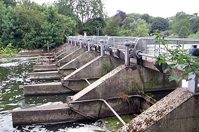
Until 200 years ago the River Thames cut an awkward channel between Staines and Chertsey. At Penton Hook it followed a teardrop-shaped loop around a wooded peninsula, forcing a circuitous (and somewhat turbulent) detour almost a mile long. The neck of the peninsula was barely fifty yards across and often flooded, but was only made navigable in 1815 when an artificial channel was cut through and Penton Hook Lock was opened. From one tongue of land three islands have been created, the first for the lock itself where a modern lock-keeper will come and press buttons to power the gates and help your craft pass through. Two further cuts have been made by broad weirs over which the Thames now rushes, each crossed by a narrow footbridge. These lead to the main island, now a nature reserve, one complete circuit of which by footpath takes a good ten minutes. Nobody lives on the island, although on my circumnavigation certain anglers looked like they'd been settled in for some time. Whilst a couple of additional paths cut inland, the strangest sight on the island is a river flowing through the middle, this a relatively recently-added "fish spawning and bypass channel". Overlooked only by the riverside houses of a favoured few, this outpost of Spelthorne is a marvellously remote place, interlinked with neighbouring Runnymede like the lug of a jigsaw piece.
Somewhere sporting: Kempton Park racecourse
And there's this too, although there is a limit to how much of a Surrey district you can visit in one day when the trains are disrupted, so I gave the racecourse a miss. And anyway it had been hijacked for the day by the Race For Life, a collective jog for charity, which meant the car park was heaving with runners in unpleasantly bright pink. I bet no ladies wear a pink ballerina's tutu to the King George VI Chase on Boxing Day, not just for reasons of high fashion but because it'd be flipping cold. by train: Kempton Parkby bus: 290
Spelthorne used to be the southern slice of Middlesex, until swept away to form the only Surrey district north of the Thames. Squeezed in between the Heathrow, Hounslow and the river, it's the sixth and final Surrey district I've visited on my circumnavigation around the capital. It's also a tad dull, the largest town being Staines, and almost 20% of the district being covered by giant reservoirs. But I took the opportunity of a fifteen mile walk to try to seek out some of Spelthorne's less mundane corners, and I hope you'll agree it wasn't quite a Saturday wasted.
Somewhere historic: Staines-upon-Thames
I know, what were they thinking? Formerly plain old Staines, in 2012 the council took the somewhat pretentious step of appending "-upon-Thames" to their name, switching overnight from a homophone of "blots" to a name that sounds like there's an oil slick on the river. The town has a proper ancient history that long precedes Ali G, thanks specifically to its location on gravel at a rare natural crossing point of the Thames. The Romans knew it as Pontes, or 'the bridges', and their walled settlement now lies lost beneath the town centre. 800 years ago King John's barons set out from here to sign Magna Carta at Runnymede, just upriver, and the Civil War stopped by a few times centuries later. To get the hang of Staines and the surrounding district, be sure to drop into the Spelthorne Museum at the back of Staines library. One of its rooms is open whenever the library is, the other (plus the shop) only for three afternoons a week. How fortunate was I?
Did you know, for example, that linoleum was first produced in Staines? Businessman Frederick Walton created the famous floor covering from linseed oil, hence its name derived from 'linum' (flax) and 'oleum' (oil), and opened the Linoleum Manufacturing Company on a site to the north of the town centre in 1864. The factory grew to cover 45 acres and was by far the largest employer in the town, but closed in 1970, and the site is now covered by the Two Waters retail park and a housing estate. In commemoration (and I suspect this is unique) there's a statue in the High Street of two men carrying a roll of linoleum inscribed with a poem. “Roll out the lino from Staines to the world! Release every pattern from chessboard to twirl! In every hopeful kitchen let life unfurl..." On TripAdvisor the linoleum statue has been voted the 6th best tourist attraction in Staines, in a list of ten that quite frankly won't have you rushing.
Another Staines quirk is the London Stone, a medieval boundary marker delimiting the upper end of the City of London's jurisdiction over the River Thames. The town was once the farthest upstream that tidal flow could be observed, barely a few centimetres, but sufficient in 1285 for a London Corporation stone to be erected beside the river. In the 17th century the stone was replaced by an ornate two-foot plinth, this later raised on a stepped pedestal, and the Mayor of London would sail upriver every few years to reclaim his rights in a sword-touching ceremony. The stone's moved several times since then, its traditional location in the Lammas Recreation Ground now empty (so try not to waste fifteen minutes of your life hunting for it there). Meanwhile that's a modern replica in the Memorial Gardens, the original having been shifted in 2004 to a glass case in Spelthorne Museum, where it looks somewhat neutered behind glass.
If the thought of visiting the town excites you, next Sunday is about as good as the experience gets. June 28th is the annual Staines-Upon-Thames Day, a riverside shindig in the Memorial Gardens promising dragon boat racing, live music, a duck race and "canoe taster sessions". Spelthorne Museum will be specially opened, such is the civic joy this day engenders. Meanwhile the last Sunday in the month is also when the Staines Society of Model Engineers get out their self-built locomotives and ride passengers round a loopingwooden track in Staines Park. Interestingly that's not Staines-Upon-Thames Park, neither is the town's river crossing Staines-Upon-Thames Bridge, nor is the local station Staines-Upon-Thames, but presumably that's austerity renaming for you. by train: Stainesby bus: 117, 203, 216, 290
Somewhere random: Staines Moor
England's worst ever air crash took place just outside Staines, on a drizzly Sunday afternoon in June 1972. BEA Flight 548 took off for Brussels from Heathrow shortly after 5pm, and crashed less than three minutes later killing all 118 on board. Various factors came together to cause the crash, including an argument set off by strike action planned for the following day, and the possible cardiac incapacitation of the pilot. He failed to maintain sufficient air speed after take off, and the crew failed to notice (or believe) instruments in the cabin suggesting that a deep stall was imminent. The Trident dived out of low cloud above the King George VI Reservoir, grazed the traffic on the Staines bypass and plunged tail-first into a narrow field on the outskirts of town. No houses were damaged, not quite, but the plane broke in two on impact and there were no survivors.
Amemorial to the crash has been built nearby in Moormede recreation ground, and a remembrance ceremony has been held here every year since 2004. Visiting two days after the anniversary I expected to see the floral tributes still laid out, but they'd all been removed and the 'Papa India' memorial lay bare. Instead, somewhat awkwardly, a local man sat on the benches smoking a cigarette, and seemed bemused by the interest I was taking in his seat beneath the trees. The plaque at his feet was small, meaning I had to get closer than I'd like to see it, and had to make do instead with a surreptitious inspection from behind the grassy mound. Elsewhere a significant proportion of the dogs of Staines yapped excitedly beside the playground as their owners stood and chatted, as if nothing untoward had ever happened.
Close by, beneath the bypass, is the vast expanse of StainesMoor. Two square kilometres of alluvial meadow have survived here, sandwiched between the M25 and a reservoir, unploughed for more than a millennium. The moor has a rich and diverse flora, attracts copious bird species and also boasts Britain's oldest anthills (of one particular type, before you get too excited). The Colne and Wraysbury rivers thread through the site, a remarkably open space with free public access, while an abandonedrailwayviaduct crosses the western flank. Yesterday the moor was dry with an abundance of yellow flowers, although I can imagine it's potentially impassable during a wet and marshy winter. At one point needing to cross a footbridge I ended up walking through the centre of a watchful herd of cattle and horses, which unnerved me somewhat, but my trek to the village of Stanwell Moor was an unexpected delight.

Beyond London (8): Spelthorne (part 1)