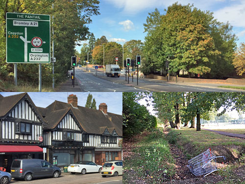
THE UNLOST RIVERS OF LONDON Kyd Brook Locksbottom → Petts Wood → Chislehurst (4 miles)
[Kyd Brook → Quaggy → Ravensbourne → Thames]
First things first, the Kyd Brook doesn't flow through Kidbrooke. But its waters do get there eventually, as the river changes its title to become the fantastically-named Quaggy, one of several tributaries which eventually merge to form the mighty Ravensbourne through Lewisham and Deptford. But if it's fantastic names you want, stay with me, because we're going to Locksbottom and Tugmutton Common, in far-flung Bromley.
The Ravensbourne (proper) rises in Keston, but the source of the Kyd Brook is about a mile to the east, not far from Farnborough. Specifically there are two sources, both on private land beyond the A21, and the ensuing streams flow separately for the first mile and a half despite being not very far apart. One's called the Kyd Brook and the other the East Kyd Brook (which is baffling because geography dictates it ought to be the West). Let me take them in turn, starting with the stream which appears above ground first.
The ponds where the Kyd Brook begins are the private preserve of whoever owns Lakesview, a residential fortress with massive gates and a garden large enough to require four green wastebins. The river's invisible too, culverted beneath the main road, then crossing the bottoms of gardens on a 1930s housing estate. A dip in Starts Hill Road provides the first convincing evidence of fluvial erosion, then some allotments get in the way, and finally the stream emerges from a pipe in the corner of Tugmutton Common.
Originally called Leg of Mutton Common, because of its shape, 'Tugmutton' is obviously a lot more fun. In the 19th century this was a popular winter base for a large group of gypsies, who failed to endear themselves to the local population, who grouped together to enclose the site and see them off. Their descendants are a friendlier bunch, meeting twice a month on Wednesdays for a spot of litter picking and light maintenance, ending up with coffee and biscuits. The Kyd Brook hugs the eastern edge of the common, in a ditch barely half a metre wide, then follows a short dead-end path into another housing estate.
Pondfield Avenue is a street name which strongly hints at what was here before the houses came. The postwar detached chalets hereabouts are low-key desirable, with parked cars one notch classier than you'd expect, and a surprising number of personalised numberplates out front. Find the right cut-through and you emerge in Crofton, near the Scout Hall and the village sign, at a crossing point which'll be familiar to anyone who's walked London Loop section 3. And here's the river again, popping up behind a brick screen and wiggling up the edge of Crofton Woods.
A tarmac path tracks the Kyd Brook all the way, initially in earthen channel, now at least a metre wide. It's not rained so much lately so the flow is attractively low, rippling over exposed roots and flat pebbly beds. Occasionally footbridges or stepping stones connect to the streets beyond, allowing direct access for joggers and dogwalkers to the extensive thick woodland. At one point the stream slips just behind the fence, creating a water feature at the bottom of all the gardens on Heath Side. Ponies graze. Schoolchildren shriek. The cul-de-sac at the far end is called Kydbrook Close, and indeed it is.
Meanwhile, back in Locksbottom, the East Kyd Brook also rises unseen on wooded slopes. A dip in the A21 is the first physical sign, beside a pub called Ye Olde Whyte Lyon, which started out as the White Lion before someone anachronistically mangled every word in its name. The dip is also why this area was once known as Lock's Bottom, where Bromley sited its workhouse, which eventually metamorphosed into the Princess Royal University Hospital. The stream now hides beneath Sainsbury's car park instead, before skirting the other side of Tugmutton Common.
This time we're going on a proper walk through Crofton Woods, 150 acres of dense ancient woodland, which is far more of a treat. The East Kyd Brook first pops up in what looks like one corner of an old walled garden, then meanders up the centre of the woods like a proper river should. It's a little wider and less tamed, but still with a scattering of rounded pebbles forming the bed. Gnarled roots break through the earth above each twist and turn, the banks darkly shaded, the shallow waters currently a placid ribbon. Ten of the best minutes of the walk, this.
At the northern edge the stream emerges onto Petts Wood Recreation Ground, again hugging one side in a crinkly ditch. It looks like the footpath continues over the footbridge behind the playground, but this promising trail narrows and peters out at one final bend, useful only for overenthusiastic kickers who need to get their ball back. Here we find another metal screen, designed to filter out larger chunks of debris before the river heads back into culvert... and just ahead is Kydbrook Close, which means it must be time for the two tributaries to merge somewhere underground.
The conjoined Kyd Brook spends the next mile underneath the suburb of Petts Wood, running roughly parallel with Tudor Way and Crossway. The town's houses are finer than most, all shining semis and leaded lights, dating back to a developers' landgrab in 1927. The National Trust responded by buying up 300 acres to he north of the railway to preserve the unblemished landscape, which is where we're heading next. Grab a free NT map from the dispenser just beyond the subway - a truly excellent production - and you can learn all about it.
The Kyd Brook has now re-emerged, crossing gardens on Hazelmere Road, before veering sharply to follow the railway embankment via a screened artificial channel. Only when it cuts underneath do we regain proper view, and see how much wider the river has become while we weren't looking. It's almost paddlable, not that I'm convinced I'd risk it. The footpath here is briefly part of London Loop section 2, but this time eschewing the leafy delights of Petts Wood for the open fields of the Hawkwood Estate. The National Trust saved this valley too, and retain it as haymeadow and pasture, with the Kyd Brook flowing bucolicly down the middle. The other ten of the best minutes of the walk, this.
Livestock I spotted included sheep and cattle, and a startled Siamese cat whose afternoon siesta was disturbed by me unexpectedly tramping by. I followed the line of oak trees beside the stream, along an all-weather path kindly laid a few years ago by the Chislehurst Society, and smiled my way ahead. Now is not the time to enjoy the bluebell carpet in Pond Wood, but I've made a note. Although the landscape could be described as normal for outer Bromley, I did have to keep reminding myself I was still in Greater London.
To escape Hawkwood at the far end, either divert onto Gosshill Road at the footbridge, or stick with the stream for a few more untainted minutes. It's now a few metres wide, briefly at least, although at depths entirely unsuitable for the playing of Poohsticks. And then you've no choice but to head up the hill alongside one last field, emerging at the foot of a wealthy cul-de-sac of commuter palaces. It's no distance from here to Chislehurst station, which is where I'll leave things for now. Downstream of Chislehurst the Kyd Brook becomes the Quaggy, and that'd be a whole new post (or two), no kydding.
Sat 1: When the train arrived at Newhaven Harbour station, I pressed the button on the rear carriage and the door didn't open. The door into the next carriage didn't open either, and I feared I was going to be left behind. The guard yelled down the platform that I should use his door, so I ran up and climbed aboard. His excuse was that "the book" said only the front four carriages fitted into the platform. Sun 2: I went to the Angel Canal Festival but it was really busy, because that's what happens when you hold a festival on a towpath.
Mon 3: I went back and bought an 'Apple Crunch' signature cone from Bears Ice Cream in Starch Green. They sliced the apple specially before sprinkling everything with salted caramel and cinnamon, and it was delicious. A passer-by enquired where I'd bought it, then jumped onto a number 94 bus through the middle doors without paying and smiled back at me. Tue 4: I'm never sure if the council are actually going to turn up and collect my recycling bags off the pavement, but they did, so that's good. Wed 5: The pharmacy had my tablets, which was a relief, because I no longer quite understand how their automatic renewal/reordering procedure works, and usually end up standing there looking like an idiot. Thu 6: Wow aren't the Malvern Hills amazing? I don't think I'd seen them properly before, but there they were from the train, this big sticky-up ridge in the middle of nowhere. I bet they're amazing to climb on a good day, and I have added them to my longlist of UK places I must visit before my legs give out. Fri 7: Tesco had Lemon Drizzle KitKats on special offer, nine for £1, so I bought more than one packet. This is why I still prefer buying in person rather than online, because otherwise you miss these bargains and end up paying full price for the usual Wagon Wheels or mint chocolate Clubs. Sat 8: The Crystal Palace Subway is properly amazing, isn't it? The vaulted brick pillars under the A212 are stunning, even if they are an iniquitous remnant of unequal provision, provided solely for first class travellers exiting the former station. By visiting late on the Open Day there were no queues, hence better opportunities to take people-free symmetrical photos. Sun 9: I don't normally sit in the Costa outside Harrow-on-the-Hill station watching other people drink tea, but today I made an exception.
Mon 10: I decided this would be the ideal time to catch up on a couple of programmes I recorded over Christmas while I was away in Norfolk, if only to release some disc space for when I do the same thing this Christmas. That M. R. James knows how to unnerve. Tue 11: My hard drive, on which I rely for the storage of 10+ years of irreplaceable photos, has started intermittently disconnecting itself from my laptop, which isn't ideal. How often we only realise the importance of additional back-ups after the horse has bolted. Wed 12: Although it looks like there's a pavement alongside the A13 behind Poplar station, it doesn't lead anywhere and peters out at a No Pedestrians sign before the tunnel, and you have to walk all the way back to Blackwall. Thu 13: My eldest nephew has somehow managed to reserve a flat in a new development in London, even though he hasn't seen it yet, so today my brother and I particularly enjoyed being shown round by the saleslady, and admiring his surfaces and especially his views, then sending him lots of photos afterwards. I hope the trains don't keep him awake at night. Fri 14: I have new neighbours. It's always a toss-up every time a new lot move in whether they're "go outside to smoke on the balcony" types, and I fear this lot may be the full-on weed contingent. Sat 15: It turns out that the Royal Society of Sculptors' HQ at Dora House in Kensington isn't particularly worth crossing London for. Sun 16: Some days only a good walk across Hampstead Heath will do, from the kiteflyers on Parliament Hill across the grassy humps and through the woods to the heights of Kenwood, then exploring the undervisited reaches of Sandy Heath before a spin round Golders Hill Park.
Mon 17: That fish and chip shop on Roman Road I said I'd go back and sample still has a sign outside saying "Back in 2 weeks", so I assume they've closed permanently. I went back to the Saucy Kipper instead, and theirs is still deliciously tip-top. Tue 18: Today on the footpath round the North Greenwich peninsula; a lot of hoardings, a muddy beach covered with gulls, wobbly bikes, a splendidly empty section along the dockside, and sheesh haven't they reopened that section of path past Enderby Wharf yet? Wed 19: I wish everyone didn't keep stealing trolleys from Tesco, because there are never any out front when I need one. This time I'd scarcely packed everything away at the till when a lady approached and offered a quid for mine. Thu 20: Some years getting the Gold Card discount added to my Oyster is really simple, and other years everyone shakes their head and says "no, we can't do that here, go away". This year's attempt proved almost, but not quite, at the easy end of the scale. Fri 21: If you walk really quickly across Walthamstow Marshes, it is possible to reach the bandstand before the rain chucks it down. Nice rainbow. Sat 22: So there was one Open House venue I visited but never told you about, not because it wasn't amazing, but because there's only so many consecutive days you can blog about London buildings before hundreds of your readers drift away. Sun 23: I took off my waterproof jacket on the top deck of a number 77 bus and forgot to pick it up, and only realised halfway down the road ten minutes later. Gaaah. I did all the stuff you're supposed to do, contacting the garage with full details, but they got back to me later and said "sorry, we looked, but no". It wasn't the world's most expensive jacket, but if you found it without handing it in, I hope it doesn't fit.
Mon 24: My youngest nephew has also reserved a property, but his is in Lancashire not London, so it's much larger than my eldest nephew's new flat and costs a quarter as much, so he wins. Tue 25: The four new galleries at the National Maritime Museum are good, my favourites being the Pacific Encounters and Polar Worlds galleries, which successfully manage to balance derring-do with the morality of Britons sailing overseas and exploiting everything. I was less impressed by the inaugural exhibition at the Science Gallery London, SE1, which didn't hook me for long. Wed 26: I took a farewell trip on the (current) Woolwich Ferry, whose boats are due to be scrapped at the end of this week. I bet the new boats won't include anywhere as grimly atmospheric as the labyrinthine passenger deck, which I always picture full of dockworkers and headscarved women sailing home in November fog. Thu 27: I stopped off at the Amesbury Heritage Centre, whose collection of mesolithic remains is second to none, and got told an awful lot about local airfields, but I fear I interrupted the volunteers sitting down to cottage pie for lunch. Fri 28: BestMate invited me round for dinner so we could catch up on that Netflix show neither of us subscribe to, but is readily available via alternative channels. Sat 29: Blimey, Cannizaro Park is gorgeous, a proper unexpected walled treasure accessed off the southern end of Wimbledon Common. I managed to avoid the wedding reception crowds at the big house, poked my nose inside the aviary, explored the shrubby slopes and found a seat in the Italian Garden to do the crossword while the sun blazed down. Ah, summer seems so long ago now. Sun 30: The Olympic Park remains busy at weekends, from top to bottom. The ghost road immediately to the north of the Velodrome has become a gathering point for moped crews doing wheelies. A barge and a narrowboat moored up near White Post Lane over the summer offering brunch, tea, canoeing and trampolining for kids. The lawn by the Orbit has been relaid, just in time to be ripped up and turned into a university. Where did that cold wind whip up from?
ENGLISH HERITAGE:Stonehenge Location: near Amesbury, Wiltshire, SP4 7DE [map] Open: 9.30am-7pm (last entry 5pm) Admission: £19.50 (but £2 cheaper if pre-booked) Free entry: English Heritage and National Trust members Website:english-heritage.org.uk/visit/places/stonehenge Six word summary: as English Heritage as it gets Time to allow: half a day
Last time I visited Stonehenge access was via a miserable clump of prefabs through a tunnel under the road beside the stones. That's all changed. The A344 has been closed to traffic and partly grassed over, and a new VisitorCentre built a mile up the road at Airman's Corner. This is where your journey must begin... as I discovered when I arrived at Stonehenge on foot and was told to go away and get a ticket.
The Visitor Centre is a silvery shed beside an enormous car park, half glass, half timber, and safely hidden from the stones by a rise in the land. It houses an exhibition on Stonehenge and its surrounding landscape, plus a 360° projection which allows you to pretend you're standing in the centre of the ring, which you won't be allowed to do later. A few cases of neolithic artefacts are displayed, not easy to view when the room's even part-full of people, and a rolling history displays on a big screen. The underlying message appears to be "this place is amazing but we don't genuinely know what it is". A new collection of goodies from the British Museum opens next month to celebrate the 100th anniversary of Stonehenge being gifted to the nation, but unless that turns out to be amazing there's not really a great deal to see.
Other things to engage with at the VC include a) a small village of neolithic huts, b) a sarsen stone that's too heavy to pull, c) a cafe, where a regular Stonehenge Hot Pot costs £6.45, d) a gift shop, e) some toilets. Here is where you buy your ticket which is easy on a weekday in September but be warned, at busier times the slots sell out and they advise you to book in advance. This is also where you pick up your audio guide which necessarily comes in multitudinous languages. I plumped for the official Stonehenge app instead, which is free and contains all the same audio tracks, but alas went silent every time my screenlock kicked in and was so infuriating to use I gave up.
From the Visitor Centre you catch the free shuttle to the stones, which is simply a single decker bus painted gold. But if you're up for it (and the weather's decent) by far the nicer option is to walk instead. Either follow the old road or, better, break off across the fields to plant your footsteps in the ancient landscape. It'll take you 20-30 minutes. On your way you'll cross the end of the Cursus, a two-mile-long earthwork of unknown ceremonial origin, and pass several funereal barrows, the smaller of which are quite easy to miss. The land is grazed so I got to walk through a herd of docile cattle, and my word what a lot of helicopters buzzed past on manoeuvres courtesy of military bases on Salisbury Plain.
Now that the former car park by the stones has been turfed over and the tunnel filled in, things look rather more sylvan than they did before. There's not even a kiosk or toilet block, just a gate where a member of staff checks your ticket and ushers you through. Wahey, England's premier prehistoric monument lies immediately ahead, and you're about to be able to walk all the way around it. Tourists who haven't forked out for admission should note that the field immediately to the north is open access land, allowing you to get almost as close as the paid-for visitors inside the fence, but you do have to wait for them to get out of the way before being able to take a photo.
The official path orbits the stones clockwise, but impatient or oblivious visitors barge past the discreet 'No entry' sign for an immediate close encounter instead. Don't be like them, because it's better to enjoy the brief central sojourn as the climax to your visit, rather than prematurely.
The central henge changes in structural appearance as you circulate, from some angles seemingly complete, from others evidently broken. It's also further away than your smartphone would like, which makes selfie-taking from the outer orbit somewhat underwhelming. The Heel Stone is a better bet as it stands right beside the perimeter, precisely marking the alignment of midsummer sunrise. A lot of foreign visitors seemed strongly drawn to the sheep grazing the grass alongside and took several photos of them too, this likely their one close encounter with rural Britain while they're over. As for the A303 which passes notoriously close to the south, I didn't find that as intrusive as everyone says it is, and the proposedtunnel may do more damage than it clears up.
Take your time on the grassy outer reaches because one circuit is essentially what your £20 is paying for. But eventually the path swings in on close approach, and this is your one chance to examine the stones at first hand. Gaze in wonder at the standing sarsens, chunky lintels and fallen totems, and peer through gaps in the stones at all the lumpen clutter in the centre of the circle. This brief fly-by is the peak photo-taking section, hence the wall of grinning faces lined up in front of an iconic background, each digital snapshot then fired around the world to confirm attendance. But don't be too busy snapping to forget precisely where you're standing, at the almost-heart of an astonishingly ancient solar temple, or whatever it actually is. [10 photos]
Most people hop straight back onto the bus afterwards, but better to explore the surrounding landscape a little before you go. Most of the adjacent fields are open access land, which I hadn't fully grasped before I arrived, and incorrectly assumed the lack of footpaths on the Ordnance Survey map meant I couldn't walk that way. North is good, and delightfully empty once you step off the main tracks. What's not officially recommended is to head a short distance south and view the cluster of burrows on Normanton Down, because there's no safe way of crossing the A303, and the traffic is relentless.
How to get to Stonehenge
If you don't have a car, and haven't brought a bike, the most usual way to arrive is via the green Stonehenge Tour bus from Salisbury, which starts outside the station. But it costs - a return trip plus access to Stonehenge and Old Sarum is £30. Only mugs buy the £36.50 "plus Cathedral" ticket, because entrance to Salisbury Cathedral is free. For those of us with English Heritage or National Trust membership who only need the travel, the return fare is an eyewatering £15. But I paid only £6.40 for my return bus ticket to Amesbury, the town nextdoor, from which Stonehenge is a two mile walk along the formermain road or a three mile walk across the fields. The all-important Visitor Centre is another mile on top of that. I enjoyed the hike, you may not.
ENGLISH HERITAGE:Woodhenge Location: Amesbury, Wiltshire, SP4 7AR [map] Open: whenever Admission: free Website:english-heritage.org.uk/visit/places/woodhenge Six word summary: concentric post holes, formerly something mysterious Time to allow: ten minutes
Having not read up properly before I arrived, I was stupidly disappointed to discover that Woodhenge is no longer made of wood. Instead it comprises over 150 concrete stumps, inserted into holes in a field where tall timber posts once stood, and was only discovered thanks to an aerial photograph in 1926. Six concentric rings of holes were uncovered, of which one ring had broader holes than the others so may once have supported some kind of roofed structure, but nobody really knows. Woodhenge too is oriented towards the midsummer sunrise, so may have been a precursor to Stonehenge, and the dead body of a child was excavated from the very centre. As a field of concrete stumps beside a lay-by it's not especially overwhelming, but pictured in the landscape as the site of a 4300-year-old astronomical monument, evokes resonant charm.
Salisbury is a wonderful city.
They have a famous cathedral there, Salisbury Cathedral.
My friends have been suggesting for quite a long time that I visit.
It is a very convenient trip from lodgings on Bow Road.
This saves money and it’s totally practical.
I went to the train station to check the schedule, to see when I could go.
The initial plan was to go there for a day.
Just take a look and return the same day.
The cathedral is very beautiful.
Salisbury Cathedral is famous throughout the world.
It’s famous for its 123-metre spire.
It’s famous for its clock, one of the oldest working clocks in the world.
I walked around, enjoying those beautiful English Gothic buildings.
I went to a park, but there was nowhere safe to sit.
One man was so frightened of the benches he had brought his own seat.
It was impossible to get anywhere because of the awful weather.
I wanted a hot meal because I was drenched.
Unfortunately the restaurant was closed, it did not say why.
One day in Salisbury is enough.
There’s not much you can do there.
I absolutely did not go anywhere near any sensitive military targets.
I really wanted to see Stonehenge, Old Sarum, and the Cathedral of the Blessed Virgin Mary.
But it didn’t work out because the transport system was paralysed.
Maybe I will give it another try tomorrow.
A snapshot of 1950s tube ridership statistics has come to light, courtesy of former TfL employee Mike Horne. The filled-in map shows the total number of users at each London Underground station in the week ending 17th February 1951. It's an internal London Transport document, with blank boxes which would have been filled in by hand, very neatly.
n.b. The map only gives data for London Transport stations, not British Rail-run stations. So, for example, there is no data for stations south of Putney Bridge, west of Northolt, north of Kilburn Park or east of Bow Road.
n.b. All numbers are rounded to the nearest thousand.
I've used Mike's map to knock up lists of the most and least used stations at the time. Thanks Mike!
It's a surprise to see Charing Cross, now called Embankment, at the very top of the list - the station's a lot quieter now. It's less of a surprise to see King's Cross St Pancras hot on its heels. Waterloo and Victoria are a little further down the list than they are today, because the Jubilee and Victoria lines weren't operational in 1951. West End stations like Piccadilly Circus, Leicester Square, Tottenham Court Road and Holborn were relatively busier in 1951 than they are today.
Of course, what everybody really enjoys is a list of least used stations.
London's ten least busy tube stations (1951) 1=) Blake Hall (1000) 1=) North Weald (1000) 3=) Ongar (3000) 3=) Wendover (3000) 5=) Fairlop (5000) 5=) White City (5000) 7=) Chalfont & Latimer (6000) 7=) Stoke Mandeville (6000) 9=) Barkingside (7000) 9=) Chigwell (7000)
1951's three least used stations were on the Epping-Ongar shuttle at the farthest tip of the Central line. Blake Hall no doubt had considerably fewer passengers than North Weald, but both have been rounded to 1000. Blake Hall left the Underground network in 1981, followed by North Weald and Ongar in 1994. Wendover and Stoke Mandeville were last served by Metropolitan line trains in 1961. White City, which closed in 1959, was formerly known as Wood Lane (and was located 100m west of the current Wood Lane station). Of these ten, only Chigwell is amongst the 10 least used stations today.
The next 10: Chesham, Grange Hill, Theydon Bois, Shoreditch, Chorleywood, North Ealing, South Acton, Moor Park, Roding Valley, Watford
The least used station in central London was Aldwych with 28000 passengers. Across the entire map, it was only the 40th least-used station. Aldwych closed in 1994.
You can get a rough idea of annual ridership by multiplying these numbers by 52. It should be noted that 1951's figures are for 'users' and 2017's figures are for entries and exits only, which isn't the same thing. However, this does sort-of enable me to compare 1951's figures to 2017's, based solely on available data.
For example, Bow Road station had 82000 passengers a week in 1951, which equates to 4.3 million passengers a year. But these days it has 5.7 million passengers a year, a 33% increase. The average increase across all the stations is more like 90%, although the figures vary massively, so don't read too much into this.
In 1951 Highbury & Islington was a minor interchange on a minor branch of the Northern line, whereas today it's on the Victoria line and the Overground, which helps explain the massive leap. Wood Lane served a ruined stadium rather than a massive shopping centre, so it too has perked up hugely. London Bridge, Marylebone and Euston are three rail termini whose numbers have shot up, and blimey, look how Covent Garden's mushroomed since it stopped selling fruit and vegetables.
Greatest % decrease in annual passenger numbers (1951-2017) 1) South Harrow (6.4m→2.2m, -66%) 2) Charing Cross (48m→20m, -59%) 3) Ealing Common (7.7m→3.2m, -59%) 4) Park Royal (4.3m →2.0m, -53%) 5) Roding Valley (0.7m→0.4m, -46%) 6) Ruislip (3.6m→2.0m, -45%) 7) Burnt Oak (7.9m→4.5m, -43%) 8) Sudbury Town (3.1m→1.8m, -42%) 9) Sudbury Hill (3.0m→1.9m, -38%) 10) Edgware (8.3m→5.3m, -36%)
I'm struck here by the concentration of stations in northwest London, and specifically the Uxbridge branch of the Piccadilly line. Half the stations in the list lie between Rayners Lane and Acton Town, where it seems the local population no longer travel in anything like their former numbers. Burnt Oak and Edgware suggest a similar decline at one tip of the Northern line. Meanwhile the full extent of Charing Cross's descent is laid bare, as commuters no longer pour down to the Embankment in anywhere near similar numbers. 1951 was a different world.