The Serpentine doesn't really cut it as an Olympic sailing venue, so all the yachters and sailspersons are off to the Dorset seaside instead. A full 120 miles from the main stadium, in the lee of the Isle of Portland, they'll be all a-flutter come 2012. To conclude my summer series, here's a report from the one remaining out-of-London Olympic venue.
The best sailing waters in Northern Europe are to be found in Weymouth Bay. Lucky, that. The waters are protected by coast on three sides, with only the non-prevailing easterlies able to blow in unhindered. But even that wasn't good enough for the Royal Navy, who in the mid 19th century built a series of breakwaters to create one of the largest man-madeharbours in the world. Prince Albert laid the foundation stone - and there aren't many other Olympic venues which can claim the same thing. The Navy sold up in 1996, allowing the watersports industry to move in instead, and the Weymouth & Portland National Sailing Academy was established four years later. One nigh-perfect global sailing venue, up and running in advance of London 2012's successful bid, and making barely a scratch on the Olympic budget.
The WPNSA can be found off the northern tip of the Isle of Portland, on reclaimed land in the lee of Chesil Beach. Don't think glamour. The inshore area at Osprey Quay is covered with car parks, metal sheds and a heliport. As for the boatyard, that's shielded behind metal railings to keep mere landlubbers at a safe distance. The fence isn't standard Olympic issue, no mile-high razorwire or anything, but no doubt that'll change once 2012 comes around. The clubhouse is a blue toastrack of a building, not as capacious as you might expect, and with its most interesting side out of sight facing the waters. Hundreds of high-masted boats are lined up nearby, some on the tarmac, the rest spaced out along pontoons in the water. Pick your weekend carefully and the harbour is a mass of flapping white sails tacking across the waves, and a quite magnificent sight. I picked my weekend less carefully, and got a few racing canoes instead.
Nextdoor is the Portland Marina, a commercial proposition which meets the needs of the more aspirational yacht owner. They have a two-storey restaurant called "The Boat That Rocks", named after last year's pirate radio film which was shot around here. How long the name survives remains to be seen, but the place was packed out with boating clientèle when I walked by. I doubt that many of these diners came from the local area, but one day soon they will. Some gleaming green-domed apartments have just been finished nearby, looking wildly out of place like they were meant for the Battersea riverside. In the meantime Castletown on the rim of the island is little more than one weatherbeaten street, lined by grand hotels whose glory days are long past and the occasional dead pub. Further up the hillside are the outskirts of Fortuneswell, a patch of council housing strung out like fingers along the upper contours of the island. [photo]
These two settlements are joined by the Merchant's Incline, a steep footpath once used for the haulage of Portland stone down to the docks below. It's well worth making the climb to the top, turning round occasionally to stare back at the panorama below [photo]. The best view is from outside the gates of HM PrisonThe Verne, hidden in the rockface at the very peak of the island. From here the entire bay is spread out below, with a focus on the protected waters inside the Portland breakwaters [photo]. This'll be a great spot from which to watch the Olympic yachting in 2012, even though you won't have a clue who's winning. You probably won't even need a ticket. Sailing's traditionally been a free-to-view Olympic event, and it's likely that the cliffs will stay open to all throughout. Hospitality enclaves and spectator boats may be introduced at sea level, and they'll no doubt cost a small fortune, but the slopes of Fortuneswell offer as fine an overview as one could hope to find. Genuinely spectacular.
Seaside postcard: Weymouth Blimey, Weymouth's a long way away. That's unless you live somewhere like Wyke Regis, in which case it's only a short hop in the car or even a swift walk. It's all of three hours by train from London to this Dorset outpost, which has been a bustling seaside resort ever since King George III made this his holiday destination of choice. And it took him even longer to get here. What's the attraction?
Weymouth Bay: From the beach at most seaside resorts, all you get to see is the sea. Not here. The coast swoops round in a long sweeping curve, with an undulating wave of ancient cliffs stretching off towards almost-Swanage. Lulworth Cove's out there somewhere, and Kimmeridge Bay, and the rest of East Dorset's so-called Jurassic Coast. Closer to town there's a regally-ridden chalk horse on a hillside, and then the Georgian terraces kick in. The beach is proper sandy, sloping out gently towards splash-and swim blue waters. Protection from Channel currents is provided by the town's harbour, which juts out past the Pavilion Theatre (Joe Pasquale, anyone?) to the so-called Pleasure Pier. Few coastal structures are more inappropriately named. There's little paid-for pleasure to be had, unless you fancy a breakfast bap from the rickety wooden cafe or an ice cream from the dingy lower kiosk. A handful of hardy anglers dangle their lines over the edge, in direct contravention of harbourside regulations. But for most fleeting visitors, only the fine view back across the bay provides compensation for trekking out this far. [visit]
The Esplanade: August bank holiday weekend, and the Weymouth seafront is alive with holidaymakers. Some are best described as 'wide', waddling from one eating opportunity to the next. Some are elderly couples, sat smiling on the deckchairs while the world goes by, while others are most definitely 'yoof', resplendent beneath ill-advised haircuts. But most are families down for the day, probably not for the week, packing in some beach time and a fairground ride and a bit of shopping. The crowds are deepest between the King George III statue and the Jubilee Clock, where you can buy your inflatables at the beach kiosk or watch the traditional Punch & Judy. Or there's the famous Weymouth sand modelling exhibit, this year a characterful tea party from Alice in Wonderland, at which you're encouraged to throw your loose change. I bought myself a box of award-winning cod and chips from a top takeaway whose 'celebrity' customers include Maureen Nolan and the Yetties, then rested awhile in a bay-view shelter to guzzle it all down. Proper seaside, can't beat it. [webcam]
Weymouth Harbour: The most scenic part of town is the quarter mile of quayside between the town bridge and the sea. The bridge lifts every couple of hours, rather than on demand, so there can be queues of high-masted craft waiting to pass through to the marina beyond. Smaller boats throng the harbourside, many hired by fishermen, others by divers lugging brightly coloured oxygen tanks. For cheaper underwater pursuits, especially for younger visitors, a simple plastic bucket is all that's needed to grab a crab. Railway tracks are buried in the tarmac along the road on the northern side, and trains once trundledthroughthetraffic from the main station to the the ferry terminal. This on-street tramway last saw regular service in 1987, but there are still road signs warning drivers to park their vehicles in specially hatched areas to keep them clear of passing trains. For those who can't be bothered to walk up the quayside and back, a bloke in a rowing boat will ferry you across the mouth of the river for 50p. Squeeze in tight, and mind the passing yachts. [waterfront]
Rodwell Trail: Once you're done with Weymouth, another disused railway will lead you out of town. This is the Rodwell Trail, formerly the branch line to Portland, now fully accessible for pedestrians, cyclists and wheelchair users alike. You might have seen that nice Julia Bradbury wandering this way on BBC4 as part of her Railway Walks series, trying hard to make a suburban flat path sound interesting. The two-mile trail starts off at Westham station (all one word, this isn't the Jubilee line), then dips briefly down off its embankment because a previous bridge no longer exists. The view over Weymouth ought to be great, but is instead dominated by the local Asda. Then a gradual climb to another overgrown pair of platforms, ideal for walking along to avoid the dogs and pedalling toddlers beneath. Pause perhaps at Sandsfoot Castle, built by Henry VIII to protect Weymouth from invasion, now little more than a fenced-off ruin in cafe gardens. Then a final descent along the edge of the bay, with excellent views across to the Isle of Portland, right down to the Ferrybridge which links the aforementioned to the mainland. Olympics ahoy. But that'll be tomorrow. [map][leaflet]
The Fleet, Walbrook and Effra may have disappeared centuries ago, but here's one stream that's vanished within the last half decade. On 5th June 2005 it was still an insignificant channel running along the edge of an industrial estate. The following day it became an annoying obstruction in the way of a major global building project. Three summers ago it was scooped up, filled in and covered over by an army of marauding diggers. And today it lies somewhere underneath the southwestern rim of the Olympic Stadium. London's still losing rivers even to this day.
Pudding Mill River is, or rather was, part of the Bow Back Rivers. These are a network of channels running alongside the River Lea, and are a man-made attempt to drain the waters of Stratford Marsh. The first attempts at drainage took place more than 1000 years ago, with access across the marsh possible only via a raised stone causeway. A series of watermills were built to take advantage of the flowing streams, a couple of which survive (in more modern form) at Three Mills close to Bromley-by-Bow station. But the mill which interests us here was first recorded in the 12th century as Fotes Mill, then later as St. Thomas's Mill. By the 18th century the site comprised a water-powered corn-mill, a malt mill-house and a windmill, the latter of which apparently resembled an upturned pudding. The windmill earned the nickname of Pudding Mill, and the half-mile-long channel alongside became the Pudding Mill River.
St Thomas's Mill's vanished in the 1830s when the railways arrived, and the site looks very different today. A light industrial cluster grew up instead, a small corner of which lingers on as the Marshgate Business Centre. Head for the corner of Marshgate Lane and Pudding Mill Lane where the mill once stood, and you'll find an energy producer of a more modern kind - a village of eDF portakabins. Immediately alongside is the main entrance to the Olympic Park, where security guards screen incoming lorries, and from whose bus station white-helmeted workers depart to reach their specific construction sites. There's no river here any more, so a threadbare flowerbed planted to welcome 2012 dignitaries has to be almost constantly irrigated by a sprinkler system to ensure that the grass and flowers don't die off two years early. This end of the river vanished long before the Olympics came along, but it would have flowed immediately alongside the security fence on the eastern side of the road. This was, indeed still is, Pudding Mill Lane - a brief thoroughfare which runs only as far as the railway arches and which gives its name to the DLR station at its northern end.
Across the railway, and beyond the Greenway, the Pudding Mill River survived until much more recently. I say river, but this was more an overgrown concrete channel filled with duckweed, along which no substantial craft could ever have sailed. A series of willow trees lined the water's edge, and a wooden footbridge crossed the stream providing access to an area of lumpy wasteland alongside. Queen Mary College's Faculty of Engineering used to dominate the site, beneath whose ridged roof countless messy experiments were carried out. Money from regeneration budgets allowed the river environment to be greatly improved in the early 2000s, providing a pleasant-ish spot for workers in nearby factories to nip out for a smoke or to nibble their packed lunches. But the success of London's Olympic bid meant that these improvements were short-lived. The area was first neglected, with unsightly piles of tyresdumped along the banks, and then systematically erased. The willow trees were first to go, along with the river's stocks of fish which were systematically moved elsewhere. Then the entire banks were stripped and the river filled in and covered over. Firm foundations, not watery sludge, were required to support London's mighty Olympic stadium.
The most pleasant section of the Pudding Mill River used to be at its northern end. A meandering stretch of green-topped water, with banks lined by bushes and less intrusive litter, leading up to an arched footbridge alongside the Old River Lea. 150 years ago there was a watermill here, named Nobshill Mill, but in more recent times this was the home of Parkes Galvanising Ltd (for all your galvanising requirements). All gone, swept away beneath the stadium's security perimeter. [photo]
There'll be waterways galore in the new Olympic Park, and several of the old Bow Back Rivers are being reclaimed and restored in readiness for post-2012 legacy. Some will be revitalised to become wetland habitats, while others will be scrubbed up to provide a financially attractive backdrop for upcoming residential developments. One of these new eco-village locations might even be called PuddingMill, in eternal memory of the former medieval waterway that once passed through. But the Pudding Mill River will never again see the light of day, lost forever so that athletics spectators have somewhere to sit for a couple of weeks. You may even be one of them.
I've had the last week off work, in what passes as my attempt at a summer holiday.
» On Saturday my Dad and I went for lunch in an empty pub restaurant inSarratt. The waiter would have had nothing to do if we hadn't turned up. It rained. » On Sunday I spent the afternoon in an ongoing psychological battle with my alcoholic uncle. I think the full time result was a draw, but I won in extra time when he passed out. It rained. » On Monday we did that walk from Berney Arms that I told you all about. We ended up in Great Yarmouth, where we bravely sampled a hot chocolate in the station's mobile cafe. It rained a heck of a lot afterwards. » On Tuesday I joined four pensioners for lunch in Rockland St Peter, and won't be rushing back to sample the pub's cuisine again. It rained. » On Wednesday BestMate and I were planning to go somewhere ancient in the West Country, but it rained all afternoon so we hid underground in Essex instead. » On Thursday I toured around Buckingham Palace before my 1-year pass ran out, then went for drinks in Hampstead. It rained constantly throughout. » On Friday it rained again, so I gave up and stayed in all day (and did some hoovering).
Today the sun's out, so I'm going to the seaside. If you're paying attention, you'll probably be able to work out where. I bet it rains later.
Further intrigue and debate surrounds the location of the "Go" square on London's Monopoly board. The manufacturers of the famous game commissioned Ordnance Survey cartographers to pinpoint the precise location of the start square, and concluded that 'Go' is to be found "on the South Bank at Queen's Walk promenade by the London Eye". It did seem a little odd that 'Go' should be in such a conveniently world-famous location, and now it seems these suspicions are well justified. Because Ordnance Survey have had their say, and it turns out they located Monopoly's 'Go' square somewhere completely different...
So, 'Go' is apparently about half a mile away from where Hasbro said it was, outside a very ordinary Bakerloo line station on Westminster Bridge Road. There was no mention of this in Wednesday's PR fluff, presumably because Lambeth North isn't a very a good place to hold a media event. It seems that Hasbro commissioned Ordnance Survey to carry out some "accurate" research, and then promptly approximated the results to suit their own ends. Which is lunacy, but I guess only to be expected. Ordnance Survey have since published a press release which tries to make everything clear...
Ordnance Survey have even published a map so we can see how they worked it out. They shaded in Mayfair and identified its geographical centre, just to the west of Berkeley Square, which looks fair. They also coloured in the Old Kent Road and marked a point halfway between the Bricklayers Arms roundabout and the edge of the map, But that's not correct. The Old Kent Road runs a lot further than this, off the edge of the map, so the true halfway point is half a mile further down. Ordnance Survey appear to have used a subjective non-halfway location to represent the Old Kent Road, so their 'Go' location must surely be equally suspect. Here's what their blog has to say...
The map is a lovely idea. Unfortunately it's also wrong, with two major geographical errors in the orange set of properties. Monopoly's Vine Street isn't in the City, it should be a runty little backstreet to the west of Piccadilly Circus. Likewise Marlborough Street doesn't refer to a short Chelsea crescent, it's meant to be Great Marlborough Street in the heart of Soho. Please, drinkers of London, don't reorganise your Monopoly pub crawls to match Ordnance Survey's flawed map. And please, boardgamers of Britain, don't believe that the 'Go' square is at the London Eye, or even at Lambeth North tube station. Let's just stick with 'Go' being a blank square with an arrow on it, shall we?
"Something Park" quiz: London has hundreds of stations, some of them well-used, others lesser-known. A lot of these lesser-known stations have the word Park in their name (probably because they're out in the suburbs where there isn't much else to name a station after). So today's quiz is about London stations called "Something Park". In the table below there are six lists. Four of the stations in each list are genuine London (non-Underground) stations. And the other one I've made up. Can you spot the six non-existent London stations?
As a reminder, there's one fake station in each list. Try to spot the fakes before you open the comments box, because that's where the answers are. You can confirm or disprove your hunches by clicking through to the linked Wikipedia page. If you're a real expert, you'll know whereabouts in London all the real stations are before you click. And then let us know how you got on.
Imagine that you're the PR person responsible for a world-famous board game, and that this year is that board game's 75th anniversary. What you need is a big birthday splash in the media, built up around an irresistible 'exclusive' fact, backed up irrefutably by boffins. Step forward Louisa Nigro, senior brand manager for Monopoly.
Excellent idea. All the properties on a Monopoly board are geographically fixed, so what better than to announce precisely where in London the 'Go' square might be. It would be great if 'Go' were somewhere central, somewhere well-known, even somewhere world-famous. Indeed, speaking publicity-wise, it would be criminal if 'Go' were to end up anywhere else.
A perfect choice. The London Eye is known the world over, and there's also a big patch of green alongside should you ever want to host an outdoor promotional junket on the 'Go' square itself. Just like happened yesterday, in fact, as dutifully reported by severalnewspapers and websites.
But there's more. On London's Monopoly board the 'Go' square can be found midway between Mayfair and the Old Kent Road. Look on a map of London, says Louise, and the midway point between Mayfair and the Old Kent Road is the London Eye. Go, QED.
Ooh, so it's not just official, it's also accurate. If the Ordnance Survey are involved, it must be. They'll have pinpointed the precise spot with integrity using computers and stuff, so if they say the halfway point is on the South Bank promenade then it surely is. Surely. Isn't it?
Except it isn't. The halfway point between Mayfair and the Old Kent Road isn't on the edge of the Thames close to the London Eye. Not unless you fiddle the coordinates, either at the beginning or the end of the calculation. And I'd like to suggest that this is precisely what Rob and Louise have done.
To work out where the halfway point should be, I need to define one single location to represent Mayfair, and another to represent the Old Kent Road. That should be easy. Mayfair is fairly well defined as the area bounded by Oxford Street, Regent Street, Piccadilly and Park Lane. The centre of Mayfair would therefore be somewhere around the northern end of Berkeley Square. I'm sure Rob with his mega-computers could calculate the precise mathematical centre with ease, but Berkeley Square will do. Identifying the middle of the Old Kent Road is even easier. The street's 1.7 miles long, and halfway down is approximately outside the giant Asda superstore, close to the junction with Ossary Road. I don't need Rod's technology once I have these two points, I simply use a Google map to draw a straight line between them [map]. And the midpoint of my line, where the 'Go' square should be, lands slap bang in the road outside St George's Roman Catholic Cathedral in Southwark. That's quite close to the Imperial War Museum, which is a fine upstanding London tourist attraction. But it's nowhere near the London Eye. Bugger.
Well, maybe I've made a wrong assumption. Rob assures me that his London Eye midpoint is correct so, given one endpoint, I should be able to work backwards and deduce where the other must be. What if only my Old Kent Road endpoint is correct? That would put the Mayfair end of the line close to Edgware Road station, nowhere near Mayfair at all. So that can't be right. What if only my Mayfair endpoint is correct? That would put the Old Kent Road end of the line on Falmouth Road in Elephant and Castle, not quite as far as the closest end of the Old Kent Road. So that can't be right either. Which suggests I've made two wrong assumptions. My Mayfair end's far too far west, and my Old Kent Road end's not far enough east. Back to the drawing board.
In which case I need to fix the line's midpoint at the London Eye, because that's correct, and then fiddle around with both ends until I get one into Mayfair and the other on the Old Kent Road. Once two points on the line are known, geometry decrees that the third will fall into place. It soon becomes clear that the Old Kent Road end has to be right up at the top of the street, at the Bricklayers Arms roundabout, not anywhere near the middle. And this tugs the Mayfair end back below Oxford Street, where it needs to be, roughly in the northwest corner of Grosvenor Square. Like so [map].
If you didn't read all the geographical intricacies above, simply know this. I had to fiddle the precise locations of 'Mayfair' and the 'Old Kent Road' in order to get the halfway point where I wanted it to be - on Queen's Walk below the London Eye. And that's what the Monopoly people must have done too. They wanted a photo opportunity with giant Scottie dogs on the South Bank, so they selected subjective locations within Mayfair and the Old Kent Road to give them the 'Go' square they wanted. They warped the facts to get an exciting end result. They cheated.
So the Monopoly 'Go' square is officially located beside the London Eye - I have no problem with that. But please don't try to drag in a cartographer to prove it, because they'll have to abandon any degree of scientific integrity in order to do so. Do not misrepresent 'Go'. Do not collect £200.
By this same ludicrous halfway argument... » Jail must be located halfway between Pentonvile Road and Pall Mall, ie outside the front of the British Museum » Free Parking must be located halfway between Vine Street and the Strand, ie round the back of the National Gallery
Disembark from one of the occasional trains at Berney Arms station, and your options are limited. But your next destination is obvious, it's that giant windmill quarter of a mile across the fields. Mind the cowpats on the way. Berney Arms Mill is the one of the tallest in Norfolk, topping 21 metres (and that's without including the sails) [photo]. It's a Victorian model, first used for grinding clinker and later for pumping water to drain the surrounding marshland. English Heritage liked it so much they bought it up and renovated it, but your chances of taking a look inside are very limited. The mill's only open during the summer months (and only on Mondays, which sounded promising), although it seems not early enough in the day to match either of the two trains from Norwich. Instead access is optimised for a paddle steamer which chugs up from Great Yarmouth bringing curious daytrippers, and it appears that casual walkers don't get a look-in.
If the mill's closed, at least there's the pub [photo]. The Berney Arms has been around for years, originally serving millers and wherrymen, now welcoming boaters and ramblers who brave the journey to this remote spot. It's located on the water's edge alongside the River Yare, with a rather pleasant beer garden alongside a lengthy mooring. They've scribbled an advert in blue felt pen back at the station, promoting "home cooked food" and "local real ales" (the latter from the Humpty Dumpty brewery in Reedham). Breakfast is served in the tea shop up until the 11am train arrives, then personnel switch across to the pub nextdoor with food served from noon. The pub was allegedly open, according to a toppled-over blackboard on the quayside, although we saw no obvious signs of life apart from a bloke revving up a car engine round the back. The presence of a vehicle surprised me, given that there's not supposed to be a road within two miles of this spot, but closer investigation revealed a rough private track disappearing off across the marshes.
Beyond the pub, even this slight vestige of civilisation disappears. The Yare joins up with the Waveney a few yards down, and here the two rivers combine to create a sweeping tidal estuary. It's fairly narrow to start with, then opens out to form BreydonWater - an important sanctuary which is home to countless birds and wildfowl. Maybe not quite so many in midsummer, although we spotted oystercatchers and herons swooping over the empty flatness. No coots, alas, because Breydon Water was the setting for Arthur Ransome's seminal Coot Club (which readers of a certain age will remember reading). Dick and Dorothea came unstuck in the estuary's shallow waters, which revert to acres of mudflats at anything below high tide, so modern yachts have to be guided through via a special deep channel lined by bullet-headed markers.
As for the footpath, this hugs the water's edge for the full five miles or so all the way to Great Yarmouth. The route follows a low sea wall which protects the marshes inland from flooding. There are an awful lot of marshes, one after another into the distance, on which cattle and the occasional sheep can be seen grazing. If global warming ever assaults the coast of England, the Halvergate Marshes will be one of its first victims, creating a new inland sea across to Acle and beyond. The current barrier between land and sea is fairly featureless, marked only by a single pumping station and an abandoned sail-less windmill. Pleasant enough in summer, this remote shoreline is nowhere you'd want to be stuck during a storm or in driving rain. [photo]
The view could be better, to be honest. Walking in the opposite direction you'd see an atmospheric panorama of marsh, sky and distant pinprick sails. Walking northeast, however, the approaching horizon consists of inland Great Yarmouth, which isn't the loveliest sight. One ugly office block, one swirling windfarm and the rooftops of Norfolk's easternmost town. Great Yarmouth takes a while to creep up, slowly enlarging beyond the extensive estuary, but eventually the walk's destination draws near. The footpath draws back close to the railway for one final mile, before swinging round beneath the cantilever bridge which marks the northernmost tip of the A12. This is the final opportunity to look back towards Berney Arms Mill, still visible on the horizon as a brief hump across the water/mud.
And then civilisation returns with a vengeance, in the car park of a giant Asda superstore, just round the back of the recycling bins. Great Yarmouth's unsightly railway station is nearby, where holidaymakers wait patiently to escape on the next hourly train. Pick your time carefully and the service might head back inland across the southwestern marshes towards Berney Arms station. No need to stop this time, but raise a smile in the knowledge that you're one of the few adventurers to have alighted at this remarkably desolate halt.
It's the remotest station in Norfolk, quite possibly in the whole of England. It's in the middle of a broadland fen, accessible only via footpath. It's a couple of miles from the nearest public road. It's named after a nearby pub that you can't reach by road either. Hardly any trains stop there, except on summer Sundays. Its single platform isn't even as long as a carriage, let alone a whole train. It's used by less than two thousand passengers a year. It's Berney Arms, and yesterday I was one of the station's handful of visitors.
You have to pick your train carefully. A couple of departures from Norwich in the morning, and a couple from Great Yarmouth in the afternoon. Most other trains between the two termini take the direct route, but these four journeys divert south via Reedham, including a long run across the marshes. Nobody lives here, nobody at all, so it's incredible that this railway line has survived into the 21st century unchopped. It's only here in the first place because the original landowner insisted that a station be built in return for selling the necessary thin strip of land. He was Thomas Berney, the nearby pub is named after him, and so the station that serves nowhere is named Berney Arms.
You have to warn the driver that you want to get off, otherwise they won't stop. Travelling west that means popping up to the cab window on the platform at Great Yarmouth, while travelling east there's a longer run-up so the guard can warn the driver on your behalf. She seemed surprised, but not overly so, that our family party wanted to alight at the request stop in a field. Maybe we look like the sort of eccentrics who'd get off five miles before the seaside so that we could walk there instead. As the train rumbled ever closer to our destination, she called over the train intercom for passengers for Berney Arms to move to the very rear of the train. We wandered back past scores of holidaymakers and daytrippers, to join the other rambling party by the rear doors. But no, we weren't going out that way, because these modern trains can't cope with selective door opening for half a carriage only. Instead we were led out via the rear driver's cab, stepping carefully across the gap to the stunted platform alongside. There were even four folk waiting to climb aboard, and they entered the train via the same unusual route. Rush hour at Berney Arms, mind the gap. [photo]
As the train slowly disappeared along the arrow-straight track, we were left to stand on a most unusual platform [photo]. One modern station name sign and one old, the latter reminiscent of an era when a steam train might have pulled alongside [photo]. One tiny wooden shelter, of a size to protect only two waiting passengers from driving rain, containing a map of the local area (mostly empty) and a telephone number to call 'to advertise here'. One help point, consisting of a button and loudspeaker on a stick, plugged in goodness knows where. A cycle rack, with space for only two bikes, although goodness knows who'd be able to ride out this far to use it. And a ramp down to ground level, leading to a crossing point over the track and a short path down to the station 'entrance' [photo]. It's this ramp and flat path which allow Berney Arms to be described as a "step free station", although this accessibility triumph is somewhat hollow as no wheelchair users could negotiate the stiles and kissing gates required to make a getaway.
The next train wasn't due for another 3¼hrs, so we had the choice of holing up in the nearby pub for several pints or walking our way back to civilisation. Civilisation was just about visible on the horizon, across miles of flat marshland, in the form of miniature rooftops and tiny traffic on the distant A47. But closer at hand the only other visible lifeforms were grazing cattle, spread out in herds across a patchwork of squelchy grass and drainage channels. Nobody ever comes here by accident. Indeed, just five minutes after the train had departed, it was easy to imagine that nobody ever comes here at all.
One of the more spectacular Olympic sports is the canoe slalom. Lots of splashy white water, several flashing oars, and some very wet athletes careering downhill to a frothy finish. Again, fairly easy to organise if you have a mountain to hand, but rather harder when the land's flat. So, this time, destination Hertfordshire.
The plan was always to hold the slalom events somewhere in the Lea Valley. A short trip upriver from the Olympic Village, and a course that would provide a long-term sporting legacy for local residents. So a former industrial site was identified Broxbourne station and the river, and plans made for a Games-standard whitewater course. That was the plan. But the Spitalbrook site turned up to be more deeply contaminated than anyone had guessed, and would have cost millions to clear up. So an alternative location was sought, as a matter of urgency, but still in the Broxbourne area because they'd hate to let the local council down. Which is how a whopping great building site ended up on a greenfield site halfway between Waltham Cross and Waltham Abbey.
There are several ways to get to the new Lee Valley White Water Centre. The official recommended route is via Cheshunt station, not because it's the closest but because it has the most frequent rail service. It's ideally located for the river, is Cheshunt station, if not for the surrounding town. It's also perfect for the Lee Valley Youth Hostel, amongst whose smart fresh chalets an information point has been set up for those wishing to find out more about the new venue. They're very keen to get visitors, by the looks of it, because the existence of this information centre is advertised on signposts and posterboards in the middle of nowhere up to a mile away. But it's not really worth a half hour detour to reach. A small unstaffed room off the main hostel reception, with a few big photos on the wall and a whitewater video and a web terminal that doesn't work. Oh, and plenty of information, which manages to make the new course sound fairly exciting. But not very nearby.
The most direct route is via TheobaldsGrove station. You've probably never been, but this was the nearest station to my gran's house while I was growing up, so I know it all too well. Then down Trinity Lane, past the parish church where my parents got married, and across the unmanned level crossing onto Cheshunt Marsh. It's more than pleasant here, within the boundaries of the Lee Valley Park. Rolling water meadows edged by flowery undergrowth, and a speckling of streams and lakes threading through verdant woodland. All except for one patch of land to the south, where a sprawling building site has been rudely plonked. The Olympic planners have attempted to destroy only mown grassland and a car park, but this corner of the marsh has been irrevocably changed. Down that blocked footpath, behind that temporary fence, the whitewater slalom course is taking shape.
The best views of the new centre are from the edge of the Lee Navigation. Cross over the footbridge (from Essex into Herts) and you can look down on the emergent course from a hump in the path. Last summer nothing was here but a huge pile of earth [photo], but 12 months later there's almost enough infrastructure here to paddle down [photo]. At its heart is a timber-framed building shaped like a hardback book, with a sweeping wooden terrace stretching out above the starting pool for the Olympic course. The water level only drops five metres from start to finish, but the gradient's steep enough to provide a rocky ride for the professional canoeists. The pumps were switched on for the first time last week to check that the course doesn't leak, and the good news is that everything appeared to splish and splosh appropriately [video]. I visited a few days too early to see any of that, so had to make do with a vague glimpse of the pre-filled lower pool surrounded by snapping diggers [photo]. It's possible to get a better view of the central facilities building from further along the towpath, hovering above ground level like a floating encyclopaedia. But the path's too low down, and the main course too far away, to get a decent glimpse of any Olympic water whatsoever. Never fear, potential 2012 spectators, because a special earthy lump is being piled up for thousands of you to sit on, and there'll be a much better view from up there.
One final way to reach the Centre is along Eleanor Cross Road from Waltham Cross station. Unfortunately this only works at the moment if you're an Olympic contractor. This is the official entrance, the one with smart graphic pictograms hanging from the gates, and the one that everyone will be using in 2012. And in 2011, because the unique thing about this particular Olympic venue is that it'll be open to the public one year early. If you fancy trying your hand at the scary slalom, or more likely a bit of rafting down the separate intermediate circuit, turn up here from spring 2011 onwards and get your feet wet. Certainly Broxbourne Council are more than delighted with their new world class watersports venue, and are crowing about its existence on banners hung all along the adjacent roadway. Local landlubbers may not be quite so pleased at swapping grassland for white water, but officials hope that tens of thousands will take full advantage once the slalom gates open.
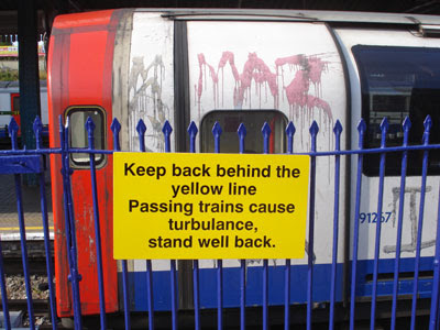
This is platform 4 at Ealing Broadway station, served by First Great Western trains towards London. The big yellow sign is no one-off, there are another four-or-so identical signs further up the platform, and a similar number along the platform opposite. If you're going to make an embarrassing ill-educated mistake, why not repeat it several times? Makes the graffiti on the Central line train behind look positively professional.
This is New Thames Bridge, where the M4 crosses the Thames at Bray. It was built in 1961 to carry the motorway out of Buckinghamshire into Berkshire. It's unusual up top because there's a footpath on either side of the dual carriageway, immediately alongside the hard shoulder. And, as you can see, it's strangely beautiful underneath.
NOT-LONDON 2012 Exploring Olympic venues outside the capital 4) Hadleigh Farm
Most of the cycling events at the 2012 Games will be taking place at the Velodrome in the Olympic Park - that Pringle-roofed stadium just off the A12. Obviously the Road Race has to take place elsewhere, where there are roads, and is likely to run from the Mall out to Box Hill and back. But one particular discipline has proved rather harder to locate, and that's the mountain biking. Because, well, London's not renowned for its contours, is it?
When London won its Olympic bid, the plan was to hold the mountain biking at the Weald Country Park near Brentwood. That's near junction 28 of the M25 - a corner of Essex not especially renowned as mountain country (indeed the highest point in the park is no more than 100m above sea level). The International Cycling Union were not impressed. Not hilly enough, they said, not enough challenge, have you got anywhere else? So London 2012 looked around Essex (because they'd promised the mountain biking to Essex) and tried to see if there was anywhere steeper that they could carve out a course instead. Yes, obviously, Canvey Island.
OK, not quite Canvey, but a hill on the mainland at Hadleigh which looks out towards the pancake-flat isle. The hilltop may be only 70 metres high, but it has far more exciting slopes than the Weald, so it's been deemed excitingly acceptable by the powers that be. Which means that, on the final two days of Olympic competition, 30 women and 50 men will be coming to Essex to test out their skill, balance, daring and verve on cross-country saddleback. It's just a pity that, with so many other events scheduled for that weekend, so few TV viewers will be watching.
Hadleigh's not a town that's used to the spotlight. A few streets before Southend, where the A13 dual carriageway fades into a bus garage and a parade of shops, that's the heart of Hadleigh. Take Chapel Lane down towards the river and eventually you'll reach a poorly used car park beside a fake Iron Age Roundhouse. This lonely spot is currently the gateway to Hadleigh Country Park, but come 2012 it'll be transformed into the official Olympic car park (for official Olympic vehicles). From here it's but a brief freewheel into the field where the mountain biking course is located, or at least it will be once the whole shebang is ready. It isn't yet, but they've already made a start.
A public footpath crosses Sandpit Hill, which is the uplifted zone selected for international competition, but alas it's not public any more. The stile leading off from the lane has been fenced over, and someone's erected a "temporary footpath diversion" sign which looks anything but temporary. No doubt it's only for a couple of years, although any determined intruder could easily nip over the netting and wander around the entire course to their heart's content. Law-abiding souls have to walk a little further down the track, then turn off through a parallel field, from where there's a pretty good view of what's been built so far. [photo]
There's not much to see yet, to be honest, just a few sinuous paths cut into the hillside and surrounded by flapping orange netting. It's not yet clear whether these are tracks for competitors or access routes for spectators, probably the latter. But what is clear is that there are definitely enough contours here - nothing too precipitous, but equally nothing too restrictively feeble. There's also every chance of a mudbath should the clouds open during the week before the competition. My boots got absolutely covered in sludge during my wanderings in the local area last weekend, and I had to endure more than one awkward scramble down a treacherously slippery mudslide. Even if the rest of London 2012 is thwarted by torrential rain, at least here it'll make for some damned fine competition.
The site has one further bonus, which is the presence of a haunting Norman ruin on the hilltop nextdoor. This is Hadleigh Castle, once an important Thames-side citadel and a favoured residence of Edward III. No longer. The walls have almost all fallen, which is what happens over the centuries when you pile large chunks of stone on top of an unstable clay outcrop. A few outline foundations remain for visitors to pick over - that's part of the great hall, there's the kitchen, and that's the floor of the King's old bedroom. Some of the original towers still stand, most only barely (thanks to a long-ago landslip), but one as half a shell looming high above the marshland below. No French invaders pass upriver these days, only a succession of huge container ships and tankers heading towards the chimneys of Corringham. Southend is clearly visible to the east, while the flat wastes of the Isle of Grain fade off to the horizon across the snaking river. As the estuarine Thames goes, this is definitely one of the prettierspots (although admittedly it hasn't got much competition). [photo]
One further point of interest can be found a few hundred yards inland from the castle - the Salvation Army's Hadleigh Training Centre. William Booth created the Home Farm Colony here in the 1880s "for the benefit of men who, through misfortune, need a helping hand." The Army continues its sterling work in the local community to this day, but the skills offered now are rather less manually-based than before. Having said that, they do run a Rare Breeds Farm which is open to the public every summer, and which four-year-olds are bound to find more exciting than a wander round some old ruins. There are also tearooms, I think inside a mighty big chalet, although a shocking lack of publicity meant I only worked out they were tearooms from the internet once I got home. They'll stay open during the Games in 2012, you'll be pleased to hear, even if the castle will be blocked off to stop spectators getting too good a free view. No problem. The mountain biking's one event, I suspect, it'll be well worth paying to see.
They're coming thicker and faster. Especially thicker. Emails from pluggers and marketing types suggesting that I mention something specific on this blog. Sorry folks, it still ain't happening. So here are some more desperate requests for publicity, all from the last month, but with all the brand names heartlessly deleted. And I hope it's damned frustrating for all those concerned.
Hi, I can see from your site that you’re interested in travelling and holidays and thought you might like to hear about one of London’s most vibrant areas; Westminster. Westminster has a huge variety of things to do and places to see. Head to the famous Big Ben and Houses of Parliament, or check out some art at the Tate Modern. If you fancy chilling out with some music, try the Southbank Centre. Where better to stay to enjoy all that Westminster has to offer than <cheapo hotel>, opening up on August 30th, located just 10 metres from <tube station not in Westminster>.
I'm not the only person to have received this one from Sally, but it is a classic clanger of the genre.
Hey, I was just wondering if you got my previous email from last week as I didn’t get a response. If you didn’t manage to check it out I was emailing about this great new competition from <radio station> called <name of festival> I am working with and wanted to know if you would be up for posting about it on Diamond Geezer?
You didn't get a reply, Chris, because you didn't send me an email last week. Get with the programme.
Hello, Do you mind if I link to your site from my footwear blog? Thanks.
If you even need to ask, Kathy, the answer is yes.
Hello! I contact you a few days ago about a sponsored article for your blog. I can pay you £200 for the fully disclosed article which will include you uploading a <theme>-themed photograph, some blurb about the competition (in your own style to fit your blog) a few links, and one brand image for <British bank>. If you are interested, please get back to me asap because the offer may be taken up by another blog!
At least two other London blogs took up Zarina's offer, so you've no doubt read all about this sponsored competition elsewhere. Easy money.
Dear DG, I came across your blog Diamond Geeker...
Stop right there. Was that a Freudian slip, Lucy, or can you simply not read?
Hi there I hope you are well. I was excited to stumble across Diamond Geezer and thought you would be the perfect people to get involved in a project we’re working on at the moment with <Male-based Pills Company> who have just launched an anti-ageing tablet, totally based on natural ingredients. Basically, we’d like to offer you a free 3 month sample of the product for you to try out and review on your blog/website. <Male-based Pills Product> isn’t even available to the public yet so I would really like you to be one of the first to try it.
Oh Becky, so I'm perfect for this am I? Go away.
So my message remains the same. If you're a social marketing guru who hasn't taken the hint yet, please stop sending me sycophantic promotional emails. It only makes you look desperate. Many thanks.
Oh hurrah, it's coming back. The Story of London festival, that is - a Mayoral initiative to celebrate the capital's varied and most fascinating heritage. The festival took place for the first time in June 2009, and it'll be returning again in the autumn. Stick 1st-10th October in your diary right now. I'm sure there'll be something worth doing this time.
Last time round, asyou mayremember, was a bit of a disappointment. Or you may not remember, because the publicity was dire and several events got seriously overlooked. Many of the supposedly special events were happening anyway, and weren't actually especially special. I'm sure the organisers will have learned their lesson, and in 2010 there'll be loads of inspirational activities promoted via a state-of-the-art website. Let's see what we know so far, according to a drum-banging press release rolled out by City Hall on Monday.
Sounds great. We're promised approximately 100 events all across the capital, and for more information to go to www.london.gov.uk/storyoflondon. Except, ah, hang on, that's just a holding page at the moment. Three short paragraphs announcing that something exciting is going to happen, but as yet no details. There is a timeline, but that's only for partner associations interested in taking part. According to the timeline, the "Announcement of participating organisations and events" was originally due to take place way back on 30th June. Missed that deadline, then. We've only just had the 'announcement of organisations' bit, six weeks late. As for the individual events, as yet no sign. That's not good, because the "Media campaign coordinated by the GLA" was scheduled to run from "July-September", and we've lost half that time already. Surely we're not heading for another ill-publicised SoL fiasco? One hopes not.
Thankfully the press release is dripping with hints as to what the eight day extravaganza will contain. Here are some highlights:
» "The season will include the legacy of Jimi Hendrix at the Handel House Museum" (great, but that exhibition's on for two months anyway) » "the development of surgical practices at the Hunterian Museum at the Royal College of Surgeons" (and that exhibition's on anyway too) » "a new project that 'remixes' archive film to create new visions of London; and the chance to create your own version of London's future 'in a box'" (could be good, could be) » "There will be talks from the likes of environmentalist Sir Crispin Tickell... musician Billy Bragg and architect Sir Terry Farrell ...and Poet John Hegley" (lovely, this is beating last year already) » "a look at what London would be like had Joseph Bazalgette not developed the first sewage" (no, they haven't proof read this press release, have they?!) » "an experiential look at London architecture involving newly composed music" (is this the bloke from Lemon Jelly playing on a bridge?) » "Hip website the Londonist will be hosting a special pub quiz, in conjunction with the Royal Institution" (I'm not sure Londonist will be chuffed by that description, it makes them sound like a blog for arthritis sufferers) » "Following the extraordinary success of the walking tours through Brunel's tunnel at Rotherhithe – the first to be constructed under water – there will be guided train journeys" (a guided train journey's not quite the same, is it? And these are fun, but by no means a oneoff) » "Key partners in the Story of London include the Heritage Lottery Fund" who have already announced seven participating projects, including a £10000 grant to a group who want to celebrate "The social housing of Tower Hamlets through art, archives and ambulation" (I, for one, am excited)

The WPNSA can be found off the northern tip of the Isle of Portland, on reclaimed land in the lee of Chesil Beach. Don't think glamour. The inshore area at Osprey Quay is covered with car parks, metal sheds and a heliport. As for the boatyard, that's shielded behind metal railings to keep mere landlubbers at a safe distance. The fence isn't standard Olympic issue, no mile-high razorwire or anything, but no doubt that'll change once 2012 comes around. The clubhouse is a blue toastrack of a building, not as capacious as you might expect, and with its most interesting side out of sight facing the waters. Hundreds of high-masted boats are lined up nearby, some on the tarmac, the rest spaced out along pontoons in the water. Pick your weekend carefully and the harbour is a mass of flapping white sails tacking across the waves, and a quite magnificent sight. I picked my weekend less carefully, and got a few racing canoes instead.
These two settlements are joined by the Merchant's Incline, a steep footpath once used for the haulage of Portland stone down to the docks below. It's well worth making the climb to the top, turning round occasionally to stare back at the panorama below [photo]. The best view is from outside the gates of HM Prison The Verne, hidden in the rockface at the very peak of the island. From here the entire bay is spread out below, with a focus on the protected waters inside the Portland breakwaters [photo]. This'll be a great spot from which to watch the Olympic yachting in 2012, even though you won't have a clue who's winning. You probably won't even need a ticket. Sailing's traditionally been a free-to-view Olympic event, and it's likely that the cliffs will stay open to all throughout. Hospitality enclaves and spectator boats may be introduced at sea level, and they'll no doubt cost a small fortune, but the slopes of Fortuneswell offer as fine an overview as one could hope to find. Genuinely spectacular.
The Esplanade: August bank holiday weekend, and the Weymouth seafront is alive with holidaymakers. Some are best described as 'wide', waddling from one eating opportunity to the next. Some are elderly couples, sat smiling on the deckchairs while the world goes by, while others are most definitely 'yoof', resplendent beneath ill-advised haircuts. But most are families down for the day, probably not for the week, packing in some beach time and a fairground ride and a bit of shopping. The crowds are deepest between the King George III statue and the Jubilee Clock, where you can buy your inflatables at the beach kiosk or watch the traditional Punch & Judy. Or there's the famous Weymouth sand modelling exhibit, this year a characterful tea party from Alice in Wonderland, at which you're encouraged to throw your loose change. I bought myself a box of award-winning cod and chips from a top takeaway whose 'celebrity' customers include Maureen Nolan and the Yetties, then rested awhile in a bay-view shelter to guzzle it all down. Proper seaside, can't beat it. [webcam]
Rodwell Trail: Once you're done with Weymouth, another disused railway will lead you out of town. This is the Rodwell Trail, formerly the branch line to Portland, now fully accessible for pedestrians, cyclists and wheelchair users alike. You might have seen that nice Julia Bradbury wandering this way on BBC4 as part of her Railway Walks series, trying hard to make a suburban flat path sound interesting. The two-mile trail starts off at Westham station (all one word, this isn't the Jubilee line), then dips briefly down off its embankment because a previous bridge no longer exists. The view over Weymouth ought to be great, but is instead dominated by the local Asda. Then a gradual climb to another overgrown pair of platforms, ideal for walking along to avoid the dogs and pedalling toddlers beneath. Pause perhaps at Sandsfoot Castle, built by Henry VIII to protect Weymouth from invasion, now little more than a fenced-off ruin in cafe gardens. Then a final descent along the edge of the bay, with excellent views across to the Isle of Portland, right down to the Ferrybridge which links the aforementioned to the mainland. Olympics ahoy. But that'll be tomorrow. [map] [leaflet]
The Fleet, Walbrook and Effra may have disappeared centuries ago, but here's one stream that's vanished within the last half decade. On 5th June 2005 it was still an insignificant channel running along the edge of an industrial estate. The following day it became an annoying obstruction in the way of a major global building project. Three summers ago it was scooped up, filled in and covered over by an army of marauding diggers. And today it lies somewhere underneath the southwestern rim of the Olympic Stadium. London's still losing rivers even to this day.
St Thomas's Mill's vanished in the 1830s when the railways arrived, and the site looks very different today. A light industrial cluster grew up instead, a small corner of which lingers on as the Marshgate Business Centre. Head for the corner of Marshgate Lane and Pudding Mill Lane where the mill once stood, and you'll find an energy producer of a more modern kind - a village of eDF portakabins. Immediately alongside is the main entrance to the Olympic Park, where security guards screen incoming lorries, and from whose bus station white-helmeted workers depart to reach their specific construction sites. There's no river here any more, so a threadbare flowerbed planted to welcome 2012 dignitaries has to be almost constantly irrigated by a sprinkler system to ensure that the grass and flowers don't die off two years early. This end of the river vanished long before the Olympics came along, but it would have flowed immediately alongside the security fence on the eastern side of the road. This was, indeed still is, Pudding Mill Lane - a brief thoroughfare which runs only as far as the railway arches and which gives its name to the DLR station at its northern end.
Across the railway, and beyond the Greenway, the Pudding Mill River survived until much more recently. I say river, but this was more an overgrown concrete channel filled with duckweed, along which no substantial craft could ever have sailed. A series of willow trees lined the water's edge, and a wooden footbridge crossed the stream providing access to an area of lumpy wasteland alongside. Queen Mary College's Faculty of Engineering used to dominate the site, beneath whose ridged roof countless messy experiments were carried out. Money from regeneration budgets allowed the river environment to be greatly improved in the early 2000s, providing a pleasant-ish spot for workers in nearby factories to nip out for a smoke or to nibble their packed lunches. But the success of London's Olympic bid meant that these improvements were short-lived. The area was first neglected, with unsightly piles of tyres dumped along the banks, and then systematically erased. The willow trees were first to go, along with the river's stocks of fish which were systematically moved elsewhere. Then the entire banks were stripped and the river filled in and covered over. Firm foundations, not watery sludge, were required to support London's mighty Olympic stadium.
"Something Park" quiz: London has hundreds of stations, some of them well-used, others lesser-known. A lot of these lesser-known stations have the word Park in their name (probably because they're out in the suburbs where there isn't much else to name a station after). So today's quiz is about London stations called "Something Park". In the table below there are six lists. Four of the stations in each list are genuine London (non-Underground) stations. And the other one I've made up. Can you spot the six non-existent London stations?
Disembark from one of the occasional trains at Berney Arms station, and your options are limited. But your next destination is obvious, it's that giant windmill quarter of a mile across the fields. Mind the cowpats on the way. Berney Arms Mill is the one of the tallest in Norfolk, topping 21 metres (and that's without including the sails) [photo]. It's a Victorian model, first used for grinding clinker and later for pumping water to drain the surrounding marshland. English Heritage liked it so much they bought it up and renovated it, but your chances of taking a look inside are very limited. The mill's only open during the summer months (and only on Mondays, which sounded promising), although it seems not early enough in the day to match either of the two trains from Norwich. Instead access is optimised for a paddle steamer which chugs up from Great Yarmouth bringing curious daytrippers, and it appears that casual walkers don't get a look-in.
As for the footpath, this hugs the water's edge for the full five miles or so all the way to Great Yarmouth. The route follows a low sea wall which protects the marshes inland from flooding. There are an awful lot of marshes, one after another into the distance, on which cattle and the occasional sheep can be seen grazing. If global warming ever assaults the coast of England, the Halvergate Marshes will be one of its first victims, creating a new inland sea across to Acle and beyond. The current barrier between land and sea is fairly featureless, marked only by a single pumping station and an abandoned sail-less windmill. Pleasant enough in summer, this remote shoreline is nowhere you'd want to be stuck during a storm or in driving rain. [photo]
There are several ways to get to the new Lee Valley White Water Centre. The official recommended route is via Cheshunt station, not because it's the closest but because it has the most frequent rail service. It's ideally located for the river, is Cheshunt station, if not for the surrounding town. It's also perfect for the Lee Valley Youth Hostel, amongst whose smart fresh chalets an information point has been set up for those wishing to find out more about the new venue. They're very keen to get visitors, by the looks of it, because the existence of this information centre is advertised on signposts and posterboards in the middle of nowhere up to a mile away. But it's not really worth a half hour detour to reach. A small unstaffed room off the main hostel reception, with a few big photos on the wall and a whitewater video and a web terminal that doesn't work. Oh, and plenty of information, which manages to make the new course sound fairly exciting. But not very nearby.
One final way to reach the Centre is along Eleanor Cross Road from Waltham Cross station. Unfortunately this only works at the moment if you're an Olympic contractor. This is the official entrance, the one with smart graphic pictograms hanging from the gates, and the one that everyone will be using in 2012. And in 2011, because the unique thing about this particular Olympic venue is that it'll be open to the public one year early. If you fancy trying your hand at the scary slalom, or more likely a bit of rafting down the separate intermediate circuit, turn up here from spring 2011 onwards and get your feet wet. Certainly Broxbourne Council are more than delighted with their new world class watersports venue, and are crowing about its existence on banners hung all along the adjacent roadway. Local landlubbers may not be quite so pleased at swapping grassland for white water, but officials hope that tens of thousands will take full advantage once the slalom gates open.
OK, not quite Canvey, but a hill on the mainland at Hadleigh which looks out towards the pancake-flat isle. The hilltop may be only 70 metres high, but it has far more exciting slopes than the Weald, so it's been deemed excitingly acceptable by the powers that be. Which means that, on the final two days of Olympic competition, 30 women and 50 men will be coming to Essex to test out their skill, balance, daring and verve on cross-country saddleback. It's just a pity that, with so many other events scheduled for that weekend, so few TV viewers will be watching.
There's not much to see yet, to be honest, just a few sinuous paths cut into the hillside and surrounded by flapping orange netting. It's not yet clear whether these are tracks for competitors or access routes for spectators, probably the latter. But what is clear is that there are definitely enough contours here - nothing too precipitous, but equally nothing too restrictively feeble. There's also every chance of a mudbath should the clouds open during the week before the competition. My boots got absolutely covered in sludge during my wanderings in the local area last weekend, and I had to endure more than one awkward scramble down a treacherously slippery mudslide. Even if the rest of London 2012 is thwarted by torrential rain, at least here it'll make for some damned fine competition.
The site has one further bonus, which is the presence of a haunting Norman ruin on the hilltop nextdoor. This is Hadleigh Castle, once an important Thames-side citadel and a favoured residence of Edward III. No longer. The walls have almost all fallen, which is what happens over the centuries when you pile large chunks of stone on top of an unstable clay outcrop. A few outline foundations remain for visitors to pick over - that's part of the great hall, there's the kitchen, and that's the floor of the King's old bedroom. Some of the original towers still stand, most only barely (thanks to a long-ago landslip), but one as half a shell looming high above the marshland below. No French invaders pass upriver these days, only a succession of huge container ships and tankers heading towards the chimneys of Corringham. Southend is clearly visible to the east, while the flat wastes of the Isle of Grain fade off to the horizon across the snaking river. As the estuarine Thames goes, this is definitely one of the prettier spots (although admittedly it hasn't got much competition). [photo]
Oh hurrah, it's coming back. The Story of London festival, that is - a Mayoral initiative to celebrate the capital's varied and most fascinating heritage. The festival took place for the first time in June 2009, and it'll be returning again in the autumn. Stick 1st-10th October in your diary right now. I'm sure there'll be something worth doing this time.