THE UNLOST RIVERS OF LONDON River Graveney Norbury → Streatham → Tooting (3 miles)
[Graveney → Wandle → Thames]
The River Graveney is the new name for the Norbury Brook, new that is if you're a droplet of water heading underneath the A23. It heads west through parts of Streatham and bits of Tooting, one neighbourhood of which bears the river's name, before entering the River Wandle round the back of Lambeth Cemetery. For a large part of the way it defines the boundary between Wandsworth and Merton, and has been an administrative dividing line since the Domesday Book. It too is confined to an above ground culvert for almost all of its length, but still presents a risk to local housing, as this flood map shows.
Hermitage Bridge in Norbury is where the river changes its name, and briefly double-channels, before threading into a modern housing estate via a pedestrians-only zigzag path. There aren't many blocks of postwar flats on this walk, the remainder of the river valley having been covered by villas and semi-detached avenues over several decades, so it feels odd to see the river as a central landscape feature. This aberration is only brief. Beyond the London-Brighton railway the river is once again hemmed in between back gardens, with locked-up alleyways running alongside for wheelbarrow access. Do not consider trying to nip through yourself, as a decaying London County Council sign warns that those found trespassing "in or on the river or its banks will be prosecuted".
This area is Streatham Vale, the valley in question that of the River Graveney, with this section of the river prosaically named Streatham Vale Reach (or, as the Environment Agency have it, Streatham Vale Reach Dangerous Site Risk Of Drowning Keep Out). Again the river is only infrequently glimpsed, and in one case on Sherwood Avenue briefly bridged so that the homeowner at 210a can get his Nissan out. I was hoping for a better view at Eardley Road Sidings Nature Reserve, because surely a nature reserve would showcase any stream flowing through it, but no. When these were railway sidings circa 1905 a culvert was dug underground to keep the water out of the way, so all we see today is a leafy rectangle of woodland thriving on coal dust, clinker and gravel.
The railway's a serious problem for those of us trying to follow the river, because there isn't a way across. The embankment runs for a full mile without a footbridge or transverse tunnel, forming an impenetrable barrier across the former fields of Mitcham. I made the mistake of turning left rather than right, thinking I might catch a glimpse of the river in the allotments on the other side, but after half an hour's diversion I discovered that these were locked off, and then faced another ten minute hike to get back on track. The river had it easy, it cut straight through.
At the bottom of Mitcham Lane the Graveney arrives in deep trench and makes a show of its antiquity. This is Roe Bridge, first built in 1652 after a merchant called Sir Thomas Roe nearly drowned whilst trying to cross the river on horseback. Although the current span dates back only to 1992, the Portland stone block carved with the arms of the Worshipful Company of Merchant Taylors is from the 17th century original, now somewhat faint, and made fainter by being secured behind a protective sheet of perspex. On the opposite parapet is an iron shield labelled L.C.C. in one half and S.C.C. in the other, because until 1965 the Graveney marked the boundary between Surrey and London. Little river, big significance.
The river continues in boundary mode for the next two miles, initially along the edge of an estate known as the Links, where an alphabetical series of short streets was populated just before the First World War. Only one bridge crosses the river, at E in the sequence from A to J, again with a plaque revealing it was rebuilt in the 1990s. The Graveney doglegs left through a full right angle at Amen Corner, and a big hump in the tarmac to accommodate it can be clearly seen at the western end of Seely Road. This is the hurly-burliest stretch of the entire walk, past the police station and the fried chicken shops down to Tooting railway station, where another natural dogleg swings right.
The neighbourhood ahead is Tooting Graveney, with which we'd be more familiar if only there was an intermediate stop on the Northern line between Tooting Broadway and Colliers Wood. Tooting Graveney's not named after the river, the river is named after it, and originally after the Norman nobility who ruled over the area, the De Gravenel family. In 1868 the line of the river was absorbed by the Tooting, Merton & Wimbledon Railway, so that the Graveney now runs in culvert on either side of the tracks, visible only from the train. Around this time development also began on the parallel Longley Road, which has some gorgeous detached Victorian villas with ornate frontage, plus other almost-as-nice houses filled in between as residential density increased. Sir Harry Lauder (Music Hall Artiste) lived here from 1903-1911, according to the only blue plaque on the Graveney.
Beyond Tooting High Street the now-invisible river continues along the line of the railway, somewhere. It can't be seen from the footbridge on Boundary Road, then a cemetery gets in the way, and access can only be regained by diverting via Wandle Meadow Nature Park. But this is ultimately worth it to see the Graveney for its final 150 metres alongside Mead Path, now flowing between two six-foot-high concrete walls, because you can't be too careful where flooding is concerned. For purely artistic reasons a viewing platform has been installed where the Graveney meets the Wandle, a splendid snakelike pier bending out towards the confluence, its railing wrapped around a tree at the far end. Finally the river runs free, if only for a few metres, in a leafy depression that almost looks natural... before merging with its parent river and flowing away.
THE UNLOST RIVERS OF LONDON Norbury Brook Selhurst → Thornton Heath → Norbury (2½ miles)
[Norbury Brook → Graveney → Wandle → Thames]
Weather's been nice, so April seemed a good time to get out and follow another unlost river. This one's easily overlooked, but fairly significant if it floods, and crosses a lot of inner suburban south London. It pretty much follows the railway from Selhurst to Norbury, or rather I suspect the railway followed it as the line of least resistance. And then it changes its name for no particularly obvious reason and flows on to become the most significant tributary of the River Wandle, so there's something to look forward to. For today it's the Norbury Brook, a wiggly ditch that ducks behind the backs of hundreds of houses and under dozens of residential backstreets.
As far as I can tell, given the paucity of online information and some contours, the Norbury Brook sprung into life somewhere to the north of the Selhurst railway depot. Today it's first visible in a culvert running immediately alongside one of the sidings, and culverted it'll remain for almost all of its journey downstream. Thankfully an accessibly scenic landscape curves around the inside of the bend, namely Heavers Meadow, a looping banana-shaped path surrounding a wetland mire. This flood meadow was created when the Croydon Canal cut through, because a canal crossing a river is always awkward, one of several reasons why this artificial waterway proved an expensive failure. But the meadows are lovely, with squidgy pools and stalky willows and yellow marsh flowers, plus a grating to draw off all the water into the culvert after heavy rain. My apologies, it's rarely good news when the most scenic part of an entire walk occurs during the opening paragraph.
Having departed the Everglades of SE25, the Norbury Brook promptly disappears underground. It runs somewhere beneath Selhurst station, then under the streets round the back of The Brit School, before re-emerging between Bensham Manor Road and Kynaston Road to perform its new role, that of water feature at the bottom of the garden. The suburbs of Thornton Heath grew up in the late 19th century, with well-turned out but unprepossessing housing, and promptly camouflaged the Norbury Brook from view. It's still there on certain roads - Swain, Ecclesbourne, Boswell, Lucerne - a brief bridge parapet squeezed into the middle of a run of Victorian houses, and a low channel perhaps visible to those who think to peer over.
For those who like a more obvious verbal clue, Brook Road is pretty in-your-face, leading northwest from the dip in the main road by the station near the car wash. This leads to the Thornton Heath Recreation Ground where the Norbury Brook almost comes into its own, released to run along one entire edge of this long thin park. It'd look nicer were it to run down the centre as a landscape feature, but instead it skulks in a channel between railings and the backs of fences, leaving room for football pitches, cricket wickets and the like. Here teenagers smoke rebellious cigarettes in the kids playground, here the girls of Class 3 invite you to peruse their panelled birdwatching guide, and here pizza delivery bikers find time to bowl a few overs before the app buzzes again. Cruelly only the river passes out at the far end, no footpath follows, and a lengthy detour is required to catch up again.
As the street names switch to 'Scottish' avenues, the Norbury Brook returns to being the dividing line at the foot of back gardens. Where it doglegs from Strathryre to Dalmeny, one house has planked over the stream to create a narrow space beside the front garden where their bins can be stored. Then near Norbury Hall the brook makes a break for the other side of the railway embankment, where a miniature arch allows only one lane of traffic and one pavement through to the other side. Cue anecdote...
Approaching the arch I noticed a lad in a hoodie on a bike with a trailer riding towards me on the footpath. I expected to have to move out of his way, but instead he vanished into what turned out to be a brief alcove where some old iron railings met a fence. I was surprised, indeed shocked, to see that he'd leapt off his bike and was busy using a large heavy plank to try to wrench one of the poles out from the railings. This was an almost perfect unobserved spot for a bit of metal theft, and suddenly it made sense why there was a low trailer on the back of his bike, to cart his haul away. I considered asking him what the hell he thought he was doing, then thought better of it because he had a large heavy plank in his hand. I considered taking a covert photo as evidence, except he had his hood up in a stereotypically suspicious way, plus I thought better of it because he was about to have a heavy metal pole in his hand. Instead I dithered, capitulated and walked on, because I was only safe so long as he didn't think I'd noticed. I didn't want to ring 999, and I couldn't remember the unmemorable number you're supposed to ring for lesser misdemeanours, and he'd be off on his bike before any police officer had even reached their vehicle, but I felt bad about it. And so another chunk of heritage infrastructure started its journey to the crooked scrap merchant, and its final transformation into a little ready cash.
Beyond the railway the Norbury Brook escapes briefly into the Manor Farm Nature Space, formerly a scrap of wasteground, recently scrubbed up by GCSE students from the neighbouring school. Though still a watery trickle in a deep concrete trench, the banks at least are clear of litter, and local residents can now peer at pristine undergrowth through the iron railings... while they remain. What follows is Norbury Park, which used to be a nine hole golf course, and where I hoped to see the Norbury Brook again. But alas no, it's hidden along the back of the allotments for about a quarter of a mile, and then plunges into a pipe as soon as it reaches the grass at the other end.
A snaking hump then crosses the grass to the far side, where finally the Norbury Brook emerges and slinks along the edge of the park in as deep a trench as ever. Nowhere in its journey has it been allowed to run freely at ground level, for fear of flooding, instead confined and disguised, the needs of suburbia prioritised around it. The brook next disappears beneath a car park, where the retailers of Norbury hope customers will leave their vehicles rather than being lured into Lidl up the road. Hermitage Bridge, which for once is an actual bridge, marks the foot of Streatham High Road, reputedly the UK's longest high street. And Hermitage Bridge is also the point at which the Norbury Brook renames itself, becoming the River Graveney as it trickles out on the other side. We'll follow the Graveney tomorrow.
6♥ Banstead/Epsom & Ewell Here's one of only two London boroughs proposed by the Herbert Commission in 1960 no part of which ended up in Greater London. Banstead instead joined with Reigate while Epsom and Ewell remained fiercely independent, and both stayed in Surrey despite geographical proximity hinting otherwise. I've blogged about both constituentboroughs before, but there is one place in Banstead I've always meant to visit solely because of its name, so that's where I went on this occasion. Let's see how many times I can use its four letter name in the exposition that follows.
Nork
Beyond Sutton, less than a mile from the Greater London border, there really is a place called Nork. It's fairly significant too, a suburb of 8000 souls, with one former resident of Nork now ridiculously famous. Nork also has two railway stations, except that neither of these is called Nork, which sadly hasn't helped to raise the profile of the place beyond the immediate area. But I can confirm that Nork definitely does exist, and that several things in Nork are named after Nork, and I have photographic evidence.
Before 1740 Nork was merely the name of a field between Epsom and Banstead, at which point the local landowners built a grand mansion and called it Nork House. Time passed. The house eventually passed into the hands of the Colman mustard dynasty, who sold off the estate to a development company in 1923, and an expansive residential suburb grew up instead. Good timing, particularly if you like interwar detached houses in decent-sized gardens. Nork has barely an unattractive corner.
This commuters' dream was made possible by the railways, which arrived in 1865 whilst making a beeline for somewhere else. The branch line from Sutton was built to connect Londoners to the races on Epsom Downs, and at one point the terminus station had nine platforms to serve the annual seething throng. But it was also nearly a mile from the grandstand, whereas a second branch line to Tattenham Corner curled much closer, so passengers numbers fell away, and today an underused single line limps into a single unstaffed platform.
Epsom Downs is now a mostly silent remnant, its station building turned over to a nursery, at the tip of a long winding awkwardly-aligned cul-de-sac. The car park barely reaches half full even on a working day, and the only useful connection to the adjacent suburb of Nork is a none-too welcoming footpath. One stop up the line is Banstead, which is also technically in Nork, and almost as quiet. To read more about this backwater branchline and its chequered history, click here. There are no plans to rename the two stations Nork West and Nork North, which is a shame, because it'd be fun to see Nork on the destination board at Victoria.
Nork House was demolished in 1939, and in 1947 its environs were turned over to residents as their new municipal park. Nork Park's lovely, with three large sweeping fields climbing the hillside offering views of Ewell's rooftops across the valley, and a couple of thick woodland enclaves. There's also a recreational area which is where Nork Park Rangers play, and a Nissen-hut-style community hall with a list of regular weekly bookings listed outside. It is alas out of date, but I don't think I've ever seen anything which sums up Surrey quite as well as this.
NORK COMMUNITY ASSOCIATION
MONDAY
NORK PLAYGROUP
MOTHER & TODDLER GROUP
FOOTLIGHTS SCHOOL of DANCE & DRAMA
MARGUERITE DANCE CLUB
TUESDAY
GIRLS BATON TWIRLING & POMPOMS 4pm-6pm
NORK PLAYGROUP
BANSTEAD OPERATIC SOCIETY
WEIGHTWATCHERS
LADIES BADMINTON
ANDREA'S FITNESS WORKS
Now is perhaps the time to mention the locally-raised celebrity, who is David Walliams. His parents moved to Nork from south London in the hope of becoming more middle class, and David grew up in a detached house on a quiet close, going to cubs and eating shepherd's pie on Tuesdays. His autobiography doesn't mention which close, and there are a lot of them, plus there are far too many houses with crazy paving outside to be able to narrow it down. But I have walked the leafy avenues and twisting alleyways of Nork, which will have been his early inspiration, and can confirm that the place feels a lot more Middle Britain than Little Britain.
60% of the houses in Nork are detached, and 60% have two or more cars, because Nork is quintessential Surrey. But the undulating valley still feels relatively tightly packed, with few houses allocated an unnecessarily broad plot, merely gardens that go back a lot further than any developer would allow today. The most peculiar home is at the top of the hill on The Drive, where a prehistoric barrow has been incorporated into the front garden with a driveway sweeping round both sides. This is Tumble Beacon, a grassy lump upon which warning fires were lit in Tudor times, and which also contained a WW2 air raid shelter.
Pictured is the wigwam-likeMethodist Church in Nork, unusual around here for being of 1970s vintage, but that's because the 1930s original was structurally unsound and had to be rebuilt. Meanwhile Nork's parish church, St Paul's, lurks unobtrusively in the middle of a residential street and looks more like an oversized village hall, all warm brown tiles and brick. Elsewhere there are two shopping parades in Nork, the longest on Nork Way being home to a barber called Groomed@Nork, a Co-op that hasn't yet been branded Welcome to Nork's Co-op, and more than one interior designer specialising in shiny objects that no home genuinely needs.
Nork's second shopping parade is at Driftbridge, a Tudorbethan tumble on the Reigate Road, where a handful of pre-20th century cottages survive. The area was named after the Drift Bridge hotel, built in 1931 using teak timbers from HMS Ganges, the last Royal Navy flagship to operate under sailpower. You might be able to guess the hotel's 21st century evolution, which has been i) pub ii) Toby Carvery iii) luxury flats. The Driftbridge crossroads is now dominated by separate showrooms for Audi and Volkswagen, and consequently a swarm of young men in sharp suits touting around and between the two.
Speaking of the motor trade, if you've ever wondered where Toyota's UK HQ is, it's here in Nork. They've built a state-of-the-art circular office block in a parkland location, apparently ideal for furthering your career in sales or HR, plus there's a large Georgian mansion behind the screen of trees, previously used by BP. And this old building was originally Great Burgh, home to the landowners who in 1740 built Nork House, which is where I came in. Blimey there was a lot more to Nork than I expected, so well done for reading to the end of it, and for reading the word 'Nork' thirty-seven times.
Back in 2014 I observed the arrival of proper barista-style coffee in London E3, with a Costa appearing on Roman Road and a handful of more independent specialists sprinkled here and there. Your part of London may have had flat whites for ages (even Stratford has had a Starbucks since 2007), but it was a surprise to see this sign of gentrification finally hit Bow. So I decided to track down all of E3's coffee outlets, and then assembled a comprehensive list of offerings on one map. The E3 coffee map. Three years later I thought it was time for an update, so I went out and tracked them all down again.
Disclaimer: I don't like coffee. I therefore haven't sampled caffeinated beverages from any of the following, merely wandered past to confirm that they exist. I traipsed all over E3 to collect this information (which was an eight mile hike, because my local postcode covers pretty much everywhere between the Regent's Canal to the west, Victoria Park to the north, the River Lea to the east and the Limehouse Cut to the south). I've then categorised the three dozen coffee vendors into various categories, with the more impressive at the top and the push-button merchants at the bottom. If you're seeking top coffee I'd say the list's top twenty (marked by cups on the map) offer the best chance of a gourmet brew. But then what do I know? If you're local and have any direct experience or any further updates, please let me know.
Craft Coffee
☕ Zealand Road Coffee Shop As independent as it gets [391 Roman Rd, E3 5QS]
☕ The Chesterfield Double-fronted speciality table-grazing [341-343 Roman Rd, E3 5QR] [NEW - arrived Nov 2014]
☕ Mono London Smart-fronted flat white repository [535 Roman Rd, E3 5EL]
☕ Muxima Long-standing classy caffeine nexus [618 Roman Rd, E3 2RW]
☕ CarmeliteCafe Beanbeard's Nude Espresso, at the Nunnery Gallery [181 Bow Rd, E3 2SJ]
☕ Bean About Town Chirpy coffee cart, commuter hours only [outside Bow Rd station, E3 4DH]
☕ The Coffee Room Newer-than-it-looks pastryland [10 Grove Road, E3 5AX]
Chain Coffee
☕ Starbucks OMG they're here! (formerly the independent 'Chez Pepi') [389 Mile End Rd, E3 4QS] [NEW]
☕ Costa E3's first, beneath the Green Bridge [556 Mile End Rd, E3 4PL]
☕ Costa Sole purveyor of chainbrew on the Roman Road [554-556 Roman Road, E3 5ES]
Cafe Coffee
☕ Stour Space Cafe The last surviving Fish Island canalside hub [7 Roach Rd, E3 2PA] [was The Counter Cafe]
☕ Cafe Greenway Tiny hideaway at the top end of the Greenway [41 Dace Rd, E3 2NG]
☕ Magus & the Fool Gallery-style fusion cafe [357 Roman Rd, E3 5QR] [was Roman Road Art Cafe]
☕ Symposium Wine-focused, but with deli and cafe [363 Roman Road, E3 5QR] [NEW]
☕ Mae + Harvey On-trend "All day + evening cafe" [414 Roman Road, E3 5LU] [NEW, was Fika]
☕ Hiland Cafe Boardgame-friendly retro/modern cafe [467 Roman Rd, E3 5LX] [NEW]
☕ La Table des Saveurs Less French than its predecessor [494-496 Roman Rd, E3 5LU] [NEW, was Boulangerie de Moulin]
☕ L Randolfi Classic formica caff, here since 1908 [514 Roman Rd, E3 5ES]
☕ Barone Shabby chic cafe between Iceland and Poundland [576 Roman Rd, E3 5ES]
☕ Coffee Espresso: Opportunistic squeezed-in buzzy joint [1a Burdett Rd, E3 4TU] [NEW]
Caff Coffee
☕ Semz Cafe: When money's tight, but not otherwise [483 Roman Rd, E3]
☕ Fiesta: Fully Licensed 'Restaurant', a market favourite [546 Roman Rd, E3 5ES]
☕ Idea Store Cafe: A sit-down in the library [Roman Rd, Gladstone Place, E3 5ES]
☕ Cafe Creme: Brown-clad cafe, "established 2011" [566 Roman Rd, E3 5ES]
☕ The Unique Cafe: I'm unconvinced it lives up to its name [585 Roman Rd, E3 5EL]
☕ Riverside Cafe: Proper (hidden) greasy spoon [Dye House Lane, E3 2TB]
☕ Targa Green Cafe: Isolated deli sandwich bar [137 Tredegar Rd, E3 2EU] [NEW, was Del. Boy]
☕ Mighty Bite Cafe: Small eggs'n'bacon place, open 6.30am-2pm [123 Bow Rd, E3 2AN]
☕ Gardiner's: Sandwichy cafe near St Clement's [630 Mile End Rd, E3 4PH]
☕ Delizia: Middle Eastern, also does coffee [33 Burdett Rd, E3 4TN]
☕ Devons Cafe: With a tinfoil potplant in the window [113 Devons Rd, E3 3QX]
Curious Coffee
☕ The Peanut Vendor: Late 20C furniture, with speciality barista [6 Gunmakers Lane, E3 5GG] [NEW]
☕ Growing Concerns: Canalside garden centre, with weekend-only drinks cart [2 Wick Lane, E3 2NA ]
☕ Pie In The Sky Cafe: Unity Kitchen at the Bromley by Bow Centre [St Leonards Street, E3 3BT] [under new management]
☕ Morgan Arms: Gastropub keen to entice daytime coffee drinkers [43 Morgan Street, E3 5AA]
☕ The Mayor's Parlour: First floor of old Poplar Town Hall [Bow House 153–159 Bow Road E3 2SE]
☕ Miller's Cafe: Occasional eaterie at the House Mill [Three Mill Lane, E3 3DU]
☕ Towpath Cafe: Occasional cafe at the Ragged School Museum [46-50 Copperfield Rd, E3 4RR]
☕ Out of the Box: Tiny cupcake outlet at Bow Wharf [221 Grove Rd, E3 5SN]
Clockwork Coffee
☕ McDonalds: Drive-thru by the Bow Flyover [4 Payne Road, E3 2SP]
☕ Greggs: Squirty coffee-to-go [628 Roman Road, E3 2RW]
☕ The News Kiosk: Outside Bow Road station [50A Bow Road, Bow E3 4DH]
☕ Tesco (Bromley-by-Bow): Costa Express machine [Hancock Rd, E3 3DA]
☕ Shell garage: Costa Express machine [445-453 Wick Lane, E3 2TB]
☕ Texaco garage (Co-op): Costa Express machine [127-131 Bow Road, E3 2AN]
☕ Yummy Pot: Workmen's burger van [Old Ford Trading Estate, E3 2JE]
☕ Local Express: Minimart Nescafe [86-88 St Leonards Street, E3 3LR] [NEW]
Ex-Coffee
☕ Muff: Fish Island cafe, now a block of flats [4c Roach Rd, E3 2PA]
☕ Chicchi: Cheap market cafe, shuttered [516 Roman Rd, E3 5ES]
☕ Chez Pepi: Bought out by Starbucks [389 Mile End Rd, E3 4QS]
☕ Cafe Meeshee: By Mile End station, shuttered [562 Mile End Rd, E3 4PH]
☕ Paper and Cup Community-staffed, closed November 2016 [83 St Paul's Way, E3 4AJ]
What's noticeably changed since 2014 is an even greater concentration of espresso-friendly premises to the north of the postcode, and a retreat from the south. Roman Road has several additional outlets, particularly at the western end (away from the market) where it seems almost every alternate unit is serving well-scrubbed food and drink to an influx of moneyed residents. Time Out would very much approve. A smaller coffee cluster can be found to the west of Mile End station, around the Green Bridge, where the postcode's first Starbucks has crashlanded... perhaps there are a lot of students to feed and water. This is not the E3 I recognise from when I moved here at the turn of the century, but it is a reflection of the spread of gentrification trickling east from Shoreditch and beyond.
But the large area to the south of Bow Road remains a coffee desert, indeed the only place serving up proper craft brew closed in November last year. Posh coffee has yet to gain a foothold in Bow Common and Bromley-by-Bow because it's an unnecessary luxury, and there are far more important things to blow your cash on than frothy beany milk. I also note with sadness the gradual disappearance of Fish Island's canalside culture, as the Olympic regeneration zone creeps across the Lea and turns former warehouses packed with creative enterprises into flats. Various emerging pockets of relative affluence will be demanding contemporary high-end barista-crafted drip-blend soon enough, but as the wave of gentrification percolates through, as yet only certain parts of E3 are feeling the rush.
National Army Museum Location: Royal Hospital Road, Chelsea, SW3 4HT [map] Open: 10am - 5:30pm Admission: free Brief summary: military history/subliminal recruitment Current state: refreshed and refurbished Website:www.nam.ac.uk Social media:Twitter/Facebook/Instagram Time to set aside: about an hour
The National Army Museum was opened by the Queen in 1971, and seems to have stayed mostly off-radar ever since, despite its size. In fact it's located 10 minutes walk away from Sloane Square station, immediately adjacent to the Royal Hospital where the Chelsea Pensioners live, on a quiet road most Londoners would never stumble down. I last visited in 2009 and gave the place a mostly positive write-up, even if some of the exhibits felt a little outdated. Three years ago the entire building was closed for a major refit - specifically a complete internal gutting and a rethink in the way exhibits would be displayed. Now that long refurbishment is finally over and the museum reopened last week, just in time for the Easter holidays, and the NAM is back on-radar again.
It all looks rather different when you arrive. The brutalist building has had its ground and first floor mini-windows ripped out and replaced by welcoming sheets of glass, through which those sipping coffee can now gaze. The armoured vehicles, cannons and flagpoles that used to sit outside have been removed, and the concrete bollards have been replaced and upgraded in favour of more defensive flower beds. Most crucially the entrance is no longer an apologetic door up the side but a swish automatic portal facing the road, considerably more welcoming than before. It all looks even more different inside.
The museum now has one of those Wow! moments when you walk in, much like the new Design Museum in South Kensington, and for pretty much the same reason. A large proportion of the previous interior has been removed to create a sweeping multi-flooratrium, providing a colourful panorama from basement up to third floor level, plus a large lobby containing only the bag check and the information desk. If you haven't been before you'll be impressed. But if you remember how things were before, this might be the moment you start thinking "hang on, this corner of the building was full of gallery space before, and now it's mostly air".
There are five galleries, each themed, whereas previously the museum arranged its exhibits chronologically. Before the upgrade you'd start at the bottom and work your way up from 1066 on the ground floor to the 21st century at the top, with the army's story told campaign by campaign along a series of gentling sloping corridors and warren-like galleries. The English Civil War, the American War of Independence, the two World Wars and even the Falkland Islands all got lengthy mentions, and I remember learning quite a lot by reading all the panels on the way round. Those who prefer their information on the lighter side will be relieved to know there's none of that fusty, comprehensive, verbose vibe here any more.
The first fresh gallery is called Soldier, and was my favourite of the five, providing insight into the life of a conscript from signing up to passing out. A lot of emphasis is placed on camaraderie and the collective experience, rather than actually fighting, because that's what the majority of a soldier's life is like. Quotations from a handful of ordinary soldiers are scattered throughout, not all of them positive, while the presence of female recruits appears to get remarkably short shrift, both here and throughout the rest of the building. The highlight is probably the virtual drill sergeant who puts up-for-it visitors through their paces, then gets shirty with those who wander away.
The Army gallery tells the story of the evolution of the ground-based military from the 17th century to the present, in skimmy detail, with large infographics used to cover some walls, and a brief selection of uniforms in glass cases to fill the space within. As for the Battle gallery, this takes a similar approach and skips lightly over campaigns which in the previous museum would have merited considerable exposition. Not even World War Two merits much of a display, although there is a cutaway tank to climb inside and some camo gear to try on, perhaps with a military selfie in mind. I was pleased to see the enormous Siborne scale model of the Battle of Waterloo still given due prominence, its undulating fields and tin soldiers now behind glass, and with a short (unengaging) video about tactics projected on the far side. Napoleon's horse is in the cabinet alongside, or rather its skeleton, though you may have to hunt for the label which reveals how amazing this exhibit is.
Up at the top of the building, the Society gallery takes a rather different approach and considers the army as "a cultural and military force that impacts on our customs, technologies and values". This is a good excuse for a lot of posters and newspaper front covers, plus a few artefacts from Action Men to scout badges, even a juke box with a selection of of pro- and anti-war songs. As for the remembrance corner with poppies, this is sensitively done and by no means jingoistic, indeed none of the museum is, with overt mention of "heroes" muted throughout. The Insight gallery promises a global perspective on British military action, but instead comes across as a few magnificent artefacts with not much of a tale attached. And yes there's still an art gallery, in a temporary exhibition smartly entitled War Paint, but whose paintings are rather dimly lit and merit only a cursory wander.
The former coffee bar has been significantly upgraded and is now a large airy cafe serving "tasty British fare". I'd say it covers an equivalent area to the entire 18th century in the former museum, which may not be ideal, but offers tea drinkers, cake-grazers and soup-slurpers a pleasant place to perch. Down in the basement is an educational area, already well used, while behind the shop is the only activity you have to pay for - PlayBase - which offers hour-long sessions to the under nines. The presence of an assault course is something you might expect, whereas the Cookhouse, Quartermaster store and Fieldcraft zones are part of a more inclusive message that it's fun for everyone in the army, because 2030's recruits might just be here.
On leaving I was intrigued to note that my 2017 visit had lasted only half as long as my 2009 visit, and not just because of the loss of internal floor space. I could best conclude that you'll enjoy the National Army Museum most if you don't remember what was here previously, because it looks proper impressive now, and an all-round immersive experience to boot, plus it's much better suited to younger visitors. But what's on display is more shallow and snippety than before, focused more on the visual than the written word, and more about the big picture than strategic detail. How very 21st century to prioritise the footsoldier over the expert.
TfL have justlaunched a collection of tourist itineraries to showcase some of London's most famous landmarks and attractions.
So far there are three suggested itineraries, each outlined in their own three-page pdf, and each beautifully designed. One itinerary lists London's 10 most popular attractions, with information on the closest stations and the best times to visit. This is rather good, and I can imagine many visitors to London finding it useful to plot their way around. Another itinerary lists 10 of London’s most popular transport design icons, from tiles to architecture to heritage Routemaster buses. This too is rather good, and I can imagine even Londoners finding it interesting to follow. And the third itinerary suggests you ride the number 94 bus. This is very much not good.
It's a smart idea, to encourage visitors out of the centre of town to some attractive spots further out. The advent of the Hopper fare makes brief bus journeys more cost effective, so it's an idea whose time has come. The map makes it look all so simple, with the ten neighbourhoods neatly shown.
Each neighbourhood has its own information panel, with the bus stop you're supposed to get off at clearly stated. Even tourists unfamiliar with how London works should be able to follow along.
But somewhere along the way the idea of visiting neighbourhoods by number 94 bus has gone badly awry, and any tourist taking the advice is likely to enjoy a less than perfect day out. I know, I've tried following it all.
1. Covent Garden
Bus stop – Charles II Street
Covent Garden is simply a must see for those who enjoy shopping, theatre, history and culture. The Royal Opera House, Covent Garden Market, Somerset House and our very own London Transport Museum are all a short walk away.
Covent Garden is evidently an excellent place for tourists to visit. Not only is there the iconic market, but there's also a museum owned by TfL, and they're not going to pass on the opportunity to recommend that. There's only one problem, which is that the number 94 bus doesn't go to Covent Garden.
Route 94 starts at the foot of Regent Street, approximately two tube stations away, beyond the far side of Trafalgar Square. To walk to the first stop from the Royal Opera House or London Transport Museum takes 16 minutes, according to my stopwatch, and from Covent Garden Market 14 minutes. As for Somerset House that's 19 minutes away, indeed so distant as to be five stops away by bus. By my calculations there are at least 30 bus routes which pass closer to Covent Garden than the number 94, so the 94 definitely isn't the way to go. What's more, Charles II Street isn't exactly well known, nor easy to find, so any tourist attempting to start their Bus Route 94 itinerary in Covent Garden faces a lengthy and bewildering walk. And that's just the beginning.
2. Soho
Bus stop – Conduit Street/Hamley’s Toy Store
Situated in the heart of London’s West End, Soho has long been established as London’s most lively entertainment district. It offers a diverse mix of live entertainment, global cuisine and a thriving nightlife. Soho is also home to Hamley’s, the largest and oldest toy store in the world.
Actually this recommendation is fine. Route 94 runs along Regent Street up the western edge of Soho, and the designated bus stop is almost directly opposite Hamley's, which is pretty much perfect... although you'd actually have been much better off catching the 6, 23 or 139 bus direct from the Strand rather than hiking to catch the 94.
3. Mayfair
Bus stop – Selfridges
This area is renowned for some of the best shopping in London. As well as luxury shops, it is packed full of fine restaurants and sumptuous hotels. The art galleries of Bond Street are also well worth a visit.
The 94 bus runs round two sides of Mayfair, stopping six times on the perimeter, including the stop outside Hamley's where you last got on. If you're a tourist going shopping it makes perfect sense to recommend the stop outside Selfridges, although all the commercial opportunities mentioned in the text are on the opposite side of the road in Mayfair proper. As for the art hotspots of Bond Street it would have been better to get off at the previous stop, or indeed any of the four previous stops, it being a seven minute walk from Selfridges back to the nearest gallery.
4. Hyde Park
Bus stop – Marble Arch/Bayswater Road
One of the Capital’s largest and most iconic parks, you can easily spend a day in here. Be sure to hire a boat on the Serpentine Lake and pay a visit to the Princess Diana Memorial.
In good news, the recommended bus stop is right alongside Hyde Park, up close to Marble Arch. But as for the attractions mentioned, the boathouse is 10 minutes walk away, and would have been better accessed from the next stop, and the Princess Diana Memorial Fountain is another 10 minutes walk beyond that. A special mention to whoever placed the 'Hyde Park' logo on the map, and who managed to miss the largest green space in central London, plonking it on the wrong side of Oxford Street instead.
5. Kensington Gardens
Bus stop – Palace Court
Once the private gardens of Kensington Palace, this stunning area is now open to the public and lies immediately to the west of Hyde Park. Featuring the Peter Pan statue and the Diana, Princess of Wales Memorial Playground, it is the perfect place for a family day out.
The 94 stops three times along the northern edge of Kensington Gardens. Unfortunately whoever devised this itinerary hasn't chosen any of these three, but the next stop beyond the edge of the park, adding an unnecessary additional walk to your journey. The Memorial Playground is thus five minutes away, rather than three, Kensington Palace is 11 minutes away, and the Peter Pan statue 15 minutes away. Adding to my suspicions that the person who devised this itinerary has never been here, the claim about "once the private gardens" is lifted from the opening line of Kensington Palace's Wikipedia article, and "this stunning area" has in fact been open to the public since 1637.
6. South Kensington
Bus stop – Palace Court
Boasting a range of free-to-visit museums such as the Natural History Museum, Science Museum and Victoria and Albert Museum, South Kensington remains an area of great cultural and scientific importance. Just a short walk from Hyde Park, it has a stunning backdrop of London’s most sought-after residences and the Royal Albert Hall.
Here's where the itinerary goes truly mad. Route 94 runs along the northern edge of Hyde Park and Kensington Gardens, whereas as every Londoner knows, South Kensington is to the south. This means that anyone trying to access the museums from the number 94 bus faces a lengthy walk across the entire breadth of the park, and a hike down Exhibition Road after that. I timed the journey, walking fast, and it was 25 minutes to the Natural History Museum, and 24 minutes to the Science Museum and Victoria and Albert Museum. At least a dozen buses actually go to South Kensington, rather than running over a mile away, and you'd have been hugely better off riding one of those.
See how deceptively the South Kensington marker has been placed on the map - almost directly on top of Bayswater station, rather than anywhere near where the Royal Albert Hall actually is. I get that this itinerary is about 'neighbourhoods', rather than individual attractions, but there is no way anyone could describe the number 94 as going anywhere close. What's more, the recommended bus stop is again Palace Court, which is again sub-optimal, indeed there are seven other bus stops along the top of the park which would have been fractionally less ghastly options.
All in all, in following the itinerary's suggestions for neighbourhoods 4, 5 and 6, I walked for over three miles down to the Cromwell Road and back. By the time I got back to the bus it had been over an hour, so my Hopper fare would have expired, plus I was walking much quicker than a tourist would manage, plus I actually knew where I was going. I fear for anyone unfamiliar with London, particularly with children, and trusting in the document TfL have produced - their intended journey to the museums could become a nightmare.
7. Notting Hill (Portobello Road)
Bus stop – Notting Hill Gate Station
Notting Hill is one of London’s most desirable boroughs where you will find fabulous restaurants, theatres and galleries. Every August the area plays host to Europe’s largest street festival, the Notting Hill Carnival, with millions attending each year. Portobello Market, situated nearby, is also one of London’s finest, crammed with antique dealers and retro memorabilia.
I boarded the number 94 at stop number 6, Palace Court, to discover that Notting Hill Gate Station was only one stop down the road. I could have walked it quicker than waiting for the next bus, just about. Having alighted, it was then an eight minute walk to the first stretch of Portobello Road that has a market, which isn't great, but by previous itinerary standards wasn't all that bad. Meanwhile I'd like to point out to whoever wrote the itinerary's copy that Notting Hill isn't actually a borough, and also suggest that Carnival weekend is the very worst time to try to travel through the area on the number 94 bus.
8. Holland Park
Bus stop – Holland Park
One of London’s finest green spaces, Holland Park houses the stunning Japanese-style Kyoto Gardens as well as large areas of woodland abundant with wildlife. If visiting in the summer, be sure to catch a performance in the open air theatre; opera under the stars is not to be missed.
Here's a stop on the itinerary that actually delivers. Holland Park is a treasure well worth visiting, and the number 94 bus is indeed one of the best ways of getting here. The Kyoto Garden (singular) is gorgeously blossomy at the moment, and seven minutes walk away, while the open air theatre is ten. But again I'm willing to bet that whoever wrote the itinerary has never visited, because the open air theatre has a geometric canopied roof which means the stars are always obscured.
9. Shepherd’s Bush
Bus stop – Goldhawk Road Station
Home to Shepherd’s Bush Market and Westfield’s vast shopping centre, Shepherd’s Bush is a hub for shopping. After some retail therapy, why not catch some of the biggest names in music performing at the world famous Shepherd’s Bush Empire.
If most people were going shopping in Shepherd's Bush they'd probably get off the bus at Shepherd's Bush station and go to Westfield. This itinerary peculiarly keeps tourists on board until two stops later, delivering them instead to the gates of Shepherd's Bush Market... which, perhaps not uncoincidentally, is owned by TfL. From here it's a five minute walk back to the Shepherd's Bush Empire, and ten back to the nearest corner of Westfield. I'd also like to suggest to the author that one of the worst things to do "after some retail therapy" would be to take all your shopping to a music concert.
10. Chiswick
Bus stop – Turnham Green Station
Leafy Chiswick is a welcome retreat from the hustle and bustle of central London. Situated on the banks of the Thames, it is the perfect spot to sample a pint of ale from the local brewery. The recently restored Chiswick House and Gardens are well worth a visit, as is the Chiswick High Road, full of local pubs, bars and restaurants.
And finally, after the longest bus ride of the lot, the 94 deposits travellers just round the corner from Turnham Green Station. Annoyingly the 94 doesn't run along Chiswick High Road, even though seven buses do, and itinerary-followers would have been much better off catching the 237 bus from Goldhawk Road station because it runs direct. Riverside Chiswick is indeed gorgeous, but the 94 stops so far away that a walk of at least 20 minutes is required to get there. There are no Fullers pubs on the waterfront, not unless you go all the way back to Hammersmith, but The George and Devonshire at the top of Church Street might well be close enough. As for Chiswick House, which is nowhere near where the blob on the map suggests, that's 24 minutes walk away from the number 94 bus, and there are better ways to get there too. There are better ways to get almost everywhere.
In conclusion, the Bus Route 94 Itinerary is an excellent idea thoughtlessly delivered. It links broad neighbourhoods rather than actual places to visit, and in at least two cases goes nowhere near the neighbourhoods claimed. It tempts tourists out of the centre of town to enjoy some top class attractions elsewhere, which is admirable, but misleads them in terms of accessibility, and fails to mention more efficient ways to get there. A ride on route 9 would have ticked off seven of the ten neighbourhoods, for example, without several of the long walks that route 94 requires.
I recognise that TfL's itinerary is meant as something to dip into, rather than to slavishly follow, but anyone who dipped in and only visited stops 1, 6 and 10 would have had a thoroughly miserable time. All in all I spent four hours following the itinerary, only 40 minutes of which was on the bus, and this was without stopping walking to spend any time at any one place. Do not under any circumstances do what I did.
Imagine how good this itinerary could have been, either along a bus route that did actually go to brilliant places, or better still one whose text didn't over-promise and had been carefully checked. Best stick to the other non-bus-related itineraries for now, or risk ending up tired and frustrated.
Day out:Stourbridge Stourbridge is a large town on the edge of the West Midlands, unsurprisingly located on the River Stour, which used to be the dividing line between Staffordshire and Warwickshire. It's now part of the Metropolitan Borough ofDudley, which makes today's post technically a continuation of yesterday's, which I'm sure will excite you. The town is best known for the manufacture of glass, and is reached via an extraordinary train service, and I fear I know which of those two things you're going to find most interesting.
» [This Michael Portillo video will save you having to read any of what follows]
Stourbridge Town branch line
Britain's shortest railway branch line is less than a mile long - officially only 1287 metres. It's been running since 1879, with a variety of types of rolling stock. It has an impressively regular service, much better than certain bits of the Underground. It's run by the only Train Operating Company ever to have scored a perfect 100% in its Public Performance Measure. But it's the train itself which'll make you go Oh My Goodness! What Is That? I mean, look at it.
This is a Class 139, or Parry People Mover, a railcar less than ten metres long, and a sort of cross between a train and a tram. It looks like something Thunderbirds might have deployed, but is actually a proper timetabled vehicle, and very environmentally friendly too. It uses flywheel storage to recapture energy from braking and then uses this for acceleration, topped up by a small LPG engine when necessary, because a perpetual motion vehicle would be technically impossible. This avoids the need for cables or powered rails, and allows the maximum space inside for actual passengers.
Passengers board at the back or at the front, depending on which way the vehicle is going, and pick a seat - there's even one up front facing the driver! It's quite spacious inside, with room for a few dozen people to stand if it's the rush hour, which it wasn't when I went, but I was impressed by how many passengers the service had attracted. I suspect the regular, frequent services helps. The line's only three minutes end to end, which allows a couple of minutes for the driver to walk to the other cab and for the guard to settle the passengers, and then off back again, and repeat six times an hour. A single track line is all that's needed.
The train exists to shuttle passengers between Stourbridge Town, in town, to Stourbridge Junction, on the main Birmingham to Kidderminster line. It's just far enough to be annoying on foot, and the ten minute frequency means it's always quicker to wait for the next train than to walk. Not a great deal happens on the trip, although there is ample time for the conductor to check your ticket. The downhill gradient out of Stourbridge Junction is on the steep side, and there have been a number of 'incidents' over the years, although none since the 139s took over in 2009. One straight section of track, with a couple of curves at each end, swiftly delivers.
I was really quite tempted to ride the line again, but then I'd have had to ride it one more time back to where I actually wanted to be, and I thought the conductor might be giving me strange looks by then. Instead I stepped off swiftly to allow the Stourbridge hordes to travel back the other way, and watched the tiny railcar depart round the bend round which it would reappear in not very many minutes time. I was damned impressed to see that the ticket office at Stourbridge Town is open for 64 hours a week, which serves the half million passengers a year better than we get in London. And yes, there are as-yet undelivered plans to introduce Parry People Movers on certain other short segregated sections of the UK rail network, and perhaps even one day to make new stretches of line viable. What's not to love? » The Stourbridge Line User Group (or SLUG for short)
The Stourbridge Heritage Trail starts off by apologising for "unsympathetic alterations and demolitions" and "the construction of the ring road", but a number of interesting old buildings survive, and the centre's anything but bland. The town hall's a Victorian pile (yes, redbrick and terracotta again), the parish church precedes the advent of industrialisation, and most of the characterful stuff is on the broad sweep of the High Street down to the river. The genuinely pretty bits of Stourbridge, I'm told, are some of the inner suburbs. Families tend not to get stabbed here very often.
The first steam locomotive to run commercially in the United States was built in Stourbridge, obviously, otherwise I wouldn't be mentioning it, plus it was called the Stourbridge Lion, so where else could it have come from? It was knocked together in 1829 at the ironworks by the canal, which still stands but has recently become a health centre. Canal Street has also survived, where yet another heritage trail can be followed along the cobbled street, past an understated arts centre in a sturdy old warehouse, past somewhere that does boat trips when the weather's better, and past a variety of increasingly tumbledown buildings. If you're ever in Baltimore, apparently you can see a few salvaged bits of the Black Country's pioneering engine in the B&O Railroad Museum. On the bend by the Coalbrookdale iron bridges I was amazed and very pleasantly surprised to spot Granny Buttons, the narrowboat owned by canal blogger Andrew Denny, with whom I've conversed a number of times over the years. Andrew no longer blogs - being Assistant News Editor of Waterways World keeps him busy enough - but you can keep up with his often Midlands-based canal adventures on Twitter.
It's about time I got round to mentioning glass. Stourbridge used to be world-famous for the production of glassware, thanks to an ideal location close to clay, lime and coal, and a concentration of highly skilled craftsmen. The skyline was once filled with tall brick cones used as chimneys, generally located beside the canal for water supply and for transport. Only one remains, at the Red House Glass Cone, and stands 100 feet tall with a diameter of 60 feet at the base, and contains an amazing two million bricks. It's possible to step inside and gawp up cathedral-like at the tiny hole in the roof, and occasionally to watch actual glass being actually made in the workshop at the back. Various gorgeous exhibits from the Stuart Crystal Glass Factory are on show - they engraved the glassware that went down with the Titanic - while numerous local artists have their stuff on sale, and for good measure there's a flight of fourteen locks out the back. Next year the White House Cone Museum of Glass will open on the opposite bank, to make a proper heritage cluster of it.
Another former glass factory has become the Webb Corbett Visitor Centre, which better gets across the skill and creativity required to make world-class glass on an industrial scale. Those pretty symmetrical patterns you see etched into tumblers, goblets and decanters don't simply appear, they were expertly cut, guided by lines drawn in pen on by marker-uppers. A more modern presence is the Ruskin Glass Centre, a fresh attempt to create a hub for 21st century glassware designers, engravers and enamellers, plus a college out the back to nurture new talent. With a hive of workshops and boutiques, plus an organic cafe at its heart, I was impressed how busy the place was. One of the remaining large-scale manufacturers has an outlet store up the road, and a couple of very retro antique shops somehow survive, presumably because it's still true that if it's glass you want, you come to Stourbridge. [8 photos]
Day out:Dudley Dudley is one of the seven boroughs that make up the West Midlands, out on the western edge in what used to be Worcestershire [map]. It's about the same size as Barnet, and with approximately the same population as Wandsworth, if that helps. Dudley is the name of the main town, along with Stourbridge and Halesowen, in an area often known as the Black Country. There are two obvious tourist places to visit, so I skipped both of those and sped round several other attractions, with a focus on industry, canals and geology.[Discover Dudley]
Black Country Living Museum
The Midlands version of Beamish, this open air conglomeration of industrial sites allows visitors to travel back in time to meet costumed characters in shops, workshops and underground, or take a ride on a tram. I didn't go, but it's at the top of my list for next time. [£17.50]
Where I did go was immediately nextdoor, and what an excellent decision. The DC&TT have been running canal trips for many years, but last March the Princess Royal popped down to open a brand new visitor centre, which has transformed the attraction. As well as a restaurant called the Gongoozler, and the obligatory shop, a new swingbridge was installed across the canal allowing visitors from the Black Country Museum to nip across for a ride. In the exhibition section you'll learn the lengthy history of the adjacent Dudley Tunnel, and how it was nearly closed in the 1960s when a railway bridge fell into disrepair, but unexpectedly saved when Dr Beeching scrapped the railway instead. And then you'll get to go for a voyage into the tunnel itself. [Guardian video]
Not all of it, not unless you come on a day when they're doing the full 3km, but the default 45 minutes is plenty good enough. Part of what's amazing is that you'd never normally expect to be able to ride through a circuit of tunnels and caverns underground, and the other part is the sense of theatre imbued at all points along the way. The guide who propelled our boat through was excellent (thanks Becky), and had something to say, point out or offer every bit of the way. Each of the various tunnel sections are somehow a bit different, either in age, breadth or construction, from the earliest narrow brick-lined arch to 1984's sprayed concrete addition which Blue Peter came to open. Several have pretty white calcite deposits on the wall, while others drip, so you can expect to get occasionally damp.
At one point there's the obligatory working scene composed of mannequins, reflecting the years when the canal helped serve limestone mining underground as well as transporting cargo onward and through. But there's also a giant screen in one of the caverns on which a quick geological history is played out, plus a sound and light show in the so-called Singing Cavern where concerts and carol services are sometimes held. There's also the opportunity to do some legging, lying flat on your back on a roped-down board, but the party I went through with weren't biting. I'll not be uploading my hardhat selfie, but blimey I enjoyed this, and it's easy to see why the upgraded experience won a Living Waterways Award last year. [£6.95]
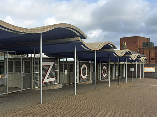
The castle semi-dominates the skyline of Dudley, built on a limestone crag, ruined, and now completely surrounded by a zoo. The castle grounds were filled with cages and animals in 1937, along with 13 pioneering reinforced concrete structures designed by Berthold Lubetkin of the Tecton Group. I'd have been keener on following the concrete than the creatures, so gave the place a miss, but I did make sure to admire the five swoopingcanopies at the entrance gate on Castle Hill. [£14.50]
In the Dudley suburbs, about a mile from the centre of town, lies this site of "exceptional" geological importance. Two folded limestone beds have been exposed where a humpy hill has been eroded, then heavily mined, leaving a rocky playground where fossils from the Silurian era are liberally scattered. Over 600 different kinds of fossil have been identified in Dudley, 86 of which have been found nowhere else on earth. Modern estates now encroach right up to the edge of the outcrop, while an outpost of Dudley College has been built in the centre, separated from the significant strata to either side. Step through to enter a completely different world. [leaflet]
The steep rocky slopes throughout the Wren's Nest nature reserve were once a tropical seabed, now sharply inclined, and with a wealth of trilobites, brachiopods and corals within. Small limestone chunks have fallen to the foot of the slope like scree, and visitors are generally free to scout through to hunt for fossils. I swiftly picked up what looked like half a giant fingerprint, and might well have been a Pteronitella retroflexa (or a mussel shell to you). At the most significant locations the geological treasures are fenced in, for example at the Ripple Beds (where wave action from 428 million years ago can be seen frozen in the upright rockface) and at the Seven Sisters (a huge artificial cavern which alas caved in a few years ago). Information boards at various spots around the site advise what you're looking at, accessibly but not patronisingly, because geology students are as much the target audience as locals out walking the dog.
I thoroughly enjoyed my own personal field trip, exploring the wooded ridges and the deep excavated gullies inbetween, ascending steep muddy staircases and stumbling on oblique exposed parallel beds. Along the way round I passed over the unseen Dudley Tunnel, twice, and kept expecting to bump into a film crew recording some fantastical drama, but met almost nobody. It's important to have a map in mind, because the footpaths thread sinuously with few connections, and even then I think I managed to miss one key route which passed the highest viewpoint. I'd sum up by describing Wren's Nest as a geological theme park, a unique site packed with considerable wonder, but where the 'rides' only move at a few millimetres per millennia. [free]
According to a poster in the window, the WW1 exhibition at Dudley Museum closes on 11th November 2018. Not so. Instead it closed on 22nd December 2016, along with the entire museum, thanks to funding cuts delivered from the Town Hall across the road. Geology and fine art were the mainstays of this municipal collection, particularly the displays of locally-sourced fossils, and if you peer through the front door you can still see half-dismantled fibreglass dinosaurs awaiting relocation at the foot of the main stairs. A smaller collection will go on display at The Archive Building in Tipton Road in the autumn, and presumably the gorgeous redbrick and terracotta building will be either sold off or rented out, and the area's geology won't get a look in. In the meantime you can still enjoy the set of meteorological instruments on the front wall provided in remembrance of Annie Smellie, mayor of Dudley in 1935, and still read in the windows the inscription "The Rocks Of The Imagination Still Remain", which is very much no longer true. [closed]
As a medieval market town brought to prominence by the industrial revolution, Dudley's market is now a somewhat lacklustre affair, and the shops not as impressive as a town of this size would normally deserve. The retail vampire responsible is the Merry Hill Shopping Centre, the West Midlands' premier out-of-town mall, which was established in nearby Brierley Hill in the 1980s. Neither that nor Dudley itself are served by the rail network, which adds an air of detachment, although there are long-term plans to add a branch of the tram network along a mostly-disused railway. Instead the sprawl of Dudley retains a certain pleasing ordinariness, its amazing heritage notwithstanding. [town trail]
This weekend sees the launch of the first diamond geezer podcast.
Sit back and enjoy the latest news, views and information from London E3.
Or why not download the podcast and take it with you to fill 30 minutes on a dull journey?
In this week's podcast:
• Introducing the neighbourhood - Welcome to Bow
• Taste test: sampling the cappuccino at the Shell garage, Wick Lane
• What's new at Bus Stop M - discover all the very latest
• City Airport Flight Path update (if you can hear me talking)
• This week's sponsor - meet the folks at The News Kiosk
• London's Best Craft Beers Sold in Bow
• Cycle Superhighway Litter Watch - the bags are back!
• Bromley-by-Bow road junction consultation - how you can contribute
• My opinions on Brexit - as relevant as they always are
• A look forward to next week's big stories in E3
I hope you enjoy listening to the new podcast as much as I've enjoyed making it.
What I particularly enjoyed was that the podcast only took half an hour to make. Normally I spend hours on a Friday evening writing text and cropping photos and checking references and adding links, but absolutely none of that is necessary to create an audio file. Instead I simply talk for half an hour and embed the file and I'm done, which is brilliant, and allows me to go out drinking on a Friday evening rather than staying in writing until midnight.
It may not be so great for you, because you have to invest half an hour of your day to listen to everything I have to say. At least with text you can read the first bit and skim down to get the general gist, or decide you don't want to read any of the rest and go off and do something else. You'll spend far less time reading something I wrote than I spent writing it, whereas with a podcast the time penalty is identical.
Tomorrow I'm thinking of doing a video, because that's even quicker. Videos only have to be three minutes long to feel meaningful, which is hugely shorter than people expect for a podcast, so I can dash that off even quicker. Being a vlogger must be really easy.
I do sometimes feel a complete fool for spending quite so long writing stuff, when I could be out doing stuff instead. Sound and vision are obviously the future. You'll cope.