Sometimes you'd like to walk/cycle/ride/drive from point A to point B but you can't because something's in the way. The Thames is London's most obvious obstruction, but other barriers to transport are major roads, waterways, railways and airports. This post is an attempt to list London's worst offenders.
London's hardest things to cross
1) The Thames a) The most significant natural barrier in London is the River Thames... and the longest impossible-to-cross section is downstream from Woolwich. It's 8 miles from the Woolwich Ferry/Woolwich Foot Tunnel to the edge of the capital (and 10½ miles to the final crossing point at the QE2 Bridge). It remains impossible to walk/cycle/ride/drive from Bexley to the neighbouring boroughs of Barking & Dagenham and Havering (and will long remain so because a half-mile-wide estuary is an expensive thing to cross). No other obstruction in London comes close. b) Upstream the next impassable gap is the 2½ miles from Woolwich to North Greenwich (where the Blackwall Tunnel/Jubilee line/Dangleway allow drivers/passengers/pedestrians/cyclists to cross). c) Drivers cannot cross the Thames between the Rotherhithe and Blackwall Tunnels. By river that's a 4½ mile gap (but as the crow flies only two). d) Pedestrians and cyclists unwilling to risk the Rotherhithe Tunnel have no way of freely crossing the Thames for the 4½ miles from the Greenwich Foot Tunnel to Tower Bridge. e) Heading upstream, the next significant crossingless gaps are to either side of Hammersmith Bridge, both of which are in excess of a mile and a half. With that bridge currently closed to vehicles, drivers face a 2½ mile (straight line) gap between Putney and Chiswick Bridges. f) The Thames cannot be crossed for the 2½ miles from Kew Bridge to Richmond Lock. g) From Richmond Bridge to Kingston Bridge the Thames forms a 4½ mile barrier to drivers. Teddington Lock provides a shortcut for pedestrians and cyclists after 3 miles. Hammertons Ferry is sometimes available after one mile.
2) The Lea
The River Lea is crossed in surprisingly few places on its 13 mile journey from the edge of London to the Thames, with a chain of reservoirs the greatest barrier. a) No roads cross the Lea Valley in the 3 miles between the M25 and Ponders End. b) No roads (and no footpaths) cross in the 2 miles between Ponders End and the North Circular. c) No roads cross in the 2 miles between the North Circular and Tottenham Hale. d) No roads cross in the 2 miles between Tottenham Hale and Lea Bridge (although three railways do). e) No roads cross in the 1½ miles between Lea Bridge and Temple Mills. f) Only a dead end and a private road cross in the 1½ miles from the Bow Flyover to the A13.
3) The Roding
The River Roding is crossed in very few places on its 8 mile journey from the edge of London to the Thames. For drivers the sole crossing points are Chigwell Road, Charlie Brown's Roundabout, Redbridge Roundabout, Romford Road (Ilford), London Road/Town Quay (Barking) and the A13. The longest gap is 1½ miles between Redbridge and Ilford. Pedestrians/cyclists also get footbridges in Woodford(1), Redbridge(2), Wanstead(1) and Barking(2). There are four railway crossing points. But that's it.
4) Rivers in Havering a) The River Beam is crossed by zero roads during the 2½ miles between Romford and Dagenham (and by the District line and three minor footbridges) b) The River Ingrebourne is crossed by zero roads during the 2½ miles between Hornchurch and Rainham (and only two footbridges).
5) Rivers in Barnet a) Only one road crosses the Dollis Brook in the 3 miles from Hendon Wood Lane to Whetstone. b) No roads cross the Folly Brook in the 2½ miles between Mill Hill and Woodside Park.
6) Grand Union Canal a) Only one road (the Uxbridge Road) crosses the Grand Union in the 3 miles between Greenford and Bull's Bridge. b) Only one road and the M4 cross the Grand Union in the 3 miles between Southall and Brentford.
7) Major roads a) Only one road crosses the A40 in the 3 miles from Northolt to Hillingdon. b) Only one road crosses the M4 in the 2½ miles from Heston to the Chiswick Flyover. c) Only one road crosses the North Circular in the 2 miles from Strawberry Vale to New Southgate. (This inspired today's post) d) No roads and no footpaths cross the A13 in the 2 miles between Rainham and Wennington.
8) Railways
Lots of railways are hard to cross, especially when they're at ground level or on long embankments. a) The longest railway-related severance I can find is the 2 miles between Tottenham Hale and Lea Bridge, which crosses no roads (and has only four crossing points on foot). b) There are 1½ mile roadless gaps between Kenton/North Wembley, Newbury Park/Fairlop, Grove Park/Elmstead Woods and Rainham/Purfleet. c) There are almost 1½ mile roadless gaps between Clapton/St James Street, Totteridge & Whetstone/High Barnet, Meridian Water/Ponders End, Albany Park/Bexley and Bickley/St Mary Cray. d) Only two roads cross the Great Western Mainline in the 3 miles between Southall and Hanwell.
9) Heathrow Airport
Heathrow, which is 3 miles across and 1½ miles wide, cannot be crossed on foot or in a private vehicle, only by train (or possibly in an aircraft).
10) Open land a) Although Richmond Park is freely accessible on foot, it creates a 2½ mile-wide obstacle for motor vehicles. b) Kew Gardens/Old Deer Park and Wimbledon Common/Putney Heath are both 2 miles across, and Hampstead Heath 1½ miles. c) A 4½ mile straight line drawn from Hainault to Noak Hill is crossed by only one road, at Havering-atte-Bower.
I'm sure I've missed a few, so do let me know.
n.b. You can explore severance lengths for yourself on this measurable version of OpenStreetMap.
n.b. I'm not really interested in severance of less than two miles (1½ miles for railways).
n.b. I'm only really interested in lines which represent physical features.
n.b. I've ignored severance on the boundary of Greater London.
n.b. My measurements are all approximate.
n.b. I have not been over-pedantic.
THE UNLOST RIVERS OF LONDON Bounds Green Brook Friern Barnet → New Southgate (1½ miles)
[Bounds Green Brook → Pymmes Brook → Lea → Thames]
To truly wreck a river, build a dual carriageway along it. My stroll along the Bounds Green Brook is thus essentially a walk along the North Circular, which isn't going to be pleasant, although on the plus side most of the waterway remains above ground alongside the eastbound carriageway. [1914 OS map]
With the addition of a couple of minor tributaries, the Strawberry Vale Brook becomes the Bounds Green Brook somewhere in the vicinity of Colney Hatch Lane. This once rural spot is now a major junction on the North Circular, here a mighty six lane beast (plus slip roads), while a waterway in a pipe sneaks diagonally underneath. The giant Tesco on the northern flank was originally part of Finchley's Victorian sewage works, until a new facility in Edmonton freed up the space and aisles of groceries replaced an expanse of filter beds. It's quite the draw hereabouts.
The upcoming stretch follows the rear boundary of Colney HatchAsylum, in 1851 Europe's largest. The main building is some distance away because this riverside land was a 75 acre farm used to keep many of the inmates occupied. Today that farmland has been converted to housing, much of it seriously luxurious, although the streets closest to the A406 are rather less so. The Bounds Green Brook runs through a long strip of woodland between Poplar Grove and the dual carriageway, with a none-too-enticing but still-well-used footpath running alongside. Behind the fenceposts, below the catkins, an abandoned Lime hirebike balances precariously on the gabions. I'm glad it's not my walk to the shops.
The nearest shops form the Friern Retail Park, a large cluster of warehouse outlets around a car park - the prime draw supposedly B&Q. It's unusual in that road access is only available via bespoke North Circular sliproads connected to a junction half a mile away, the exit route across a bridge via an entirely unnecessary roundabout. At least the developers left a landscaped patch of parkland alongside, its chief feature a pair of ponds that are probably fed by the river, and are definitely ruled by two geese. In February the vandalproof benches overlooking the water look hopelessly over-optimistic.
Back down at roadside level the Bounds Green Brook pops out again behind the bus stop, then buries itself beneath a used car showroom. Some of the litter chucked from passing vehicles ends up over the brim of its concrete trench. On Friday afternoon most of the vehicles weren't passing very fast, instead driving so slowly that two enterprising gents were stood on the central reservation attempting to flog red roses to those in the fast lane. I didn't see them succeed.
This stretch of the North Circular is called Pinkham Way, and ahead is the point where the road passes underneath the East Coast Main Line. I was entirely unprepared for the upcoming pavement experience, enduring a prolonged slog through a gloomy arched cavern beside belching lines of traffic. The railway can't possibly be this wide, I thought, and it turns out the second component bridge used to carry sidings into the local gas works. If Crossrail 2 ever gets built, this viaduct should be reused to help terminate the New Southgate spur. In the meantime, which is probably a very long time, the walk underneath is best avoided.
Beyond Bounds Green Road there's only half a mile to go,. The brook remains above ground all the way but its presence still feels like an apology, slinking to the side of the carriageway in a dismissive wiggle. Enfield Council have squeezed in a muddy space with litter bins, the kind of space you'd only visit if you were holed up in the neighbouring Premier Inn and needed a smoke. I tried following a short path down to a sheltered spot by the water's edge, but retreated rapidly when I found bottles of water and a jacket hanging out to dry.
The next bridge carries the Piccadilly line on its approach to Arnos Grove station. The river threads through one of the brick arches before continuing into slightly more pleasant wooded territory. A proper bridge spans the flow to serve three residential streets behind Arnos Library. And here at last is the reason why traffic has been queueing patiently for the last mile, the notorious bend in the North Circular where traffic attempting to go 'straight on' has to physically turn right. Even when the rest of the road was widened in the 1970s this area was too built up to add a brutal straight-through junction, and it's barely 10 years since Telford Road was upgraded from two lanes to four.
The geographical reason for that right turn turns out to be river-related. The Bounds Green Brook is about to flow into the PymmesBrook, which continues at right angles down to the Lea taking the A406 with it. The confluence is on the edge of Arnos Park, the two merging between concrete banks tall enough to minimise any risk of flooding. It's an inauspicious endpoint for a stream that's been horribly dominated by highway infrastructure for the majority of its length. Indeed the Bounds Green Brook is a river you're far more likely to drive than walk, and not an especially alluring experience either way.
THE UNLOST RIVERS OF LONDON Strawberry Vale Brook Finchley → Friern Barnet (2 miles)
[Strawberry Vale Brook → Bounds Green Brook → Pymmes Brook → Lea → Thames]
This fruity stream sounds like it ought to be pastoral bliss, and once it was, but then Finchley and the motor car intervened. Thankfully a short section survives unculverted, so it's not entirely lost. Let's go meet the founder of the National Trust. [1895 OS map]
The top of Strawberry Vale, once upon a time, was by the moated Manor House at the Finchley end of East End Lane. St Theresa's School covers the site today, and a synagogue, and a psychotherapy and counselling centre. The brook ran east alongside Squires Lane, before suburbia intruded and a flank of Edwardian houses covered the edge of the meadow instead. The neighbourhood's still smartly manicured, and within easy walking distance of Finchley Central - look, you can see the platforms from the north side of the next bridge. On the far side is the fortress HQ of Pentland, who hold the strings to brands such as Berghaus, Speedo and JD Sports, whereas the ex-stream has veered right across some allotments.
Hurrah, it's the classic signifier of a lost river - an obvious dip in a road. That road is Long Lane, another once-rural thoroughfare, its adjacent fields long smothered by hundreds of semis. An additional stream merges somewhere in the vicinity of Tudor Primary School. Then the A406 hits, and the valley is never the same again. Engineers building the North Circular in the 1920s followed rivers for much of the way to simplify construction, here using the line of the Strawberry Vale Brook to jump across the watershed from the Brent to the Pymmes Brook. The allotments on the far side of the footbridge are still called Vale Farm, but these days are watered by taps and hosepipes.
If you're still with me, this is where Octavia Hill fits in. At the age of 8 her family moved from Wisbech to a row of cottages on the Great North Road in a hamlet called Brownswell, opposite a pub called the Green Man. The Strawberry Vale Brook flowed through the fields a few yards away. Octavia and her three sisters enjoyed the freedom of their surroundings, playing beside the stream, 'leaping ditches and climbing trees'. The five years she spent here embedded a love of the countryside, and help explain why she ended up campaigning for recreational open spaces and became a co-founder of the National Trust.
Those cottages have since been smothered by a Big Yellow Self Storage warehouse, so no plaque, while the Green Man was demolished in the 1990s to make way for a surprisingly substantial community centre. Monday night bingo should restart after Easter, if you're interested in coming along. A small community garden dedicated to Octavia Hill has been opened alongside, with a somewhat sanitised feel, incorporating a pergola, a few sparse trees and a ring of benches. But the gate's locked every night (and all weekend), and dogs are banned, and a sign prohibits ball games too, and you sense this is not the tribute Octavia would have wanted.
The road descending past the community centre, called Strawberry Vale, leads to an elongated enclave with a chequered history. The Regents Canal Company bought the land with the intention of flooding it to create a reservoir, but practicalities intervened and they swiftly sold it on to a builder. He built a pair of yellowbrick cottages beside the stream, incorporating cast iron and concrete, which in 1826 was truly groundbreaking. Hawthorne Dene nearly got demolished when the North Circular was widened in the 1960s, but local resident Spike Milligan stepped in to help get it Grade II listed, and today the westbound carriageway narrowly misses.
Just beyond lay Strawberry Vale House, which 50 years ago was one of the last surviving farms in Finchley, run by a horse breeder of international renown. Then in the late 70s it was purchased for housing, and the resulting Strawberry Vale Estate is an unusually defensive bastion of high-density living. A long curving five-storey'barrier block' faces the dual carriageway, its larger windows on the opposite side, surrounding a warren of smaller asymmetric townhouses. Turret-like stairwells lead up to the battlements, now keypadded to prevent unwelcome access. A tiny corner shop on Brook Walk survives by catering to residents under siege. If social housing architecture floats your boat, this is quite something.
It's also a dead end, so to cross the fence and progress further along the line of the Strawberry Vale Brook requires a mile long detour. Welcome to St PancrasandIslington Cemetery, opened in 1854 as funereal overspill from central London, and which (despite being in Barnet) is still jointly run by Camden and Islington councils. It covers 190 acres and holds the record for the most interments at any UK cemetery - in excess of 800,000 burials and 50,000 cremations - a total which continues to increase. It's quite affecting to wander continuously past a century and a half of gravestones, the most recent still lovingly tended. On one waterlogged verge, where the SVB would once have flowed, I was jolted by a freshly filled grave topped with unblemished bouquets dedicated to a man who was born a week before me in March 1965, and died a few days into 2020.
At the far eastern end of the cemetery the Strawberry Vale Brook finally comes out of hiding, emerging from a culvert between two lines of trees, and cowers in a steeply-banked ditch for almost 300 metres. This daylighted stretch is long enough for ducks to call it home, but fails to become the glorious landscaping treat it could be. A few daffodils brighten the verge, along with artificial flowers and a Christmas bauble blown in by the wind from adjacent graves. Judging by the number of Liams, Bridies and Seans remembered hereabouts, this might be the cemetery's Irish corner. And by the eastern gates the brook ducks back underground to be carried beneath the roaring North Circular, emerging on the far side with a different name. So that'll be tomorrow's post.
The Count 2020 - half-time update (with approximate change since 2019)
Count 1) Number of visits to this blog:much the same Count 2) Number of comments on this blog:down 18% Count 3) Number of words I wrote on this blog:down 13% Count 4) Number of hours I sleep:much the same Count 5) Number of nights I go out and am vaguely sociable:same Count 6) Number of bottles of Becks I drink:nil Count 7) Number of cups of tea I drink:much the same Count 8) Number of trains I travel on:much the same Count 9) Number of steps I walk:much the same Count 10) The Mystery Count:nil
Three of my counts are exactly the same as at this time last year, and five nearly are. In these areas events are progressing normally. The two largest changes are that I'm writing less, and you're commenting less. This extra count might help to explain the fall in the number of words.
Count 11) Number of photos I posted on this blog:up 15%
My favourite walk, certainly the walk I take most often, is a stroll through the delightful backwaters of the East End. It begins in a broad open space in the ancient village of Bow, close to the former boundary of Essex. It wends its way south past all manner of intriguing wayside features. And it ends amid a wide range of food and beverage opportunities, providing welcome sustenance after an exhilarating trek.
Come join me on my favourite walk, which is the dozen steps from my laptop to my kitchen.
Reasons for setting out on my favourite walk are many and varied, but invariably involve the need to relocate to perform tasks elsewhere. I rise slowly from my chair, nudging the castors gently backwards, and take in the full sweep of my surroundings. A blank rectangular screen faces me from the far corner. Daffodils gently wilt in a container on a low shelf. The adjacent seating area has space for three, maybe four at a push.
The winter sun reflects off the brick wall opposite. Somewhere in the distance a tall crane dominates what will one day be a stack of flats. The local squirrel no longer visits to bury nuts in tubs as frequently as he once did. On a good day some kind of finch might alight on the rail above the rosebush, on a bad day a magpie, but on most days no birds at all. It's good to be heading off again.
Behind me the gateway to the upcoming walk stands open. I turn to face the handle, oblivious to conditions on the far side of the wooden door which so rarely sees the light of day. By the time I'm ready to progress forwards I've twisted through a full two hundred and seventy degrees, any swifter rotation outlawed by resistant surfaces and a loose litter bin.
This is sometimes the point at which I pick up my mug, transportation of which is an excellent reason to set out on the upcoming stroll. Then suddenly the doorway is before me and the game is afoot. I find no need to duck, the overhead bar being no obstruction for someone of my height. I always remember to mind my step, however, one of the screws holding down the carpet being fractionally higher than the metal strip securing it.
The passageway ahead is dark, there being no natural light at any point along this magnolia tunnel. But that's fine, I know my way, indeed I've trodden this path so often my progress is instinctive. It is as soft underfoot as it always is. The floorboards creak ominously as I step through, and I very much hope those below are not being repeatedly aggravated by my passage.
Coming up almost immediately on the left is the entrance to the place of rest where a large proportion of my overnight hours are spent. I shall not be deviating on this occasion, but sometimes my journey bears off here instead, especially after dark. Sometimes I like to think of all the historical figures that have passed this way. Most of the time I move on before the melancholy strikes.
The globe dangling from above provides no light, and any traveller in these parts must be now prepared for it to get darker still. A bend in the passageway cuts off whatever stray illumination might otherwise have slipped through, and also provides an obstruction which can impact the unwary foot. Any potential vibration through the walls is now impossible to miss. I have not yet met my new neighbours, but I do know their washing machine runs considerably more frequently than was previously the case.
The bend's outer corner provides space for storage and display. Here we find a lump of lava from Eyjafjallajökull, two fluffy dice, Fred Dibnah's calculator and a complimentary matchbox from Amsterdam. Here too is a bowl of old keys, whose collective provenance is now mostly lost to history. Three briefcases have been stashed beneath the occasional table, left over from a long forgotten era when handheld storage was a daily essential. Passers-by usually comment on the cartographic piles, not that passers-by often pass.
Now look up. A plastic box has been attached to the ceiling, poised to howl into action should carbon particles ever be detected in abundance. A second box can be seen barely two metres further along the trail, its presence required by strict interpretation of overly prescriptive regulation, whereas in fact it simply doubles the chance of a plaintive low-battery beep commencing in the early hours of the morning.
And yet the surfaces of this passageway remain otherwise ominously featureless. Leasehold terms and conditions require an overlord's permission before any puncture can be made, hence my grandmother's favourite Beech Glade painting continues to gather dust on a side table. The only protruding fixture is a light fitting, sans lamp, never fully wired by any subsequent electrician. The all-pervading gloom continues.
Suddenly the end of the journey is in sight! How welcome the portal seems after such a lengthy trek. But first a four-way junction must be negotiated, indeed its tempting possibilities must be entirely ignored. To the left lie such delights as a stepladder, fresh changes of underwear and several spare SCART cables. To the right are the nearest non-public conveniences, a stack of trainers and exit to the wider world. But these are destinations for another time.
Instead it's time to draw this perfect perambulation to a close. Ahead are the refreshment options long promised, perhaps a mug of tea, possibly a chilled lager from the fridge or maybe a glass of water fresh from the tap. Alternatively it may be time to slip that pizza into the oven, or take the vegetables off the boil, or simply nab a KitKat from the corner cupboard. Whichever option awaits, take a deep breath, flick the left-hand light switch and step inside.
Another favourite walk is at an end. Now all that remains is to undertake the entire safari in reverse, perhaps even with the intention of sitting down and writing about the experience, ideally with a steaming brew in hand.
The best way to see Greater London is to walk it, which is why various circuitous long distance paths have been devised to aid exploration. The Capital Ring and London Loop are the best known circumnavigations, both requiring a considerable investment of time to complete, but when they're done they're done. So I was intrigued to hear about a new-ish 100 mile walking loop called The London City Views Ring Walk and decided to give it a try.
The London City Views Ring Walk is the brainchild of Paul Maes, a Belgian travel journalist. He's drawn up a route linking some of the best viewpoints in the capital, high points like Alexandra Palace and Horniman Gardens, then divided his loop into sixteen sections each approximately six miles long. I think that's the gist anyway - the only text accompanying his walk reads more like a travel brochure than a rationale. Most of it's in zones 3 and 4, with a dash of 2 and 5. Technically it begins at Harrow on the Hill, but you can start anywhere.
The LCVRW isn't waymarked, nor are there printed directions, but exists solely as a line on a digital map. This is available on various platforms, for example All Trails, Route You and the ever reliable Saturday Walkers Club. I didn't find any of these easy to use while out in the field, due to scrolling and unzooming issues, so ended up taking a photo of the route on my laptop screen and following that instead. Pins mark the start and finish of each section and the locations of the best viewpoints, but also stations so beware, pin density can be deceptive.
Accomplished walkers will soon spot that the London City Views Ring Walk bears a strong resemblance to the Capital Ring. The are several major deviations, for example a tour of Hampstead Heath and a twiddle round Herne Hill, but a lot of the route (especially in west and east London) covers familiar ground. Also, courtesy of the capital's irregular geography, there are several sections where viewpoints are extremely thin on the ground so you won't be seeing very far. The fifteen miles from Stratford to Woolwich are a particular lowpoint... and a Ring repeat to boot.
So I selected my LCVRW debut very carefully, plumping for section 8 between Woolwich and Charlton because this twisted through unfamiliar territory past several potential fine vistas. I started off in General Gordon Square by the DLR, and eventually managed to locate the correct exit for my ascent towards Plumstead Common. Sandy Hill Road might have offered my first elevated view back towards the Thames, but an eruption of flats in the town centre put paid to that. I hoped for better on the common, but the trail yomped across to the top of a similarly obstructed street and then retreated, and that was half an hour gone.
The next backstreet was also on the route of Green Chain section 4, which proved a good omen when a sharp bend suddenly revealed a broad view down the Thames estuary. Much better was to come, after walking off grid into some scrub between allotments, then climbing a tree-lined avenue to the brow of Shrewsbury Park. Here the sweep of far east London was clearly seen, including whirling turbines in Dagenham, rows of flats in Thamesmead and the Crossness Sewage Sludge Generator. It's this kind of visual treat, normally only enjoyed by locals exercising dogs, which finally justified setting off on my walk.
It got better. The elevated streets of upper Woolwich are built across a proper uplift of contours, the houses occasionally clearing to reveal a distant landscape beyond. The skyscrapers of Docklands rose clear as anything above the semi-detached sweep of Brinklow Crescent.
There they were again behind the tower of All Saints on Ripon Road.
A breath-sapping assault on Brent Road opened up a view of Royal Wharf across the river in south Newham.
Then a gap for garages at the top of Condover Crescent revealed the optimal central Londonskyline - the City cluster merging gently into Canary Wharf... at an angle which somehow left the Gherkin unobscured.
On a map the route taken by the London City Views Ring Walk looks absurd, and if you take into account changes in height more ridiculous still, but there is panoramic method to its madness. Eventually these suburban meanderings led to Eaglescliffe Park at the summit of Shooters Hill, which as one of the highest points in London afforded the best views yet down the estuary. The borough of Bexley was a sea of lowly rooftops. The QE2 bridge spanned the river in front of a hill on the Isle of Grain. The Thames Gateway container port was marked by a line of tiny black cranes on the horizon. So that was all splendid.
From here the walk crossed into Oxleas Wood, emerging by the cafe to enjoy a view in the compass direction I hadn't looked yet, which was south towards Croydon. The skyline wasn't quite so impressive, but certainly delivered on TV masts.
It's at this point that the LCVRW latches onto section 1 of the Capital Ring and follows it for two miles to Charlton. The first mile's great but the second bland, and the whole thing somewhat over-familiar. After Severndroog Castle any concept of 'view' faded away completely, other than a brief vista down Woolwich Common, and I completed the last bit purely out of a sense of duty.
The London City Views Ring Walk is thus a mixed bag, as I confirmed the following day when I came back and tried Section 10. This meandered wildly from Lewisham to Nunhead, purely to tick off two viewpoints to either side of Catford, then chucked in Telegraph Hill right at the very end. Three decent views in two hours was not an excellent use of my time, especially when the route deliberately ignored a fourth to lurk through a cemetery instead. So I'm not going to recommend trying the entire loop, but if you cherrypick the best bits you might well see some outstanding London City Views you never knew you hadn't seen.
There are 5686 Oyster Card validators across the London Underground network.
How much do you think it would cost to sponsor them all?
The answer is £1,647,437.50 plus VAT.
That's according to a contract which has recently appeared in the darker recesses of the TfL website, pre-empting a Freedom of Information request.
The sponsors with bottomless pockets are a well-known American multinational technology company - the really big one that isn't Apple, Amazon or Facebook.
They have a digital wallet platform which owners of Android devices can use to make mobile payments. It can already be used to pay fares on the tube, but the company wants to make a big fuss in the hope that more people will start to use it. Hence the two million dollar price tag... for what's essentially a re-stickering project.
Every Oyster validator on the Underground network will have its yellow sticker replaced before the end of March. Pink Oyster readers are not affected. Oyster pads on ticket machines will not be changed. The DLR, Overground and trams will remain unsullied.
Here's what the new stickers will look like. n.b. I've replaced the the sponsor's mobile payment brand with an alternative phrase, but the size and layout is identical.
The 'Sponsor Logo', as it's called, is no longer yellow.
The new design removes the simple 'swiped card' logo and instead places a generic contactless payment logo centre stage. The name of the sponsor's mobile payment method appears in big letters above the logo, while four bank card payment types appear in smaller type below, along with specific mention of Oyster.
Payment methods which are not mentioned include Apple Pay, Paypal, Chase Pay, Amazon Pay, Samsung Pay, Alipay, WeChat Pay, Amex Pay, Barclaycard bPay, Visa Checkout, MasterPass, Garmin Pay, Uber Money, Facebook Pay and Libra... indeed, mention of these fifteen payment methods is expressly forbidden in the sponsorship contract.
TfL are paying for the new stickers, which will be of the same material and quality as the current yellow stickers. They'll also be paying to remove them all at the end of the year, unless the sponsor agrees to pay up again and extend the campaign.
And it's not just 5686 stickers. That £1,647,437.50 (plus VAT) also pays for the following...
• Rights to 1 million impressions on advertising on www.tfl.gov.uk: the homepage and the journey planner
• Rights to exclusive Sponsor Logo-branded stickers to be added to the Oyster Card Readers at five top stations of the sponsor’s choice for a two week period commencing on the Launch Date. (King's Cross, London Bridge, Stratford, Tottenham Court Road, Victoria)
• Rights to have dominant advertising on the TfL.gov.uk website from 12.00 midnight until 11.59pm on the Launch Date.
• Rights to a joint press release.
• Rights to develop a social media campaign with the TfL social media team themed round the sponsorship.
You're going to be seeing a lot of this campaign.
TfL received their first payment of £313,000 (+VAT) back in December when the contract was signed. The next payment of £285,000 (+VAT) is due at the end of March, which is the rollout completion date. Three further quarterly payments of £285,000 (+VAT) will follow, with a final payment of £194,437.50 (+VAT) at the end of February 2021.
Financially it's doubly good news for TfL. They need the cash because government funding has been withdrawn and because fewer of us are travelling. Also, every passenger they can tempt off Oyster and onto a payment system run by somebody else saves on processing costs.
Goodbye Oyster, G'Day contactless mobile payment. Coming soon to a yellow pad near you.
Acton Town Lines: Piccadilly and District Opened: 1 July 1879 Annual passengers: 6 million Architecture: One of Charles Holden's splendid geometric brick and glass boxes (Grade II). Is it in Acton?: Yes, but only just. Across the road is historically Ealing rather than Acton. The borough of Hounslow begins a few steps to the west. Distance to the centre of Acton: 800m Inside the station: Trains to Heathrow. Colour coded platform signs. A timepiece made by the Self Winding Clock Company of New York. A Book Exchange. A seriously good illustrated history of several relevant aspects of the Underground, its boards pinned up around the upper walkway at a height optimised for a five year-old child. Outside the station: A somewhat faded display of local history photographs, labelled (at a jaunty angle) 'Acton Town Local History'. A Brompton bike hire cabinet. 1-Click Properties. The London Transport Museum Depot. The Apple Tree patisserie. Somewhere to get your car fixed. Closest shop: Churchills (a private hire taxi firm employing a brazen purple roundel) Time elapsed: zero minutes, obviously
→→ Until 1959 a very minorshuttle train ran to South Acton along a now non-existent embankment from the now non-existent platform5. In its absence, best to trek down Bollo Lane and Bollo Bridge Road through the emerging Acton Gardens estate, a major redevelopment which looks utterly generically late-2010s on a grand scale.
South Acton Lines: Overground Opened: 1 January 1880 Annual passengers: 876,000 Architecture: Heavily fortified hideaway with fretwork canopies, northbound only. Is it in Acton?: Yes (the almost-Chiswick part) Distance to the centre of Acton: 900m Inside the station: Litter bags for recyclables and non-recyclables. Exposed benches. 'Mind The Step' written (twice) along the edge of the platform. A leaflet rack containing slightly soggy copies of an unhelpfully generic leaflet about changes to Overground ticket office hours. A ticket office fully stocked with a wall of maps and leaflets. A security guard arriving to collect the day's ticket takings. Outside the station: To the south, Victorian terraces. To the north, a generically early-2010s multi-coloured redevelopment. Closest shop: Sainsbury's Local (relocated from the much smaller unit beside the station at Acacia Court, now vacant) Time elapsed: twelve minutes
→→ OVERGROUND
Acton Central Line: Overground Opened: 1 August 1853 (oldest of the seven) Annual passengers: 1.9 million Architecture: A minor hallway alongside a much more impressive edifice called The Station House, now a pub stroke Italian restaurant. Is it in Acton?: Convincingly so Distance to the centre of Acton: 600m (closest of the seven) Inside the station: An Energy Garden in several planters, from which are sprouting jolly daffodils. Four panels of laminated railway history to gladden the hearts of Men Who Like Trains. Another Book Exchange. A big sign announcing that ticket office hours were cut significantly last week. Outside the station: A member of staff no longer hidden inside the ticket office. Bike rack. A community notice board. Bins for free newspapers and wellness magazines. A level crossing (which you do not want to get stuck behind, otherwise your 60 minute overall time may be in jeopardy). Closest shop: Nara Simone Medispa (because Cafe Oak Tree and Roy Robson Surveyors have both closed) Time elapsed: fifteen minutes
→→ A longer hike, unless you're lucky and the number 70 bus turns up at the stop on the other side of Acton Park, beyond the almshouses. The walking route becomes progressively less interesting after the boarded-up pub. A tedious number of pedestrian crossings is required to negotiate the A40 Western Avenue... and that's a significant chunk of the allocated hour eaten into.
East Acton Line: Central Opened: 3 August 1920 Annual passengers: 4 million Architecture: Poky building with a pitched roof. Almost quaint. Is it in Acton?: No, it's actually in the neighbouring borough of Hammersmith and Fulham, and was never in the Municipal Borough of Acton even when that was a thing. Distance to the centre of Acton: 2km (furthest of the seven) Inside the station: Not much downstairs, now that much of the space is taken up by ticket barriers. Two plastic tubes covering staircases to the two platforms. Rather more pleasant waiting conditions for westbound passengers than eastbound. Outside the station: Bins. Bike rack. Two cameras, Electric charging points. Cafe Pizzeria 59, an impressively generic seller of carbs and coffee. Corner shop which hasn't sold Mars bars, or anything, for some considerable time. Several streets named after famous goldsmiths. Avenue of trees in full blossom. Closest shop: AK Convenience Store, purveyors of Lebara Mobile and three boxes of citrus fruit. Time elapsed: thirty-seven minutes
→→ CENTRAL (select an Ealing Broadway service to tick off East, North and West on one train)
North Acton Line: Central Opened: 5 November 1923 (joint youngest) Annual passengers: 7 million (busiest of the seven) Architecture: More a portal than a building. Is it in Acton?: Yes, but really quite North. Distance to the centre of Acton: 1.9km (almost the furthest of the seven) Inside the station: Best disregard the ticket area. Steep forking steps to the westbound. A footbridge to the eastbound. Unbranded clock. Boarding ramp. 'Find Your Way Around Park Royal' map. Small perspex cage beneath wooden canopy. Passengers waiting to go up the branch not served by the train they arrived on. Outside the station: Fenced-off multi-level public realm, uninvitingly devoid of reasons to linger, optimistically called North Acton Square by brazen developers. Water fountain being used as a rubbish bin. Block of flats named after a demolished BBC rehearsal room. Towers of mercenary student flats. Lower floors of what will be west London's tallest residential building. A pub they daren't knock down because it's the only characterful thing left. The New Purgatory. Closest shop: Tesco Express Time elapsed: forty minutes
→→ CENTRAL(stay aboard!)
West Acton Line: Central Opened: 5 November 1923 (joint youngest) Annual passengers: 1.7 million Architecture: Triumphant box with massive glass wall, unexpectedly not by Charles Holden but GWR architect Brian Lewis (Grade II). Is it in Acton?: Only just. The Acton/Ealing boundary runs a short distance to the west. Distance to the centre of Acton: 1.3km Inside the station: The best benches on the Underground, long and sleekly wooden, one curved into each of the shelters on the two platforms. Workmen fixing the stairs. Uplighters illuminating a lofty featureless ceiling. Poster about taking bikes on the underground. Outside the station: West Acton Radio Cars. Roundel on a spike. A single step down, which didn't matter to architects in 1940. Yo Yo Kitchen. West Acton Superstores. One of those expensive cashpoints. Closest shop: Japan Services Ltd (property investment, letting and management) Time elapsed: forty-three minutes
→→ One final long walk, mostly along Noel Road (the 218 bus might help, although its detour round North Acton Playing Field may waste time instead), then a bit of Horn Lane. Don't dawdle, the hour's almost up.
Acton Main Line Line: Crossrail-to-be Opened: 1 February 1868 Annual passengers: 310,000 (lowest of the seven) Architecture: Small hut, alongside skeleton of unfinished step-free upgrade Is it in Acton?: Yes Distance to the centre of Acton: 1.1km Inside the station: Building works. New footbridge. New staircases. Many cameras. Lots of loudspeakers. Cables. Gantries. Help points. Pansies in cuboid planters. Purple-ended benches. Non-stopping trains. Narrow bits of platform you shouldn't wait on. Twenty-nine minute waits. Not many passengers. Outside the station: Harry's Bar and Cafe (sellers of famous Tudor coffee). Giant video billboard advertising EastEnders. Mini roundabout. Fake blue plaque for artist Patrick Caulfield (born in Acton). Purple plastic barriers. Hooded team in hi-vis. Fresh paving and pedestrian crossings, in readiness for this backwater becoming a key transport portal. Closest shop: Fresh Look barbers (closed Mondays) Time elapsed: fifty-nine minutes (klaxon)
Further trips in this series:
» The Seven Harrows
» Five Go Mad in Ruislip
» The Ealing Quintet
» Penta-Clapham
This is a post about changes to the retirement age - the date on which the state pension is first payable.
(I thought I'd do some research, because I didn't understand it properly)
Year
born
Retirement age
60
61
62
63
64
65
66
67
68
69
70
1930
W
M
1935
W
M
1940
W
M
1945
W
M
1950
W
M
1955
E
1960
E
1965
E
1970
E
1975
E
1980
E
1985
E
1990
E
1995
E
2000
E
W=women. M=men. E=everyone
For those born prior to 1950, the UK retirement age was 60 for women and 65 for men.
The discrepancy arose because the pension rate for married couples only kicked in if both partners were over retirement age, and a five year gap prevented husbands with younger wives from losing out.
In 1995 the Conservative government came under pressure from Europe to equalise retirement ages for men and women, so responded by (gradually) increasing women's retirement age from 60 to 65. The plan was for this to be complete by 2020, i.e. for those born in 1955.
In 2007 the Labour government decreed that the retirement age should rise from 65 to 66 by 2026, to 67 by 2036 and to 68 by 2046. Delaying the start of state pension payments would save billions of pounds.
In 2011 the Coalition govermnent sped up the process, legislating to raise the retirement age to 66 by 2020 and 67 by 2028. Officially at least, the increase to 68 remains in 2046. Those born from 1955-1960 therefore get to retire at 66, those born from 1961-1977 at 67, and those born after 1977 at 68.
Precise retirement dates vary according to birthday. You can check your state pension start date here. The official State Pension age timetable provides a comprehensive overview.
Where things got complicated was for those born between 1950 and 1955, as this next table shows.
Year
born
Retirement age
60
61
62
63
64
65
66
67
68
69
70
1950
W
M
1951
W
W
M
1952
W
W
M
1953
W
W
W
E
1954
E
E
1955
E
Here we see the effect of gradually delaying women's pension age from 60 to 65, not in a single leap but staggered month by month. For example women born at the start of 1951 got to retire at 60 years 8 months (in September 2011), but those born at the end of 1951 had to wait until 61 years 8 months (in September 2013). This wasn't popular, but because it was announced well in advance women had over 15 years to prepare themselves.
Things got even more complicated when George Osborne raised the target to 66 instead of 65 partway through the process. Women born in 1953 therefore suffered from the imposition of an accelerated timeline, this time with barely five years' notice.
Month
born
Retirement age
60
61
62
63
64
65
66
67
68
69
70
Jan 1953
W
M
Apr 1953
W
M
Aug 1953
W
M
Dec 1953
E
Oct 1954
E
Specifically a woman born on 1st January 1953 got to retire at 62 years 8 months (in September 2015), whereas a woman born on 31st December 1953 had to wait until 65 years 3 months (in March 2019). If you've seen Fifties-born 'Waspi' women in the news protesting loudly about loss of anticipated income, this is why.
Men and women reached retirement equality on 6th December 2018. Since then the pension age has continued to nudge up, month by month, affecting the retirement dates of all those born during 1954. The new retirement age of 66 years, precisely, kicks in on 6th October 2020. We are very nearly there.
Here's another way to look at things.
Retirement
Year
Year born
1945
1950
1955
1960
1965
1970
1975
1980
1985
1990
Men
2010
2015
2021
2026
2032
2037
2042
2048
2053
2058
Women
2005
2010
Years to go
-
-
1
6
12
17
22
28
33
38
Those born in 1955 still have a year to go before their state pension is payable, at 66 rather than 65. As someone born in 1965, I have to wait until I'm 67 (in twelve years' time). The leap to 68 begins with those born on 6th April 1977, and is complete one year later (in the spring of 2046). This is the current situation in law.
Of course all this assumes that no further tweaks will be made, whereas in fact further delays are inevitable. The latestgovernment review proposes that the UK retirement age be increased to 68 "between 2037 and 2038", affecting all those born after 5th April 1970. It also proposes to "maintain the pace of change" with further increases at approximate ten year intervals. Those born in the 1980s shouldn't expect to see their state pension before they're 69. Nineties babies will have to wait for 70.
Retirement
Year
Year born
1945
1950
1955
1960
1965
1970
1975
1980
1985
1990
Men
2010
2015
2021
2026
2032
2037
2043
2049
2055
2060
Women
2005
2010
Years to go
-
-
1
6
12
17
23
29
35
40
One big reason why retirement age is increasing is life expectancy.
Life Expectancy
After Retirement
Retirement year
1960
1970
1980
1990
2000
2010
2020
2030
2040
Men
12
12
13
14
16
17
18
18
17
Women
19
20
21
22
23
25
21
21
22
Back in 1960 a man reaching retirement could expect, on average, 12 further years to enjoy their state pension. Today it's 18, which is great for individual men but a mountain of extra money for the government to find. As for women, until very recently they've enjoyed the double bonus of retiring earlier and living longer. Equalising the pension age has knocked the average length of female retirement down from a peak of 25 years, but it's still longer than it was fifty years ago... and still longer than for men.
The underlying actuarial intent, according to the latest government review, is to maintain a two-to-one balance between our working years and our retirement.
education
20 years
work
two-thirds of adult life
retirement
one-third
So as we live longer, we need to collect our pensions later. But then they would say that, wouldn't they?
Around the perimeter is a ring-shaped bank and ditch 350 metres across. Within that is a ring of sarsen stones and within that two smaller non-overlapping circles. It was built over several centuries rather than all in one go, more than 4000 years ago, and nobody is quite sure why. Originally there were hundreds of standing stones hereabouts but most were lost or destroyed in the 14th and 17th centuries by superstitious villagers, angry Puritans and housebuilders in search of materials.
Avebury was restored by Alexander Keiller, a Scottish archaeologist and marmalade magnate, who bought up the surrounding land in the 1930s and returned as many stones as possible to an upright position. The National Trust now own the site and, unlike at Stonehenge, it's free to wander among the stones at any time of day. Winter caveat: Some of the stones are roped off at present, for the purposes of erosion control, as are three of the four sections of the outer bank, but this shouldn't detract from your visit.
The Avebury circle is divided into quarters by roads which pass through gaps in the outer henge at approximate compass points. Two are intermittently busy, carrying the main road between Swindon and Devizes, one's a dead end lane and the other leads into the heart of the village. They meet in the vicinity of the Red Lion, a 400 year-old thatched hostelry and the only pub where the landlord pulls pints within a stone circle. Winter caveat: Normally you can walk all the way round the perimeter, exploring each quadrant in turn, but at present the gate closest to the visitor centre is locked. The entire circuit remains accessible.
The outercircle is most obvious in the two western sectors, with any gaps infilled by short pointy pillars. The southern inner circle is more intact than the northern. Some of the stones are massive, indeed one is said to have toppled onto on a barber surgeon in the 14th century and crushed him to death. No stones are balanced on top of other stones - for that you need to be at Stonehenge 17 miles to the south. Winter caveat: The grass is a bit muddy around the stones, there being no paved or gravel paths, but the ground's nothing shoe-destroying at present.
It's quite the place for a good wander (or to walk the dog, if you're a villager). I particularly enjoyed the opportunity to clamber up onto the southeastern bank for a wider view across Avebury and the surrounding countryside. The carpet of gnarled beech roots where the bank dips down to the road is rather splendid. Winter caveat: One joy of visiting in February is that the circle is mostly devoid of humans, so the stones really stand out rather than being lost within a surrounding throng.
As well as the pub and several cottages, the interior of the outer circle also contains a farmhouse, a pillar box, a proper K6 telephone kiosk, two bus stops and four shops. Elements and the Henge Shop are a bit new age, selling spiritual jewellery, handicrafts and other gifts. Cobblestones is a National Trust second hand book depository, so only borderline retail. The fourth is the Avebury Community Shop - a reminder that people actually live here - offering proper groceries including pastries, preserves and handmade flapjacks. Winter caveat: The Henge Shop is a 'wipe your boots before entering' establishment, and mine were already well past that stage. The Community Shop had no such qualms, so that was obviously my favourite.
The National Trust base (and car parks) are located just beyond the circle's rim. Here daytrippers muster to gain their bearings, and return later for a pot of tea. There's also a two-part museum, one small gallery displaying several of Alexander Keiller's archaeological finds and one large thatched barn part-filled with information boards. I over-estimated how long it would take to look round. [NT][EH] Winter caveat: Normally you can also explore Avebury Manor, a National Trust-owned early Tudor manorhouse, but that doesn't open for the season until next weekend.
Various other prehistoric features cluster around Avebury, the closest of which is an undulating corridor of paired stones called the West Kennet Avenue. This stretches for a mile and a half from the edge of Avebury to an even older circle site on Overton Hill, and can be followed all the way on foot. I only made it to the top of the brow before running out of time. Winter caveat: The low sunshine was beautiful but dazzling, which made looking down the length of the avenue a bit squinty. Several of my Avebury photographs didn't come out very well as a result.
The one neolithic monument I really wanted to see was Silbury Hill, a flat-topped cone of earth 39m high and Europe's largest prehistoric man-made mound. No public access is permitted to the hill itself but the A4 runs immediately to the south following the line of a Roman road. From Avebury I had to follow a footpath from the edge of the main car park alongside half a mile of the upper Kennet before the treeline cleared and the hill became visible. Winter caveat: Absolutely nobody else was doing this because the riverside footpath was poorly signed and incorrigibly muddy. The ground stayed just the right side of quagmire throughout but my progress was slow and I realised I was only going to get a photo into the low sun anyway. I made it far enough to go wow, loud enough for nobody to hear, then retreated.
Avebury's easiest to get to if you drive, but I took the number 49 bus out of Swindon for a rollicking half hour ride. Along the way we crossed the M4, climbed steeply onto the downs, spotted a white horse carved into the hillside and passed the hangars used by the Science Museum to store half a million of their undisplayed exhibits. It's not every day you ding the bell and get dropped off inside a stone circle. Winter caveat: My outbound ride was marred by condensation across the upper deck, courtesy of the heavy complement of elderly travellers using their bus passes to travel to Devizes.
And that's how you do Swindon and Avebury in a day.
If you've never considered a day trip to Swindon, don't worry, this is normal. The main reason I'd never been before is the extortionate price of a train ticket (an off-peak return now exceeds £50, whereas a ticket to the previous station Didcot Parkway still leaves change from £30). So when GWR ran one of their occasional sales last month I grabbed a bargain and made the very best of it. All I have to do now is persuade you to follow.[15 photos]
Swindon, halfway between London and Cardiff, was a minor Wiltshire market town until the 1840s when Isambard Kingdom Brunel decided to build the Great Western Railway's main locomotive facility here. A considerable community grew up alongside, until eventually the New Town by the railway merged with the Old Town on the hill. Swindon has continued to expand, additionally boosted by postwar light industry and the convenience of the M4, and now has a population nudging 200,000. There is nowhere of comparable size between Oxford and Bristol.
Architecturally the town centre is weak, dominated by several midsize office blocks of varying design. One of these is Signal Point, the 1970s slab block above the railway station, long boarded up and awaiting transformation into something more welcoming. The tallest landmark is the Brunel Tower, an apartment block topping 20 storeys which dominates the retail side of the town centre. The tented market building has some panache, but closed three years ago and is quietly deteriorating away.
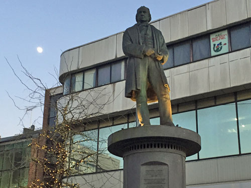
One of the longest shopping streets used to be the local canal, before that was blindly repurposed as a pedestrianised mall. The other wends south towards the Victorian town hall, a rare visual treat, but has been vacated by the council and leased to a dance school. Grey passageways thread through multi-storey car parks. A statue to municipal hero Brunel lurks in a drab square between an Iceland and a Poundland, facing the vast shopping complex that also bears his name. The Debenhams beneath brutalist New Falcon House may be the ugliest in the country.
The Old Town has a little more character, but still nothing that especially evokes a wider Wiltshire. What I did find here was Swindon Museum and Art Gallery, the former inside Georgian Apsley House, the latter inside an extension bolted on in the 1960s. The old building is a minor warren with as much emphasis on natural history and Egyptology as on local history (it seems Diana Dors and Polly Pocket both came from Swindon). Meanwhile the gallery has a top class hoard of modern art proudly displayed alongside contemporary canvases. Looking around won't take long, but I was impressed by the wide variety of temporary exhibitions cycled to entice return visitors (particularly the knitted tea party, complete with cupcakes and Jammie Dodgers, courtesy of Swindon Stitch and Bitch).
For conservation area gold you need to head west of the railway station to the site of Brunel's original Railway Village. These elegant streets were built to house workers at the original Swindon Works, there being insufficient local accommodation at the time, and are centred round a Mechanics Institute which served employees' social, cultural and educational needs. This fine old building is boarded up at present, but was once home to one of England's very first lending libraries. Behind each stone terrace are rows of short backyards faced off across a narrow alley, very much reminiscent of a northern industrial town. Of the several corner pubs, only one still trades. The Railway Village Museum opens on a select few weekends each year, kicking off this year on Saturday 4th April.
Swindon's largest tourist attraction is Steam, the museum of the Great Western Railway. This is housed inside a former machine shop where decades of locomotives were built and repaired, so has plenty of space for a good display (plus a conference centre, which helps bring in some income). Once inside you follow a weaving route past recreated workshops, classic locomotives, railway ephemera and innumerable mannequins before finally winding up amid an exploration of GWR's seaside portfolio. I got to pull signal levers to progress a royal train, ride a simulated steam footplate, walk underneath the wheels of the Caerphilly Castle and question the City of Truro's dubious 100mph speed record. It's a very fine collection, informatively arrayed, and with plenty to occupy visitors of all ages. I suspect you're very much target audience. Open daily, admission £9.80.
But most of those in the car park aren't here for Steam, they're here to roam a different disused railway shed which now houses Swindon Designer Outlet. It's both enormous and enormously impressive, if shopping is your thing, with over 100 brands selling bargains fools elsewhere previously paid over the odds for. Its twisted looping walkway reminded me of progressing forever around IKEA, but without that useful cut-through between bedrooms and lighting. London has nothing which compares. Also on site are the headquarters of both English Heritage and the National Trust, conveniently co-located, the latter organisation's shiny modern building suggesting a more comfortable level of funding.
Finally, I couldn't leave Swindon without visiting the Magic Roundabout. Its infamous five-in-one design originated in the early 1970s when the council's Principal Traffic Engineer attempted to decrease congestion at the roundabout by the football ground. A flyover would have been too destructive so instead a large area was tarmacked over and a tentative set of new road markings introduced. Around the edge were five small mini roundabouts and at the centre a ring which traffic would circle in a counter-clockwise direction. An asymmetric multi-lane alignment was discovered which increased overall capacity by 20%, and this has been in operation ever since. [aerialview][aerial video]
And it works, despite there being no directional signs to assist drivers after they've entered the roundabout. On first visit it must be terrifying, but all you have to do is aim for your intended exit and obey the road markings - the secret's all in the white lines. I watched during the evening rush hour as a ballet of cars, buses and lorries flowed effortlessly through, instinctively passing from one short section of road to the next. Someexits are busier than others, indeed one's since been downgraded to a residential cul-de-sac, but the traffic's irregular manoeuvres connect as smoothly as ever.
Swindon Fire Station sits on one corner, its occupants rarely called out to deal with disaster. Opposite is the Magic Chippy, where you can enjoy a celebratory salty bag, or better still head to the central library for exclusive Magic Roundabout souvenirs (including t-shirts, mugs, tea towels, postcards, even babies' bibs). A few other UK towns tried introducing similar multi-gyratories but only a handful remain, and only Swindon's is triumphantly lopsidedly magic.